Neuf Brisach to Ottmarsheim
Grand Est
7. Neuf Brisach to Ottmarsheim
Medium
7h
28,4km
+122m
-93m
Step
Embed this item to access it offline
At the start of this stage you join a canal that takes you across the plain of Alsace. Part of the Hardtwald forest nature reserve is on your way, then you will pass the Hardt forest on your right and the industrial area on the banks of the Rhine on your left.
8 points of interest
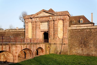
Entrée de Neuf-Brisach porte de Colmar - Eric Gaba wikimedia commons use Sting HistoricalDie befestigten Tore von Neuf-Brisach
The city gates are considered to be weak points in the fortification. Their number is limited to 4 for Neuf-Brisach. The access road is divided into several sections and the road ends at a right angle at the gate. The gate opens out into the interior of the town through a tunnel which runs under a vaulted vestibule, part of the building partially engaged in the rampart slope. The ground floor houses the police station, the duty officer's guardroom and a prison. On the first floor there is a functional apartment for a staff officer. In the 19th century, the inside of the gate served as a kitchen and bakery for the army. After 1870, it was used as an officers' club and "casino" for the German garrison.
Vauban insisted that the city be provided with magnificent gates symbolizing the power and glory of Louis XIV. They are the work of Hardouin-Mansart. Until 1792, the frontispiece was decorated with the royal coat of arms, replaced in 1870 by the German imperial eagle. Heavily damaged twice, the Porte de Colmar has nevertheless retained its original character.
Source: information panels in place on the site.
More pictures : Petit Patrimoine.com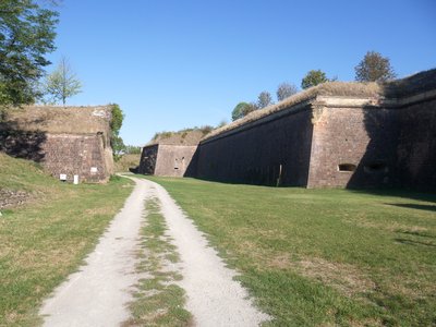
Les remparts de Neuf-Brisach - Les Amis de saint Colomban HistoricalNew Brisach Vauban Fortress
Vauban created this fortress on a flat, uninhabited site in 1697. The kingdom of France had just lost the left bank of the Rhine and the town of Vieux-Brisach built on a rocky spur. A new defence had to be built from scratch on the right bank of the Rhine.
It was Louis XIV himself who, from among the three projects submitted by Vauban, chose the octagonal plan which has come down to us and cost him 4 million pounds. A canal was specially dug as far as the Vosges to carry the pink sandstone needed for the construction.
The earthworks are carried out by four infantry regiments, along with the masonry and the framework; the decoration of the four gates is the subject of a competition by the Academy of Architecture, won by Mansard.
From an urban planning point of view, simple principles govern the internal organization: to provide practical circulation so that places of command, combat and civil activity integrate harmoniously without hindering each other.
More information on Vauban's three defence systems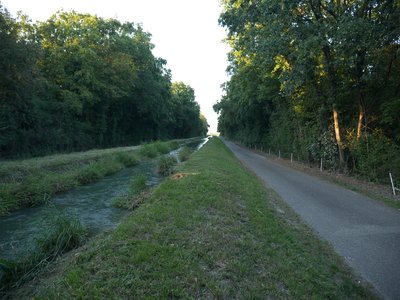
La via Columbani entre le canal d’irrigation de la Hardt et la forêt du Hardtwald - Les Amis de saint Colomban PanoramicHardtwald Forest Nature Reserve
The Méquillet or Hardtwald forest, south of Neuf-Brisach, is a typical ensemble of the dry part of the Alsatian plain. Situated on the Rhine terrace formed by the former river's alluvial cone and occupying 250 hectares, it is established on coarse alluvium characterised by outcrops of puddingue (a conglomerate of limestone cement pebbles).
This filtering nature of the land, combined with the low rainfall (500 to 550 mm per year) and the sinking of the water table, limits the development of trees. The result is a sparse forest, consisting of undergrowth coppice of low productivity, with natural clearings of exceptional botanical interest. Some steppe plant associations are similar to those found in Eastern Europe, particularly in the Danube basin. The adonis vernale, for example, has one of its only French stations there. The herbaceous edges of the dry grasslands are home to blood geranium hems, whose continental character is illustrated by the presence of fraxinella, another plant that is not very common in France.
More information: Natural Reserves of France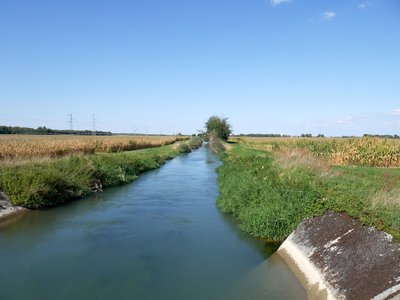
Canal d’irrigation de la Hardt et la Via Columbani à Bantzenheim - Les Amis de saint Colomban PanoramicThe Hardt irrigation canal
The Hardt Canal was originally built to compensate for the collateral effects of the canalization of the Rhine. The Hardt canals have a role that goes far beyond just irrigation for cereal crops by allowing the water table, wetlands and numerous watercourses to continue to exist in their present state.
More information : PHR Hebdo Rural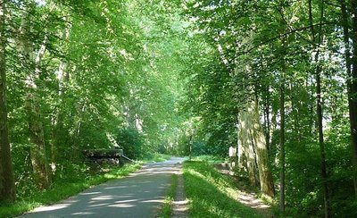
Forêt de la Hardt - Réserves naturelles de France PanoramicThe Hardt forest
The Hardt (or Harth), is one of the largest state forests in France. In the foothills of the Sundgau hills. It extends from Kembs to Colmar, between the river Ill and the Rhine. A compact massif stretching over a low Rhine terrace, some thirty kilometres long and eight kilometres wide in its middle, the Hardt forest covers an area of more than 13,000 hectares.
It is the second Alsatian massif after the forest of Haguenau. Today's Hardt is the remnant of a much larger massif, which has lost 2700 hectares in two centuries, 1000 of which have been lost since 1960.
Property of the Habsburgs, it came back to Louis XIV at the end of the Thirty Years War. State property, it is listed as a Natura 2000 special protection area.
More information on the site: Bienvenue en Alsace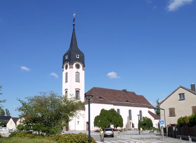
L’église Saint-Michel de Bantzenheim - Les Amis de saint Colomban TouristChurch of Saint Michael - Bantzenheim
The Church of St. Michael in Bantzenheim is one of the oldest in the Upper Rhine. In fact, it was first mentioned in a charter in 795, describing it as a "basilica". In 1756, because of its poor condition, it was rebuilt in 1780. In the same year, two different altars were installed. One altar is dedicated to San Sebastian and the second to the Annunciation.
Following the fall of a fragment of the ceiling during a midnight mass in 1900, the renovation of the bell tower began. In 1945, the church was hit by bombing and underwent numerous renovations.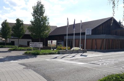
Musée de la moto à Bantzenheim - Les Amis de saint Colomban TouristMotorbike museum in Bantzenheim
Created on the initiative of the Communauté de Communes Porte de France Rhin Sud, "La Grange à Bécanes" is the first living museum of vintage motorbikes. Lovers of the mechanics of yesteryear will be able to admire the rarest models, dating from the 1920s to the 1960s, while tasting the impressions of driving these machines.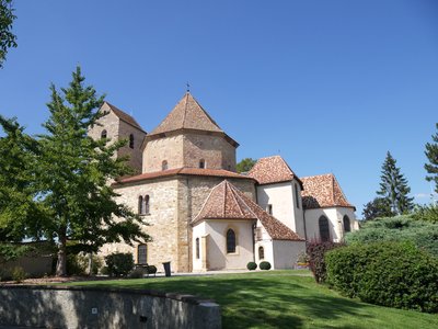
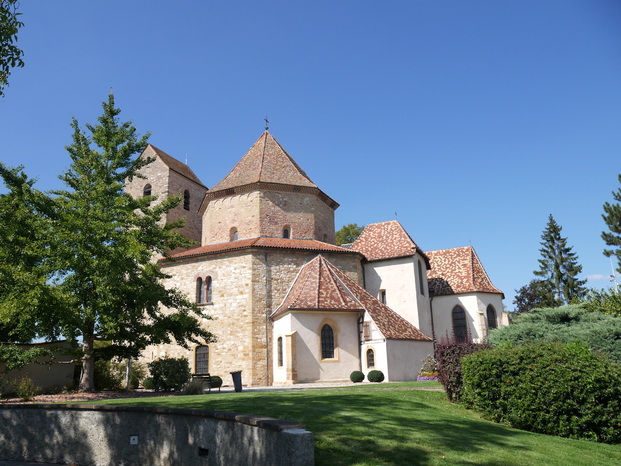
Chevet de l’église abbatiale d’Ottmarsheim - Wikimedia Commons Ralph Hammann HistoricalAbbey Church of St. Peter and St. Paul in Ottmarsheim
The agricultural village of Ottmarsheim was founded on the old Roman road that linked Basel to Strasbourg along the Rhine (French-German border). With its Merovingian necropolis dating from the 6th and 7th centuries, it is named after Othmar of St. Gallen, the founding abbot of St. Gallen Abbey in the 7th century on the site of the burial place of the Irish monk Gall, companion of St. Columban.
The Church of St. Peter and Paul in Ottmarsheim is an 11th century church. Founded by Rudolph of Altenburg, one of the founders of the House of Habsburg, and dedicated to the apostles of Christ St. Peter and St. Paul, it is famous in Alsace and the Upper Rhine for its remarkable and rare architecture of a church with an octagonal central plan in early Christian style, Byzantine, pre-Romanesque, Carolingian, and Ottonian, inspired by the Palatine Chapel in Aachen of the Carolingian Emperor Charlemagne and the Church of the Holy Sepulchre in Jerusalem (the tomb of Christ).
More info: Wikipedia
Description
Departure in front of the Saint-Louis Royal Church by your left on the Place d'Armes, take the rue de Bâle and D 468 after passing the Gate, straight on at the crossroads with D 14
- Turn right towards the Vauban school apiary, cross the D 415, turn left in front of the Rhône-Rhin canal
- 200 metres to the left to follow the small Hardt irrigation canal, left in front of the second pond on the left, go around the pond and the adjoining field to take the bank of the Hardt irrigation canal
- Follow the Hardt irrigation canal for 8,000 metres, cross a small part of the Hardt nature reserve, follow the main road across the canal and take the opposite bank southwards at the junction with the D 18bis, cross the D 3, D 50, the Potash Mine canal, D 47
- Left at the third small bridge over the Hardt irrigation canal, straight ahead leave the canal, right onto D 438, left at the roundabout you are in Bantzenheim
- Turn right into Rue de Rumersheim, right into Rue de la Chapelle, left into Rue de l'Église, Rue du Général De Gaulle
- Left at the crossroads with D468, after the railway crossing take the cycle track, in Ottmarsheim take the third street on the left, rue de l'Ours, rue du Couvent you arrive at the church of Ottmarsheim.
- Departure : Royal St. Louis Church, 26 Place d'Armes Général de Gaulle, 68600 Neuf-Brisach
- Arrival : Abbey Church of St. Peter and St. Paul, 1 rue du Couvent, 68 490 Ottmarsheim
- Towns crossed : Grand Est
Altimetric profile
Report a problem or an error
If you have found an error on this page or if you have noticed any problems during your hike, please report them to us here:
Close by7
- Information


