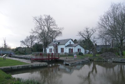
2. from Nort-sur-Erdre to Nantes
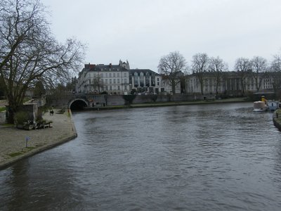
The Erdre is a river that originates in Maine-et-Loire and flows into the Loire at Nantes. It is navigable between Nantes and Nort-sur-Erdre. The canal from Nantes to Brest joins it a little downstream from Nort-sur-Erdre. After joining and following the canal, we will leave it to cross rural areas, then the urban areas of Sucé and La Chapelle-sur-Erdre. The end of the stage and the arrival in Nantes will be along the river, sheltered from any traffic.
5 points of interest
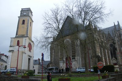
Eglise de Nort-sur-Erdre - Amis Bretons de Colomban CulturalNort-sur-Erdre Church
The church of Nort-sur-Erdre, was built at the beginning of the 20th century. It is remarkable for its stained glass windows. For budgetary reasons, it was not completed. Thus remains, isolated from the building, the bell tower of the previous church built in 1833.
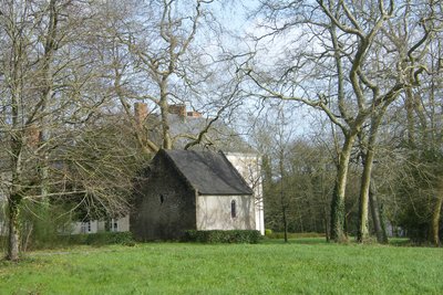
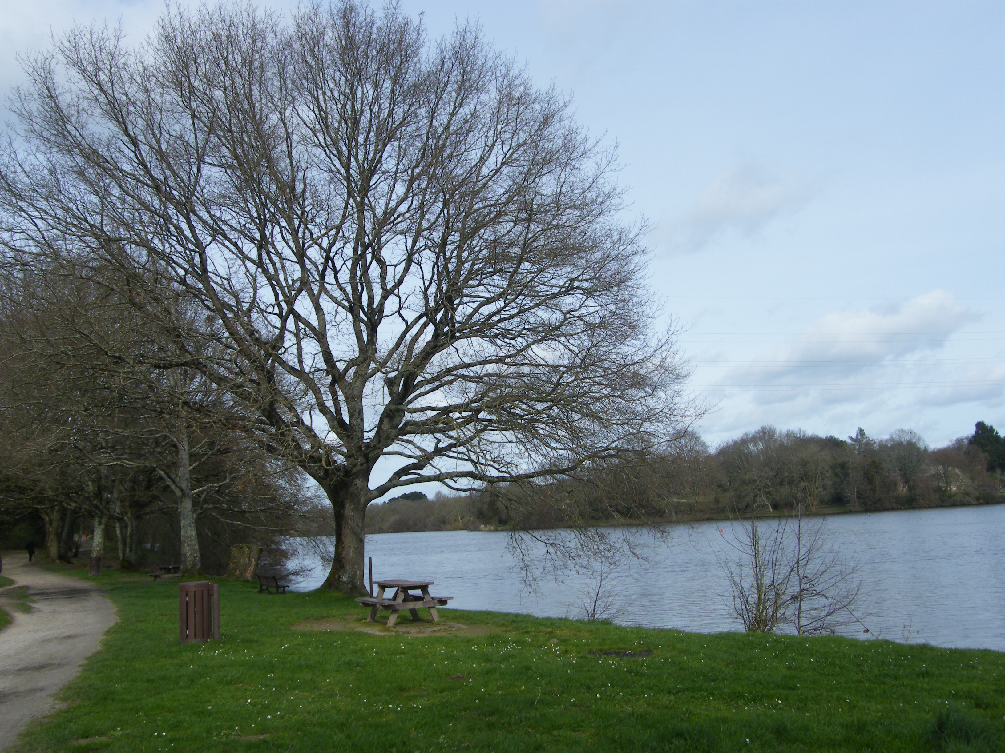
La chapelle du château - Amis Bretons de Colomban TouristLa Desnerie Castle
Numerous castles are located along the Erdre river. They are visible when you go up the river by boat.
The castle of La Desnerie, is also built on the banks of the Erdre. It is mentioned as early as 1371. It is then the property of a companion of Du Guesclin and Olivier de Clisson. It has a private chapel dated 1624. It is registered as a historical monument since 1985.
The wood of 15ha which surrounds it was acquired by the department in 2001 and has become a place of walk for the people of Nantes.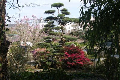
Île de Versailles - Amis Bretons de Colomban TouristVersailles Island
This 1.7 hectare artificial island, created in 1831 and originally occupied by tanners and marine carpenters, was transformed into a Japanese garden in 1983. The composition of the rock gardens and waterfalls is based around 3 buildings inspired by traditional Japanese habitat. Among them, the Maison de l'Erdre, which is surrounded by a Zen garden, serves as a setting for exhibitions devoted to the river and its aquatic environment.
Le départ du tunnel de St Félix - Amis Bretons de Colomban HistoricalThe Nantes fillings
Urban development in Nantes between 1926 and 1946 led to the filling in of two branches of the Loire (the branch of La Bourse and the branch of the Hospital). This led to the diversion of the Erdre, which joined the Loire through what became the Cours des 50 Otages. A tunnel was dug between 1930 and 1934 under the Cours St Pierre and St André and the St Félix canal was built with a lock to join the Loire.
To find out more...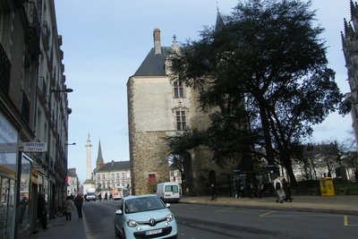
Porte St Pierre - Amis Bretons de Colomban HistoricalSt Peter's Gate
The first ramparts protecting Condevicnum, capital of the city of Namnètes, date back to 270. The stones visible on either side of the passage are the remains of the gate that then controlled the way to Juliomagus (Angers).
A new enclosure was built in the 13th century. It was reinforced at the end of the 15th century. Each time, St Peter's Gate is modified or even rebuilt.
Description
From the church, go down the rue du Général Leclerc, continue by the rue François Dupas. Cross the railroad tracks and turn left, route de Casson. At the exit of the town, take the road on the right. At the end of the road, take the road on the left, then the path that extends it. Continue on this road until you reach the village of La Tindière. Then turn right and join the canal by the path.
- Turn left and follow the towpath. At the Bout-de-Bois bridge, take the road to the left and, at the fork, turn left onto the D69 towards Sucé-sur-Erdre. Then take the cycle path on the right which runs along the canal's feeder gutter. Follow it until its junction with the D26.
- Turn left and, at the crossroads, take the path on the left (Chemin du Pas Chevalier). Follow this path through "les Prouveries", near "la Chauvelière" up to "le Champ de la Haie". Then turn left on the road, then right on the path. Follow this road until you reach the entrance of Sucé-sur-Erdre and its junction with the D69. Turn right on the D69 and join the church of Sucé.
- From the church, go down the rue de la mairie and join the port. Turn left on the quai Bliesranbach. At the end of the quay, turn right onto rue du Port, then left onto rue du Pin. Continue along the rue de La Bretonnière. After the left bend in this street, take the road on the right around the SUEZ station (cycle lane). Join the rue des " écureuils " and at its end, take the road on the right, the route des Coteaux de la Turbalière and join the D69.
- Turn left onto the cycle track which runs along the departmental road. Follow this cycle track (which sometimes goes away from the departmental road) up to the roundabouts after the gendarmerie at the entrance of La Chapelle-sur-Erdre.
- Continue on the rue des " Réfractaires au STO " which runs along the D69. At the roundabout take the rue de Sucé and join the church and the town hall square.
- Pass in front of the church and continue on the rue Martin Luther King and turn left into the rue de l'Erdre. At the roundabout continue to cross the railway and go along the cemetery and take on the right the impasse du Bois Fleuri. Follow it and take the rue de " Jean V " on the right. Then follow the railroad tracks and alleys until you reach the closed level crossing near the train stop of "l'Erdre Active".
- Cross the railway, and on the square, take the track on the left and follow it up to the "route de la Jonelière". Turn left, pass under the railway track, and take, on the right, the rue de la Gournière in the direction of La Desnerie. Pass under the four-lane road and enter the La Desnerie domain. To the right of the gates and signs indicating the "limit of the walk", take the road on the right and go down towards the Erdre. Follow this path until you reach the Espace de Plein Air de Port Barbé.
- Continue on the path along the Erdre, pass under the four-lane bridge and the railway track up to the Tortière bridge. Access the bridge by the stairs on your right and cross it to reach the other bank of the Erdre and the path along it. Pass under the Motte Rouge general bridge and walk along the quays until you reach the Quai Ceineray which marks the end of the Erdre River. Go up Rue Tournefort, to the right of the Monument aux Morts. Reach the square in front of the cathedral through the St Pierre gate and the rue de l'Evéché.
- Departure : St Christopher Church, Rue de la Paix, 44390, Nort-sur-Erdre
- Arrival : St Peter and St Paul's Cathedral, St Peter's Square, 44000, Nantes
- Towns crossed : Pays de la Loire
Altimetric profile
Recommandations
The route follows the route of the Ways of Compostela (Capitals Way).
Transport
Nort-sur-Erdre has an SNCF railway station - Nantes/Chateaubriant line.
The cathedral is located near the Nantes railway station.
Report a problem or an error
If you have found an error on this page or if you have noticed any problems during your hike, please report them to us here: