Lauterbourg to Fort-Louis
Grand Est
1. Lauterbourg to Fort-Louis
Medium
7h30
30,3km
+225m
-226m
Step
Embed this item to access it offline
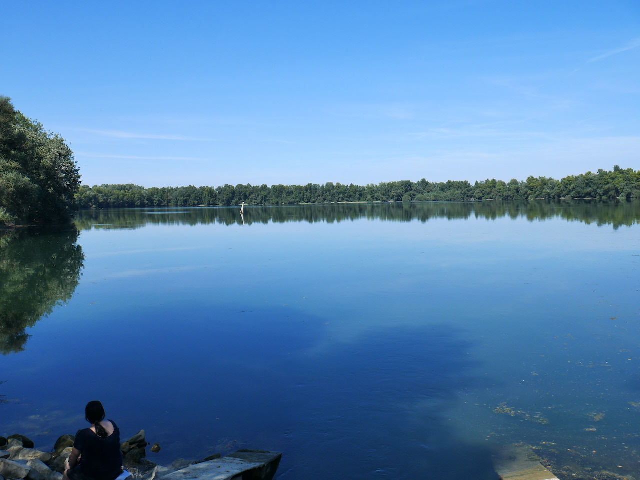
Leaving Lauterbourg you will discover a landscape of ponds, woods and fields. You go around the nature reserve of the Sauer delta to pass close to a quarry. A quick passage between an industrial zone and a loading dock of the autumn port of Strasbourg you pass in front of the base of the Cercle Nautique d'Alsace du Nord. Fort-Louis, a former stronghold built by Vauban welcomes you.
8 points of interest
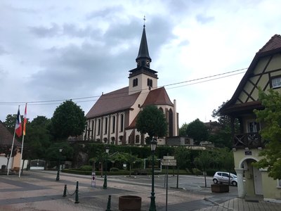
Église de la Trinité à Lauterbourg - Amis saint Colomban TouristTrinity Church in Lauterbourg
The church of Lauterbourg dates from the 14th and 15th centuries, the choir dates from this period and the nave was rebuilt in 1716. The bell tower was raised in 1845. The organ dates from 1777 and was restored in 1998.
In 2015, the church was renovated and the exterior lighting was re-lit to enhance the ensemble.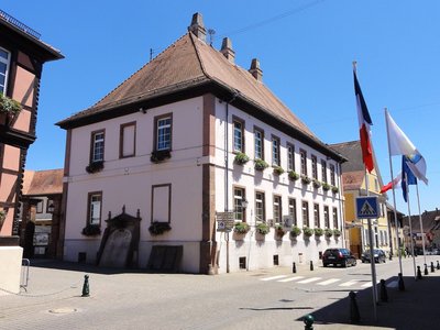
Ancien château épiscopal de Lauterbourg - © Ralph Hammann - Wikimedia Commons HistoricalAncient Episcopal castle in Lauterbourg
Lauterbourg, Haus des Landvogts Holzapfel, ehemaliges Bischofsschloss (1592-1716), dann Schule.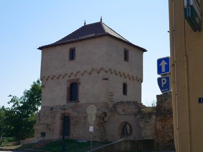
La Tour des bouchers est le dernier vestige des remparts de la ville de Lauterbourg - Les Amis de saint Colomban HistoricalButcher's Tower in Lauterbourg
The Butchers' Tower or Jewish Tower is part of the fortification of the medieval town with 15 fortified towers. This tower bears witness to the city walls. The tower was recently renovated.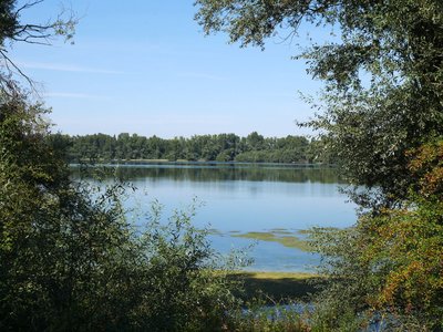
Vue sur la réserve naturelle de la Sauer - Les Amis de saint Colomban PanoramicNatural reservoir of the Sauer delta
The Sauer Delta National Nature Reserve (RNN 135) is a national nature reserve in the Grand Est region. Created in 1997, it extends over 486 ha and protects a Rhine wetland with remarkable biodiversity.
Bringing together forests, wet meadows, mudflats and aquatic environments, this nature reserve is a remarkable vestige of the Rhine alluvial forest as it was known by the monk Colomban with his companions in 610. A multitude of meanders and dead arms favouring the development of fauna and flora.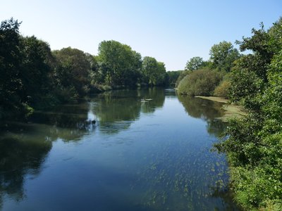
La Moder avant sa confluence avec le Rhin - Les Amis de saint Colomban PanoramicThe confluence of La Moder with the Rhine
Moder has its source in the Vosges du Nord in Zittersheim. It reaches the left bank of the Rhine, south of Beinheim, after 82.1 km. This mouth is part of a protected natural area.
Take the time to observe the flora and fauna in the wetland landscape.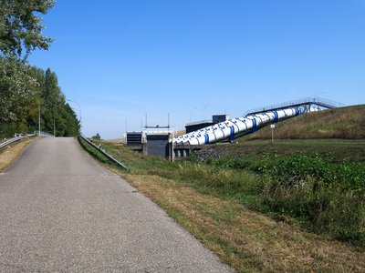
Conduits du siphon entre le Rhin et le Polder de la gravière. - Les Amis de saint Colomban PanoramicPolder of the Moder
The creation of the Polder de la Moder was financed by the agreement of 6 December 1982, which is part of a major Franco-German programme. It is a perfect example of the type of ambitious actions that can be undertaken by these resolutely forward-looking nations. Nations capable of thinking of the river that was their border as the ideal place to meet to manage together a common natural capital.
The first flooding test of the Moder polder carried out by the Strasbourg Navigation Service demonstrated the effectiveness of the six siphons that form the heart of its water intake structure. Designed to be operated remotely from a command and control station, this device will also make it possible in the future to ensure the gradual restoration of the alluvial environment thanks to ecological flooding.
Intended to curb the exceptional flooding of the Rhine, the Moder polder was created in the communes of Fort-Louis and Neuhaeusel as part of a vast Franco-German programme implemented in 1992. Its surface area of 240 hectares enables it to constitute, for a maximum duration of 15 days in a row, a flood retention area with a capacity of 5.6 million m3. Situated on the site of the former Moder delta, it thus regains its original vocation as a flood plain to cope with any rise in the Rhine's flow rate in excess of 3,500 m3 /s.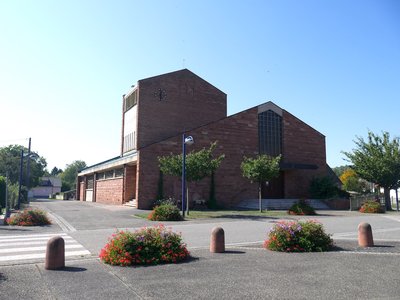
Église Saint-Louis à Fort-Louis du Rhin - Les Amis de saint Colomban TouristSaint-Louis Church at Fort-Louis du Rhin
The first church in Fort-Louis dates back to the 17th century. Built three years after the revocation of the Edict of Nantes (1685), the royal city of Fort-Louis is, by order of the king, populated exclusively by Catholics and has a parish church: the Saint-Louis church. In 1927, it was classified as a historical monument.
After its destruction on March 15, 1945, during the battles of the Liberation, a temporary church served the parish until the inauguration of the present church on October 10, 1971, by Mgr. Jean-Julien Weber, Archbishop of Strasbourg.
Source: City of Fort-Louis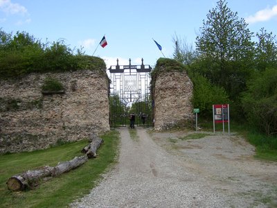
Entrée de la ville de Fort Louis - Ville de Fort-Louis HistoricalFort-Louis du Rhin
In 1648, the Thirty Years' War ended with the Treaty of Westphalia and Alsace became French.
The enemies of France are on the other side of the Rhine.
Louis XIV asks Vauban to build forts on the eastern border of the royalty and Fort-Louis is part of these constructions.
It is from 1687 that the stronghold is built on an island in the Rhine by engineers Vauban and Tarade. The King granted the rights and privileges of Ville Royale to Fort-Louis.
After the fall of the Royalty, in 1789, Fort-Louis took the name "Fort Vauban", then "Fort Libre". In 1791, it became the chief town of the canton. The stronghold declined strategically and the fortifications were dismantled during the Revolutionary Wars, then definitively during the Napoleonic Wars (1813-1815). Remains of the square fort remain.
The population grew to nearly 4,000 inhabitants in the 18th century, more than half of whom were soldiers.
More informations : City of Fort-Louis du Rhin
Description
Departure in front of the church of the Holy Trinity in Lauterbourg
Take the rue des Pêcheurs on the left at the crossroads with rue de la Gare and immediately after the 3C, on the right a dirt road in front of a wooden shed.
Take the rue des Pêcheurs on the left at the crossroads with rue de la Gare and immediately after the 3C, on the right a dirt road in front of a wooden shed.
- Turn right to go around the quarry, Straight ahead in the woods at the crossroads with the Chemin des Mouettes, stay on your left to cross D3, straight ahead, right on D 248, left under the railway line
- Right at the exit of the bridge, left on D 89 and right, pass between the ponds, go around the campsite while staying on the waterfront, follow the river, La Sauer
- Turn left, cross La Sauer, straight ahead on the left to follow the pond on the left, cross the quarry in the direction of the Rhine, cross the pier road, on the right to take the bicycle path along the Rhine.
- Turn left at the crossroads to go along the pond, turn right along the Rhine, cross the D 87, bypass the boat basin to follow the Rhine, cross the D 4
- Cross the river Moder stay on the Rhine, after the quarry take D 319 at the crossroads, route du Rhin, rue du Bourg, third street on the left rue d'Orléans you arrive at the church Saint-Louis.
- Departure : Church of the Holy Trinity, Lauterbourg
- Arrival : Saint Louis Church, Fort Louis
- Towns crossed : Grand Est
Altimetric profile
Report a problem or an error
If you have found an error on this page or if you have noticed any problems during your hike, please report them to us here:

