La Chaussée-sur-Marne to Vitry-le-François
Grand Est
16. La Chaussée-sur-Marne to Vitry-le-François
Medium
6h30
24,6km
+307m
-296m
Step
Embed this item to access it offline
The diversity of the landscapes of the Champagne region by visiting picturesque Champagne villages with their half-timbered houses.
7 points of interest
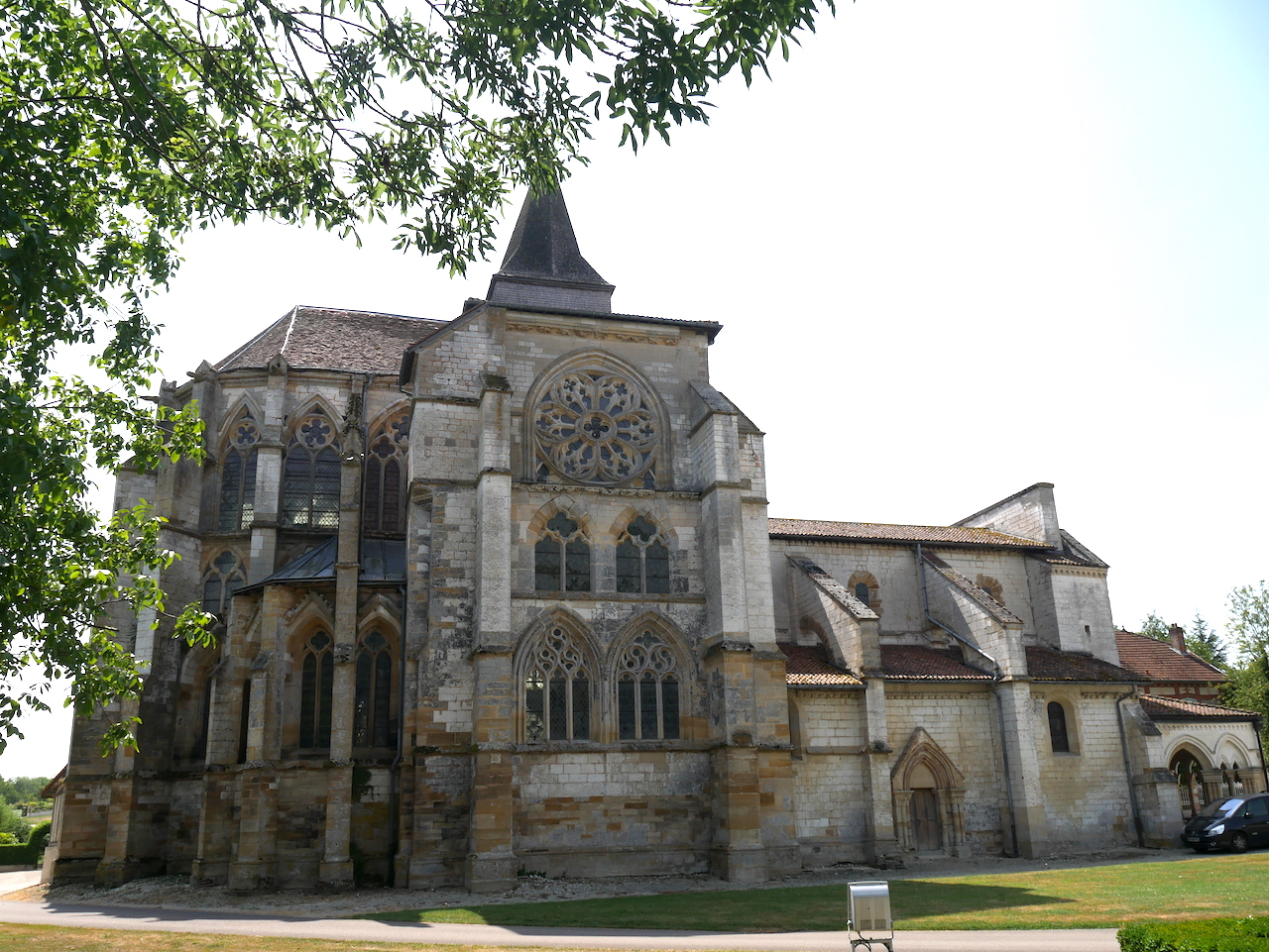
Église St-Martin à Mutigny (XVe siècle) - Amis saint Colomban TouristThe churches of Mutigny and La-Chaussée-sur-Marne
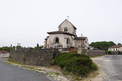
The commune of La Chaussée-sur-Marne is made up of two communes, Mutigny and Coulmier.
The church of Saint-Martin de Mutigny dates from the 15th century.
The church Saint-Pierre de Coulmier dates from the 12th century. It is in Romanesque style in chalk stone, with a polygonal chevet of Rhenish inspiration and an octagonal bell tower, classified as a Historic Monument since 1930. Today desecrated, it has become a concert and exhibition hall.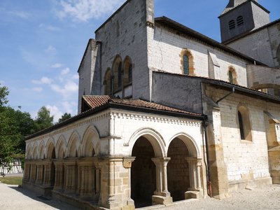
Porche caquetoire de l’église Saint-Amand, 13e siècle - Amis saint Colomban TouristÉglise Saint-Amand in Saint-Amand-sur-Fion
The church of Saint-Amand, built from 1138 to 1147, with its porch gallery or caquetry which resembles part of a cloister, but locally called "the porch". The parishioners meet under the porch, before entering the church or leaving the services, to "chat".
The church preserves a Romanesque part with, in particular, the remains of a tower, with a spiral staircase inside. On these Romanesque bases, Gothic additions have allowed the elevation of all the ribbed vaults and the creation of a large choir, abundantly lit by stained glass windows.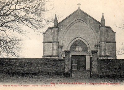
Chapelle Ste-Geneviève Sur le Mont-Fourche - © Geneanet- Massimo-Oki TouristSainte-Geneviève Chapel in Vitry in Perthois
The origin of Sainte-Geneviève Priory, located on the Monts Royer (147 meters) west of Vitry-en-Perthois, is difficult to date with precision. If a tradition seems to date its foundation to the year 865, the first document proving its existence is from 1097. On this date, Philippe I, bishop of Châlons, gave the altar of Sainte-Geneviève de Vitry to the abbey of Saint-Pierre-aux-Monts de Châlons, then directed by Abbot Lambert (1074-1099). From then on, the church of Sainte-Geneviève is a Benedictine priory attached to the great abbey of Châlons. It is subject to the visit of the bishop of Châlons.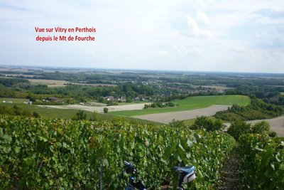
Paysage Vitry-en-Perthois - http://rvtt-51.blogspot.com PanoramicVitry-en-Perthois
The history of Vitry-en-Perthois begins in the Roman period. The destruction of the city of Perthis by the Huns in 451 made Vitry-en-Perthois the largest city and thus the new capital of Perthois, a title that it would give in the 16th century to the new city built by François I, Vitry-le-François.
Discover the Perthois or the humid Champagne region, irrigated by ponds and rivers.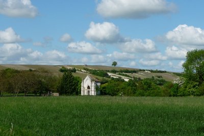
Mont Fourche avec la chapelle Ste-Geneviève - ©Massimo-Oki PanoramicThe mount "Fourche" at Vitry-en-Perthois
The Mont de Fourche, viewpoint, located at 208 meters above sea level, the highest point of the hills overlooking the Saulx, is so called because of the patibular forks that were erected there by the first counts of Vitry, as a mark of high justice.
A strategic point during the 1st World War, it became a vineyard with a view of the Perthois plain.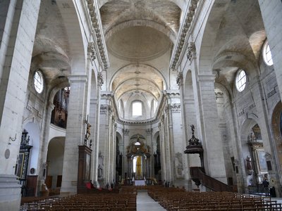
Collégiale Notre-Dame de l’Assomption à Vitry-le-François - Amis saint Colomban TouristNotre-Dame de l'Assomption Collegiate Church in Vitry-le-François
Seventeenth century building with a façade with two towers in classical style. The collegiate church has rich furnishings, a large part of which is listed. Its construction on the site of an old church dates from 1629. It took 125 years to complete the ensemble with woodwork inside. The choir and the absidial chapels were completed at the end of the 19th century.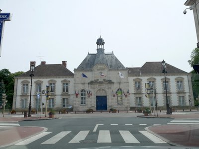
Hôtel de ville de Vitry-le-François installé dans un ancien couvent. - Amis saint Colomban TouristThe Town Hall and its renaissance park in Vitry-le-François
Vitry-le-François is at the confluence of several major communication routes and three channels.
Formerly called "Vitry-en-Perthois", this ancient stronghold was dismantled by Charles V at the end of the 12th century. Then François 1st founded the city in 1545, giving it its name and its arms: a salamander. It was an Italian architect, Girolamo Marini, who designed this geometrical city in a checkerboard pattern around its central square and opening at the cardinal points through four gates.
Take advantage of your visit to the town centre of Vitry-le-François to stroll through the park of the Town Hall. The Town Hall, formerly the Récollets Convent, is a civil building located to the east of the town centre of Vitry-le-François, on the town hall square. With its garden, it is classified as a historical monument.
Description
Leave the church of Mutigny by the street El-Biar, turn twice to the right in the avenue du docteur Justin Joly, turn left and go straight on to pass under the N44 motorway. At the crossroads with the D81 go straight on
- After 1.6km turn left in the direction of Couvany, then turn right at the first road in the direction of Saint-Amand-sur-Fion. Before the village take the rue de la liberté towards the centre of the village, turn right into the rue du pont Mathieu and immediately turn left into the rue des ruelles, turn left into the rue des Hauts Prés, turn right into the rue des Bas Prés, turn right into the rue de l'église and then D260.
- Leave the D 260 road on the left. After 900 m, turn left and then right. Drive along the sports ground, take the asphalt road opposite and then the first asphalt road on the right.
- Leave the asphalt road and turn right. After 3.7km turn right towards Mont de Fourche then first left at the second crossroads you are on the way to the chapel then rue Sainte Geneviève.
- At the crossroads with the rue de la Roche turn right, then, before the bridge of La Saulx, turn right into the rue des Cloyeres.
- After a sharp bend to the right take the road to the left towards Vitry-le-François. After 2.1 km turn left then right to cross the RN44 go straight ahead, turn right into rue des Louvières, turn left twice to go along the Marne canal.
- Cross the canal at the lock of Vitry-le-François to walk with the canal on your left, turn right on chemin du Mont Berjon go straight on.
- Turn left to follow the Marne river along the campsite.
- Turn left on avenue de Paris then straight ahead you have arrived at place d'Armes.
- Departure : Saint-Pierre de Coulmiers Church, 3 rue Hyppolyte Faure, 51 240 La-Chaussée-sur-Marne
- Arrival : Notre-Dame de l'Assomption Collegiate Church, Place d'Armes, 51 300 Vitry-le-François
- Towns crossed : Grand Est
Altimetric profile
Report a problem or an error
If you have found an error on this page or if you have noticed any problems during your hike, please report them to us here:
Close by7
- Accommodation


