7. Nort-sur-Erdre to Blain
Route along the Canal de Nantes à Brest or its feeding gullies. The locks will punctuate the journey. Birds will accompany us. No problems of unevenness, only the pleasure of walking in the middle of nature.
3 points of interest
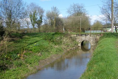
Rigole d’alimentation - Amis Bretons de Colomban TouristThe food channel of the canal
At each lock passage, a barge moves 300m3 of water. To compensate for this, the canal is fed by gullies connecting reservoirs located at a higher altitude to the canal.
This 22km long gully connects the Grand réservoir de Vioreau to the canal. It includes viaducts or underpasses. The constant slope is 14cm/km and the speed of the water is 1Km/hour.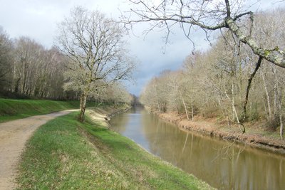
Canal de Nantes à Brest - Amis Bretons de Colomban TouristThe canal from Nantes to Brest
The Nantes to Brest canal is 360km long and crosses the whole of Brittany. The decision to build it was taken by Napoleon I in 1804. The aim was to link the military ports of the West (Nantes, Brest Lorient and St Malo) and bypass the English naval blockade. It connects 8 rivers (including the Isac here) and is punctuated by 236 locks.
We are here on the Bief de partage, the high point between the Erdre and Isac rivers. The canal is fed by the gullies connecting the reservoirs to the canal.
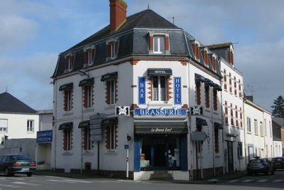
L’Arche , épicentre des galeries - Amis Bretons de Colomban HistoricalBlain's Acoustic Galleries
In the 6th century, a whole network of galleries linking different points of the town started from the arch located on the site of the latter. By speaking through an opening in the arch, the voice was propagated through the galleries and came out at the different listening points. Unfortunately, these galleries were drowned when the canal was dug in the 19th century. At the beginning of the 20th century, Émile Mouette, known as "the whisperer", replaced the network and transmitted the information entrusted to him. At the same time he tried to restore the network.
An identical network exists in Koblenz (Germany).
Description
From the church of Nort-sur-Erdre, turn right on Aristide Briant Street, then Fairand Street which extends it. After the railway crossing, continue on the D169 by turning left at the fork. At the cemetery, turn right onto rue des Fauvettes.
- Follow this street, and at its end, continue straight on the track. At the crossroads of the Calvary, take the road on the right, then at the crossroads turn left. At the next crossroads, take the track on the left and join the road. Then turn right and follow the road until you reach the entrance of "La Dubertière". Then take the path on the left along the canal's feeding gutter.
- At the second crossroads with a road, take the road to the left and join the canal. Take the towpath on the right. Pass the Pas d'Héric lock and, at the bridge that follows, cross the bridge and continue on the other bank of the canal.
- At the crossroads with the D357, at the end of the water retention area along the canal, cross the canal again and take the towpath on the other bank. Pass under the expressway (recognizable by the noise level), pass the Remaudais lock, the Gué de l'Atelier lock, the Terrier lock and the La Prée lock. Reach the port of Blain on the Surcouf wharf.
- In the middle of the wharf, turn right, Chemin des Mariniers e, direction Centre Ville. At the intersection with rue de la Petite Arche, continue across the street by the pedestrian path to reach rue Jean Moulin. On this street, turn left on the pedestrian path and join Lucie Aubrac street. Cross the Bd de la Résistance and take the Allée Jacques Prévert opposite. Cross the Avenue de La République and continue along the Allée des Tilleuls until you reach the church.
- Departure : Eglise St Christophe, Rue de la Paix, 44390, Nort-sur-Erdre
- Arrival : Eglise St Laurent, Place Jean Guihard, 44130, Blain
- Towns crossed : Pays de la Loire
Altimetric profile
Recommandations
This route follows the itinerary of the "Chemins du Mont St Michel". It is therefore possible to follow their signposts (silhouette of the Mont Blanc on a blue background).
Report a problem or an error
If you have found an error on this page or if you have noticed any problems during your hike, please report them to us here: