9. from Marsac-sur-Don to Langon
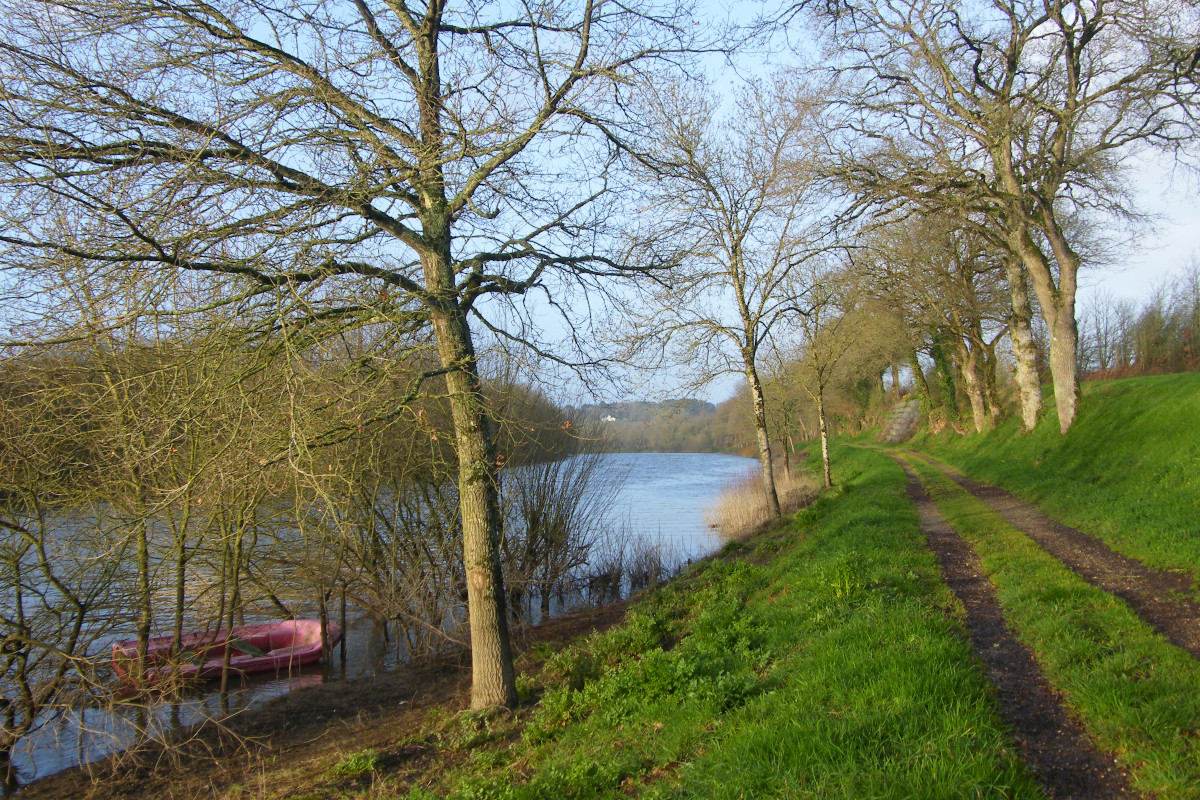
First, on the crest line above the Don valley, we will reach the banks of the river Le Don. We will follow them for a while and at the end of the route we will join La Vilaine, of which the Don is a tributary.
3 points of interest
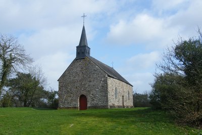
Chapelle Ste Anne des Lieux Saints - Amis Bretons de Colomban CulturalSt. Anne's Chapel of the Holy Places
The chapel of the Holy Places or Lessaint is built on the site of a former leper colony. Located on the old Roman road between Blain and Guémené, it dominates the Don valley. It has several frescoes.
Pilgrimage to Ste Anne on the last Sunday of July.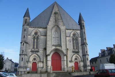
Eglise de Guémené Penfao - extérieur - Amis Bretons de Colomban CulturalChurch of Guémené Penfao
The first church in Guémené Penfao was badly damaged by a fire during the Revolution in a fight between Royalists and Revolutionaries. It was only very late (1841) and partially restored. The increase in population led to the construction of a new church in 1879. The first stone was laid on 21 September 1884 and the first mass was celebrated on 4 July 1886. The large dimensions of the building imposed an atypical Nor-South orientation to adapt to the terrain. The originally planned 60m bell tower was never built.
In front of the church, there is a statue and a stele recalling the situation of Guémené 1600km from Santiago de Compostela.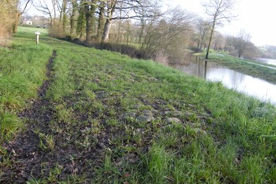
Voie romaine - Amis Bretons de Colomban CulturalRoman road
This section of road, which is curved and paved with shale and sandstone, is about 100 metres long and 4 metres wide and is known in the collective memory as the "Roman road". It is said to have linked Nantes to Corseul. However, no element has been found to certify its Roman rather than medieval origin.
Description
Leave the Place de l'Église going down to the roundabout and turn right onto Isaie Rabu street. Leave the town and follow the D124 along the path on the left. At the Moulin du Don crossroads, turn left towards the village of "La Réauté".
- On this road, pass the villages of " Réauté ", " La Ville Goué ", " Launay Bouin " up to " La Noë ". At the exit of the village, take the street on the right and continue towards the Don valley.
- At the end of this road, turn left to go along the pond. Then take on the right the path which goes up along the cliff (yellow and red markings). Rejoin the Chapel of the Holy Places. Cross the meadow in front of it and join the access path. Turn right on this path and join the D125. Turn right and, at the next crossroads (with a Calvary base) turn right then left on the path. Go down towards the village of Tréguely.
- At the entrance of the hamlet, turn left towards Guéméné Penfao. Continue on this road and at the top of the hill, take the track on the right (yellow and red markings). Follow this path until its end after the hamlet "du Tenou". Take on the left on the road and follow it until the dam of the pond of the Valley (which is not especially located in a valley...).
- Cross the dike and follow the track which follows the banks of the pond by the right. In the middle of the length of the pond, take, on the right, the path which goes up in the woods (yellow and red markings). Follow this marked and secured path through the more difficult passages to go down to the Don valley. Turn left following the river banks and reach the entrance of Guémené-Penfao. Cross the Don by the footbridge. Go up the rue du Grand Moulin, then turn right into the rue du lavoir to reach the Place Simon. Cross the square and at the roundabout, go up through the church.
- Leave the church square by the rue du Vélodrome on the left, then, on the right, the rue de La Chevauchardais and, on the left, the rue des Porteaux. At the crossroads with the rue de La Victoire, continue straight on the path around the school. Join the rue Eugène Leblay, continue on the rue Nominöé. At the end of this street, turn left on Avenue de la Gare and turn right on the path (old railway line). Follow this road to the crossroads with the D125 and its small gatekeeper's house. Turn left towards the village of Feuilly.
- At the exit of the village, take the road on the right, pass under the old railway and continue up to the D15. Turn left on the D15 and then immediately right towards the hamlet of "Beau Soleil". At the crossroads of this hamlet, take the road on the left and join Beslé via Le Châtelais.
- After the church, turn right on the rue de la Corne de Cerf. Cross the railway, then La Vilaine. At the exit of the bridge, take, on the right, the track which runs along La Vilaine. After passing under the railway, turn left on the path that runs along the railway. Follow it and join the church of Langon by taking the rue de la Bimais.
- Departure : St Martin Church - Rue Isaïe Rabu, 44170, Marsac-sur-Don
- Arrival : Ste Agathe Chapel, Grande Rue, 35660, Langon
- Towns crossed : Pays de la Loire and Bretagne
Altimetric profile
Recommandations
In winter, the paths along the Don or La Vilaine can be "very wet".
This route follows the itinerary of the "Chemins du Mont St Michel". It is therefore possible to follow their signposts (silhouette of the Mont Blanc on a blue background).
Transport
Langon is on the SNCF Rennes Redon line.
Report a problem or an error
If you have found an error on this page or if you have noticed any problems during your hike, please report them to us here: