5. from Erdeven to Plouhinec
On the customs officers' path, we join the classic Tro Breiz, never far from the sea or on the banks of the Ria d'Etel with its "bar", its fishing port, its oyster parks or the island of St Cado.
If, opposite the port, a small island with a small house attracts attention, its fame has nothing to do with its twin sister island facing the island of St Cado and photographed by Philippe Plisson.
The end of the stage, along the military field of the Polygone de tir de Gavres will be less peaceful.
3 points of interest
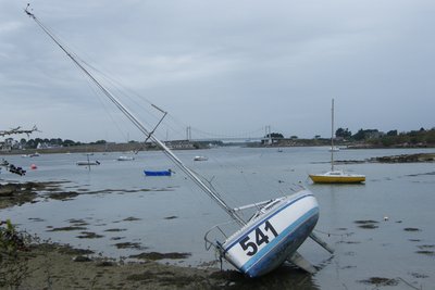
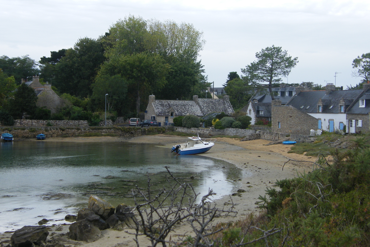
Ria d'Etel - Amis Bretons de Colomban PanoramicPort and ria d'Etel
The "Barre d'Etel" is a sandbox in perpetual movement under the influence of winds and tidal currents. It can generate breakers or ground waves. At low tide, it can complicate the entry or exit of the ria. It is for this reason that on the right bank of the mouth, a semaphore indicates its position by signals.
It is in a café of Etel that the German garrison withdrawn in the pocket of Lorient laid down arms on May 10, 1945.
Numerous oyster farms are located on the banks of the ria.
Upstream of Pont Lorois, St Cado Island is connected to the coast by a stone bridge. This one was built by the devil in exchange for the soul of the first person to cross it. It was a cat... It shelters a 12th century chapel and a fountain.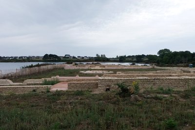
Villa romaine de Mane Vechen - Amis Bretons de Colomban HistoricalMane Vachem
Archaeological remains of a Roman villa situated on a promontory overlooking the ria d'Etel.
This "pleasure villa" was founded at the end of the 2nd century AD. By a member of the local aristocracy, was a trading centre linked to maritime trade and the production of fish salting.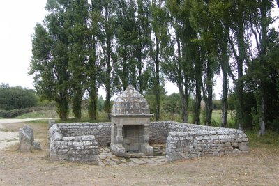
Fontaine de St Cornély - Amis Bretons de Colomban CulturalThe fountain of St Cornély
Located in a natural setting, not far from the village of Magouëro, this granite fountain is characteristic of the 18th century.
In the neighbouring village of Kerprat, you will find the chapel of St Cornély.
Rebuilt in 1768 in a rectangular shape with a bell tower dominating the façade, on the site of an old building. A small covered porch was built to the south, facing the cross where the horned beasts were blessed during a pardon (pardon on the 2nd Sunday of September).
It is used as a setting for exhibitions during the summer.
Description
From the church square, take the rue Abbé le Bach, then the rue du stade.
- At the exit of the village, take the track on the right towards the wood.
- At the junction with the white/red marked path, turn left and follow it.
- In the village of Pont Queno, cross the crossroads and take the path towards the Sac'h river.
- Cross the D16 and go towards the mill of Sac'h.
- After crossing the mill's dike, turn left and continue on the white/red marked path, along the Sac'h river and then the d'Etel river.
- Arrived on the D781, turn left and cross the Lorois bridge.
- After crossing the bridge, continue on the D781 up to the next crossroads..Turn left twice to go down on the coastal path. Continue on the white/red marked path.
- After passing the Roman villa and the small adjoining cove, leave the shore following the white/red marked path.
- After the fountain of St Cornély, turn right towards the village of Kerprat and the chapel. Continue straight on after the chapel to find the white/red marked path and follow it until you reach the place called Gueldro. Continue straight ahead and reach the church of Plouhinec.
- Departure : Church of St Peter and St Paul, Rue Abbé Le Barh, 56410, Erdeven
- Arrival : Place de l’église, 56680, Plouhinec
- Towns crossed : Bretagne
Altimetric profile
Transport
The modes of transport in Brittany are grouped on Breizhgo and Mobibreizh.
Report a problem or an error
If you have found an error on this page or if you have noticed any problems during your hike, please report them to us here: