11. from Quimper to Locronan
During this stage, we will cross the Glazik Country which owes its name to the blue colour of the men's costume.
Very hilly, it begins by following the valley of the Steir, a river that joins the Odet at Quimper. It ends with the ascent of the mountain of Locronan.
Montagnards don't laugh. For us bretons, it's already high, 289m. It's even the highest point in the Black Mountains...
6 points of interest
Quimper - Amis Bretons de Colomban CulturalQuimper
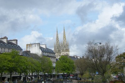
Being the seat of St Corentin, one of the seven founding saints of Brittany, Quimper is one of the crossing points of the historic Tro Breiz.
In Gothic style, the present cathedral was built in the 12th century on the basis of older buildings. Between its two towers, the statue of the legendary king Gradlon dominates the city.
The district of Locmaria is the place of the primitive city. Known today by its earthenware, it was from the 9th century the site of a double monastery. The current Romanesque church, classified as a historical monument, dates from the 11th century. The cloister remains in the garden. In the past, there would have been a chapel dedicated to St Colomban (or St Koulm?).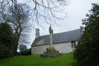
Chapelle de Seznec - Amis Bretons de Colomban CulturalSeznec Chapel
It is a modestly sized building built in 1673 (stone engraved above the side door), probably on the site of an older building, corresponding to the Christianisation of a Celtic place dedicated to the goddess of fertility as suggested by the presence of a nursing virgin.
The placister includes a very beautiful calvary with granite statues of Kersanton.
To know more about it...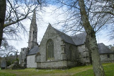
Chapelle St Thélau - Amis Bretons de Colomban CulturalSt Thélau Chapel
Large 16th century chapel, built on a former Celtic place of worship and listed in 1914.
St Thélau (or Thélo) would be a saint "à la mode de Bretagne". Some see in him, as in St Edern, a Celtic god christiannised. On the Calvary of the 16th century, near the chapel, St Thélau is, as always, represented on a stag next to the Virgin, St Peter and St John.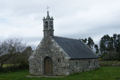
Chapelle Ar Sonj - Amis Bretons de Colomban CulturalAr Sonj Chapel
From this chapel "Ar sonj", (chapel of remembrance), located at the top of the mountain of Locronan (Plas ar Horn - altitude 289m anyway - highest point of the Black Mountains), you will have a magnificent view over the bay of Douarnenez.
The pulpit to be preached located at the entrance of the cupboard dates from 1887. The chapel was built in 1911. Considered too high, exposed to winds and lightning, it will be demolished in 1977 and replaced by the present chapel.
It is a crossing point of the Small and Large Tromenies.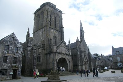
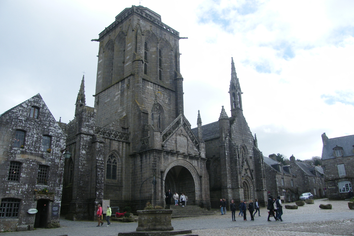
Locronan - Amis Bretons de Colomban CulturalLocronan
From the 14th century onwards, the cultivation of hemp, its weaving and the sale of the canvases brought great prosperity to Locronan. This can be seen in the built heritage.
The village of Locronan was preserved very early. It is now a member of the network of "small towns of character". Locronan is also labelled "most beautiful village in France". The village has been used as a setting for many film shoots.
The main square is dominated by the church of St Renan and the "Penity", a chapel which houses the tomb of St Renan.
Together with the Troménies, Locronan is one of the most important places of pilgrimage in Brittany.
The "Petite Troménie" takes place every year. Its 6km long route largely follows the roads and paths.
The big Troménie takes place every 6 years. The next one will take place in 2019. Its route crosses private properties and cultivated fields. It would symbolize the tour of the lands of the monastery of St Renan. It includes 12 stations formerly materialized by calvaries.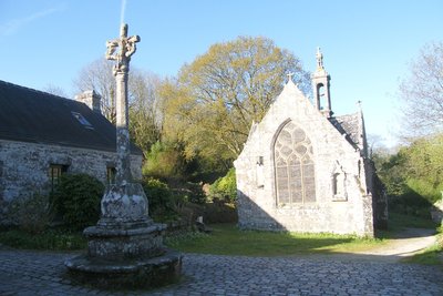
ND de Bonne Nouvelle - Locronan - Amis Bretons de Colomban CulturalND Chapel of Good News
This chapel is the fifth station of the Grande Troménie. Near the chapel is the fountain dedicated to St. Eutrope. The chapel was classified as a historical monument in 1915, the fountain and the adjoining Calvary in 1926. It has contemporary stained glass windows by Alfred Manessier (1985).
Description
From the cathedral square, join the banks of the Steir at the Rouget de l'Isle car park.
- Cross the river and go up its right bank following the white/red marked path.
- At the level of the Abel Villard street, cross the river and take the waymarked path on the other bank up to the Ar Meilhou Glaz roundabout.
- Pass under the four-lane road and take the Troheir road which runs along the drinking water plant.
- Follow the road of Troheir and pass the railway,
- At the crossroads, turn left, then after passing the high voltage line, turn left towards the village of Kermeurzin following the white/red marked path up to the D39.
- After crossing the D39, go around the village of Seznec on the left following the white/red markings.
- Leave the waymarked track in the village of Kervern by turning left. You will find it in the village of Pen ar Vouez.
- Join the road from Landrevarzec (D39) to Lezmel,
- Cross the D39 and go up towards St Thélau.
- Take the track leaving the chapel of St Thélau on your right and through the forest, join Plas Ar Horn at the top of the mountain of Locronan.
- From the chapel, go back down by the white/red marked path on Locronan.
- Departure : Saint-Corentin Cathedral- 29000 - Quimper
- Arrival : St Ronan's church, Place de l'église - 29180 - Locronan
- Towns crossed : Bretagne
Altimetric profile
Transport
The modes of transport in Brittany are grouped on Breizhgo and Mobibreizh.
Report a problem or an error
If you have found an error on this page or if you have noticed any problems during your hike, please report them to us here: