6. from Plouhinec to Hennebont
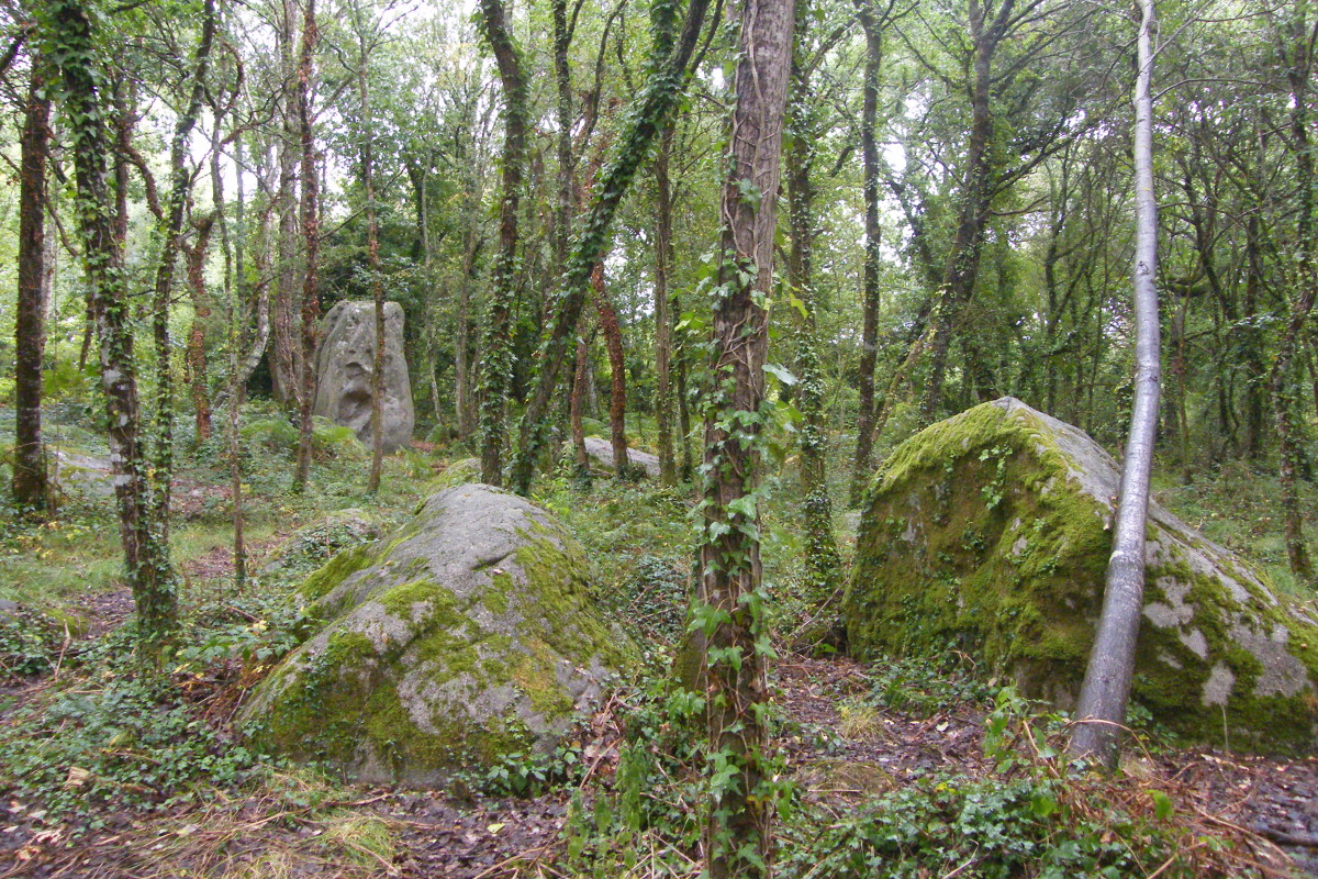
This stage will allow us to discover some more megaliths at the place called Kerfourcher lost in the woods (ruined dolmens and menhir). We will then join the Blavet which forms with the Scorff the roadstead of Lorient that we will see. The path along the river will lead us to the medieval town of Hennebont and its minor basilica.
2 points of interest
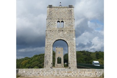
Le Pont du Bonhomme - Amis Bretons de Colomban PanoramicPont du Bonhomme
Before the current bridge was built, the crossing of the Blavet River was done by means of a suspension bridge.
Built in 1903, it was in service until 1974. The bridge deck was demolished in the early 1980s. Only the stone piers remain.
The name of this bridge comes from the name of a rock located on the Kervignac side (the "roch ar boulom").
Two statues initially in polychrome oak are placed at the top of the piles: a Breton woman on one pile holds a snuffbox out to a Breton man on the other. They were replaced by casts in 1995.
From the bridge, we have a view of the bay of Lorient.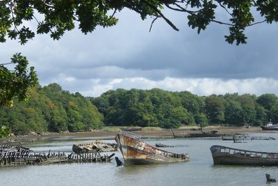
Cimetière de bateaux de Kerhervy - Amis Bretons de Colomban PanoramicKerhervy Boat Graveyard
In the Blavet de Kerhervy cove, in front of the ship cemetery, an outdoor theatre has been built. A theatre festival takes place there every year.
Description
From the Place de l'église, go into the rue du Général de Gaulle and take the rue de la gare on the right. At the exit of the town, turn right onto rue des Bois and continue on the path that extends it.
- At the intersection with the road, continue on the road to the left towards the village of Kerfourcher. Take the first track on the left, then on the right, then, at the next crossroads, turn right.
- At the intersection, turn left. At the next crossroads, turn right through the wood. Many megaliths are visible in this area. Go straight on until Merlevenez.
- Arrived on the D33, turn right towards the village, then the first street on the left towards Kerguelen.
- In the village of Kerguelen, turn left and continue until Kervihern.
- Take the direction of Mane Branroc'h.
- Turn to the right and go up to the next crossroads.
- Turn to the right, to go around the village of Mirador. From the former German fortification, view on the roadstead of Lorient.
- In the village of Kergaménan, turn to the left and cross the road D781. After crossing the village of Saint Sterlin, take the track on the right. Continue up to the bridge over the Blavet river.
- Cross the bridge.
- After the bridge, take the path on the left which leads under the bridge. Take the waymarked path going up the river.
- After the outdoor theatre, take the road which goes up on the left then take the first road on the right.
- Before the village of Kermen, take the right track which goes down towards Blavet. Continue on the marked track along the river Blavet.
- Before the railway embankment, take the track on the right. Join the Avenue de la République. At the roundabout, turn off onto Avenue Jean Jaurès, cross the Blavet, go up Avenue de La Libération. After the car park, turn left onto rue des Tanneries, then right onto rue Launay and join the basilica.
- Departure : Church Square, 56680 Plouhinec
- Arrival : Basilique ND de Paradis, Place Maréchal Foch, 56700 ,Hennebont
- Towns crossed : Bretagne
Altimetric profile
Transport
The modes of transport in Brittany are grouped on Breizhgo and Mobibreizh.a
Report a problem or an error
If you have found an error on this page or if you have noticed any problems during your hike, please report them to us here: