8. from Redené to Bannalec
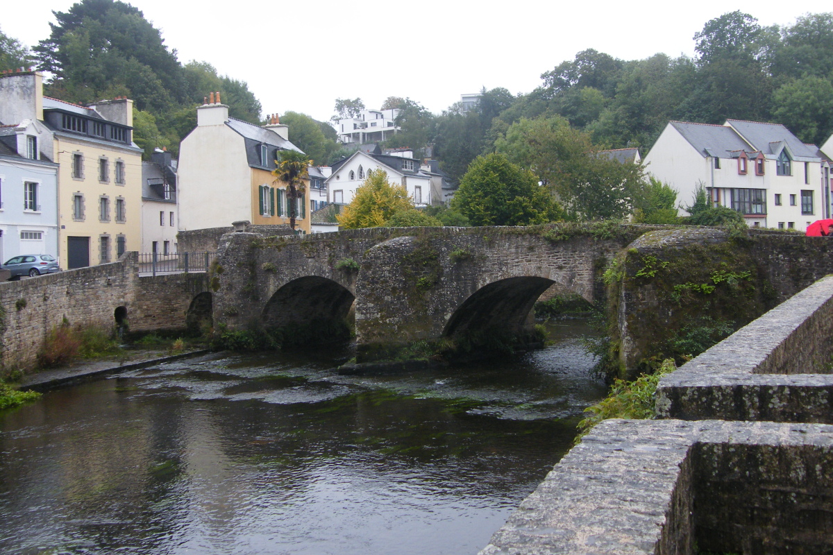
In Quimperlé, l'Isole joins l'Ellé to form the Laïta which flows into the Atlantic at Guidel. The lower town is often affected by floods due to these rivers. The heritage of Quimperlé is important, but we will also have the opportunity to pass by many chapels scattered in the countryside.
2 points of interest
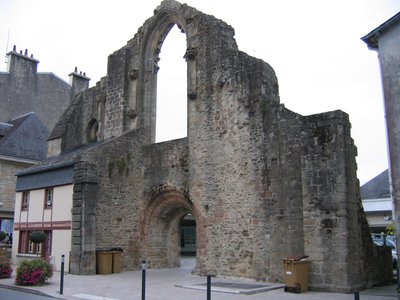
Église St Colomban de Quimperlé - Amis Bretons de Colomban St ColumbanSt Colomban Church of Quimperlé
Attested at least since the 11th century, the church of St Colomban was the former parish church of the Lower Town. The only remains currently in place, the west façade and part of the north elevation of the former choir, bear the traces of several construction periods. Abandoned since 1792 in favour of the Sainte-Croix church, which became the parish capital, the building quickly fell into ruins.
The new parish of St Colomban was created on 01 September 2017. It is composed of the former parishes of Nizon, Pont-Aven, Névez, Riec-sur-Bélon, Moëlan-sur-Mer, Clohars-Carnoët, Bannalec, Saint-Thurien, Scaër, Baye, Mellac, Le Trévoux, Quimperlé, Arzano, Guilligomarc'h, Rédéné, Trémeven, Locunolé and Querrien grouped into three local Christian communities.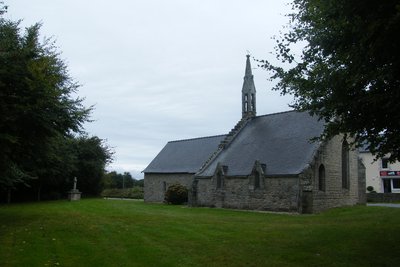
Chapelle de La Madeleine - 29300 - Mellac - Amis Bretons de Colomban CulturalChapel of La Madeleine
The chapel of the Madeleine was once used as a leprosarium for the city of Quimperlé. It was built in the 15th century. It is located on the historic Tro Breiz path.
Description
From the church square take the rue du Croeziou, then, at the first crossroads, the rue de Rosbigot, on the right.
- At the first crossroads, turn right, and, at the end of the street, take the rue de Fontaine, on the left. Continue along the road up to the village of Ty Crano.
- Turn right towards Kergoff. Continue until the D22.
- Take the D22 to the left. Then, at the first crossroads, turn right towards Kergueff. Go round the village and, once past the village, take the track on the left. This track forms a loop in the wood to come back to the D22.
- Back on the D22, turn right. The track is parallel to the road, on the other side of the ditch.
- After the EPHAD of Bois Joli, take the first road on the right towards Kerdaniel. In this village, take the marked white/red path which goes down towards l'Ellé. Follow it to Quimperlé.
- Cross the bridge. Go up to the Abbey of Ste Croix. Go around it and, on the left, join the place Charles de Gaulle, then on the right cross the Isole before its confluence with the Ellé to form the Laïta.
- Take the rue Jacques Cartier which goes up, on the left, towards the Haute Ville. By the stairs, join, by the Savary street, the church and the place St Michel.
- At the top of the Place, take the rue de l'Hôpital Frémeur, and, at the first crossroads, the rue des Tanneries to the right.
- At the rue de Pont-Aven, turn left. Continue until you leave town.
- At the roundabout, after the shopping centre, turn right, rue de Kervail.
- Take the second street on the left which goes parallel to Kerbraz.
- In the village of Kerbraz, turn left towards the four-lane road. Cross it and take the D22 to the right.
- After crossing the river "le Belon", take the track on the left. In the village of Kernivinen, take the road opposite on your right and join the village of Kermaout St Jean.
- In the village, turn right and cross the four-lane road.
- Take the first road on the right towards Lanorgard. Turn right in front of the monastery St François du Château de Lanorgard and head towards Le Trévoux.
- Cross Le Trévoux, and continue on the D106 towards the village of Logodec.
- Past the village, in the bend, turn left towards Kerandun.
- In the village of Kerandun, cross the railway, and take the track on the left. Continue up to the D765.
- Take the D765 to the right. At the first crossroads go towards the village of Kergouriou. Continue up to Kerguillerm.
- In the village of Kerguillerm, take the track on the right towards Pont-Fertil. Continue up to the village of La Cantine.
- At the crossroads, take the second on the right towards Ste Anne and join Bannalec.
- Departure : Church of Our Lady of Loreto, church square, 29300, Redené
- Arrival : Church ND du Folgoët, church square, 29380, Bannalec
- Towns crossed : Bretagne
Altimetric profile
Transport
The modes of transport in Brittany are grouped on Breizhgo and Mobibreizh.
Report a problem or an error
If you have found an error on this page or if you have noticed any problems during your hike, please report them to us here: