Chiavenna to Verceia
Lombardia
2. Chiavenna to Verceia
Easy
4h
20,6km
+153m
-276m
Step
Embed this item to access it offline
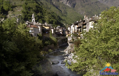
Chiavenna is the crossroads of two important valleys that lead to two historic passes to cross the Alps: on the one hand the Mera Valley with the Septimer Pass and on the other hand the Liro Valley with the Splugel Pass. After this fork, the path follows the right bank of the Mera river which supplies Lake Como, which is still overhung by mountains and from which many powerful streams descend.
2 points of interest
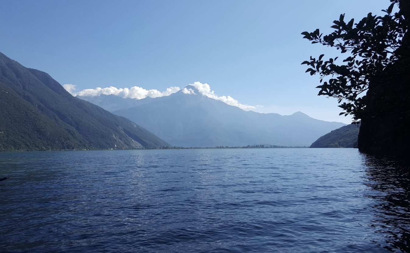
lac Mezzola - Amis St Colomban PanoramicLake of Mezzola
Panoramic view of Lake Mezzola at the point where the mountain river Mera flows into this lake, the first of a long series.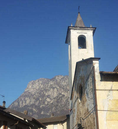
Église san Colombano St ColumbanSaint-Colomban Church
On the small lake of Mezzola is the village of Campo with the old parish church dedicated to San Colombano. The temple, now deconsecrated, suffered serious damage as a result of the war. The idea is to restore the old building and to highlight the Colombian memory of the place.
Description
There are two ways to reach Verceia:
- via the N6 cycle path, a circuit proposed in this stage,
- by the 6 km long Via Francesca, a variant described in the next stage.
On leaving the Collegiate Church of San Lorenzo in Piazza Don Pietro Bormetti, follow Via Don Luigi Guanella and turn left at the end into Via delle Agostiniane, which you will follow until you reach Piazza Giovanni Bertacchi:
- Turn right into the square to reach Via Francesco e Giovanni Dolzino, a narrow shopping street. At the end of the fountain square, turn left into Via Carlo Pedretti until you reach a roundabout. Take the third street on the right (Via Portone Vecchio) until the intersection with Viale Roma. Take this street until the next intersection on the right with Via del Grosso. Turn right into this street until you reach the bridge over the Mera. Cross the river at this point and follow the other bank along a path that passes by sports facilities. Before the confluence with the Torrente Liro, the path turns right to join a track and a bicycle/pedestrian bridge to cross the torrent.
- After the footbridge, turn left onto the cycle path that runs alongside the torrent and then back to the river Mera. Pass under the SP43 and continue on this bank of the Mera until the next road (SP2 Via Trivulzia) which crosses the river.
- Turn left and then right after the bridge to follow the opposite bank. Cross the SP2 road a second time.
- Continue on this straight track which, further on, passes under the SP2 for the third time.
- The track follows the bank of the Mera and then diverges to join the Torrente Valle del Pericchio and the SP2 before Novate Mezzola.
- After the bridge, turn right (red/white markings) and follow the left bank of the torrent to the shore of Lake Mezzola. Follow this bank until you reach the sports facilities where the path joins the railway. The track crosses the Codera stream and runs alongside the Ranchero campsite before passing under the railway line.
- At this point it is possible to climb up to the Oratorio di San Colombano along the Via San Colombano, which intersects with the SS36 road. Alternatively, turn right after the tunnel to continue towards Verceia along the lake.
- After the port, a tunnel allows you to pass under the railway and the SS36 and reach the church of San Fedele by taking Via San Fedele on the right.
- Departure : Basilica of San Lorenzo, Piazza Don Pietro Bormetti 3, 23022 Chiavenna
- Arrival : Church of San Fedele, via Nazionale 1, 23020 Verceia
- Towns crossed : Lombardia
Altimetric profile
Transport
Report a problem or an error
If you have found an error on this page or if you have noticed any problems during your hike, please report them to us here: