3. from Le Tronchet to Léhon
Stage through the state-owned forests of Mesnil and Coëtquen ending along the wild side of the Rance.
2 points of interest
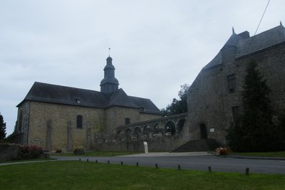
Abbaye du Tronchet - alain.faverais CulturalTronchet Abbey
Nothing remains of the 12th century abbey. The remaining buildings are those of the 17th century Benedictine abbey. Are still visible today the arcades of the cloister, the abbey church and hostelry used today as a place of exhibition.
To know more about it...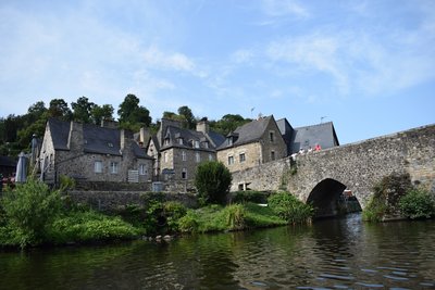
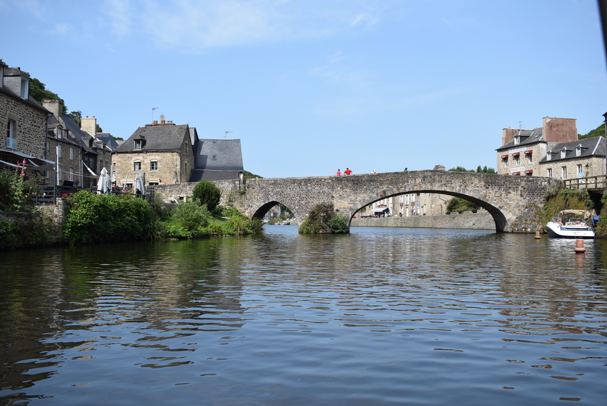
Port de Dinan - alain.faverais CulturalDinan
Dinan, a medieval town, surrounded by 3 km of ramparts and its 14th century castle dominate the Rance. Starting from the river, you can reach the town by the steep street of Jerzual and its old shops.
In the town centre, there are many timber-framed houses.
The heart of Bertrand du Guesclin lies in the Basilica of St Sauveur (12th century).
To find out more...
Description
On leaving the abbey, take the road to the right.
- After the hotel, turn right on the track at the end of the pond towards the golf course and continue until the D73.
- Take the D73 to the right
- After having passed the castle of Haut-mesnil on your right, take the forest alley on your left. Between the alleys, the tracks of the logging roads, the mountain bike tracks, it is very difficult to find your way in the Mesnil forest. Without GPS it is advisable to continue the D73 to the crossroads and turn left towards the village of Rouesnel to join the path to Bosselets.
- At the exit of the forest, cross the road and continue the path towards Gué Briand.
- Arriving on the road, turn right and cross the village of Gué Briand. Cross the C13 and take the track to go towards the 4 lanes.
- Turn left and follow the road which goes along the 4 lanes.
- Pass under the 4 lanes, then take on the left the road which goes along the 4 lanes on the other side. Turn left on the track which crosses the wood of Coët Cantel until the pond of Noël Davy.
- At the end of the pond, turn left in the direction of Coëtquen.
- In the village, before the castle, turn right then left towards St Hélen.
- In St Helen, go towards the church and turn right in front of the school towards the water tower.
- At the end of this road, turn right and continue until the D795.
- Cross the D795, (covered lane on your right), turn left and take the road which goes down to the right and continue up to the village of "Le Chatellier".
- In the village, turn left and go down towards the Rance.
- Take the ditch that once protected the barred spur on your right. Follow the path along the Rance river up to the entrance of Dinan.
- Cross the river Rance and go up the street of Jerzual. Join the basilica of Saint-sauveur, cross the city up to the esplanade of the Resistance and go along the ramparts.
- Before the street goes under the ramparts, turn right then left towards the training centre and go down towards the Rance. Go along the river on the right up to the abbey of Léhon.
- Departure : Abbey - 35540 - Le Tronchet
- Arrival : Abbey - 22100 - Léhon
- Towns crossed : Bretagne
Altimetric profile
Recommandations
Crossing the Mesnil forest is difficult without GPS.
Between the alleys, the tracks of the logging roads, the mountain bike trails, it is very difficult to find your way around. Without GPS it is advisable to continue the D73 to the crossroads and turn left towards the village of Rouesnel to join the path to Bosselets.
Transport
The modes of transport in Brittany are grouped on Breizhgo and Mobibreizh.
Report a problem or an error
If you have found an error on this page or if you have noticed any problems during your hike, please report them to us here: