12. from Pont Réan to Messac
We continue the descent of the Vilaine. Its valley narrows in places and schist cliffs appear. Pretty houses can sometimes be glimpsed between the trees. The route is always punctuated by locks and sluices.
5 points of interest
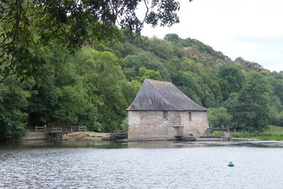
Moulin du Boël - Amis Bretons de Colomban TouristMoulin du Boël
Situated in a very steep area of the Vilaine, the Moulin du Boël was built in 1652. It is particular with its bow shape. It was used until the First World War. Heavily damaged during a storm in 1952, it was restored, with the help of local associations, by the municipality to which it now belongs
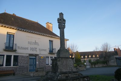
Le calvaire - Amis Bretons de Colomban TouristPléchâtel
Situated on a promontory, Pléchâtel dominates the Vilaine by more than 60m. A carved calvary from the 15th century, classified as a historical monument, decorates the town hall square.
The path going down to the Vilaine is dotted with oratories and statues.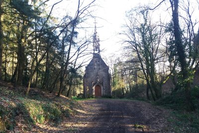
Extérieur de la chapelle - Amis Bretons de Colomban CulturalChapel of Our Lady of Montserrat
Chapel built in sandstone in 1879, for the viscount of Bouëxit following a vow made during a naval battle in Spain. It is situated on the edge of the rocks overlooking the Vilaine.
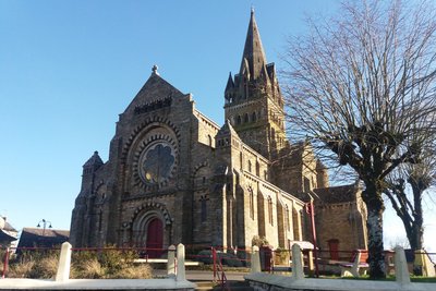
Extérieur de l’église - Amis Bretons de Colomban CulturalSt Malo de Phily
Situated at an altitude of 85m, St Malo de Phily dominates the deep valley of La Vilaine.
Its church was built in 1900. Its vault is made up of brick domes. It is known for the frescoes which decorate the choir and which describe the foundation of the village.
Around the year 700, monks who brought back from Saintes where he was buried, the relics of St Malo (his skull and his right arm), stopped in this place. Fily, the local chief, was then cured of his illness and gave the name of Malo to the village.
The frescoes in the choir were painted in 1933 by Émile Bernard.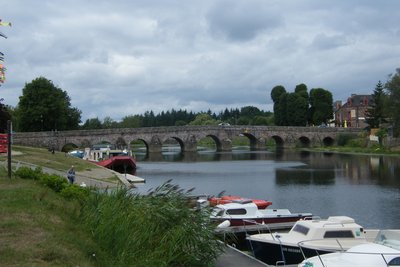
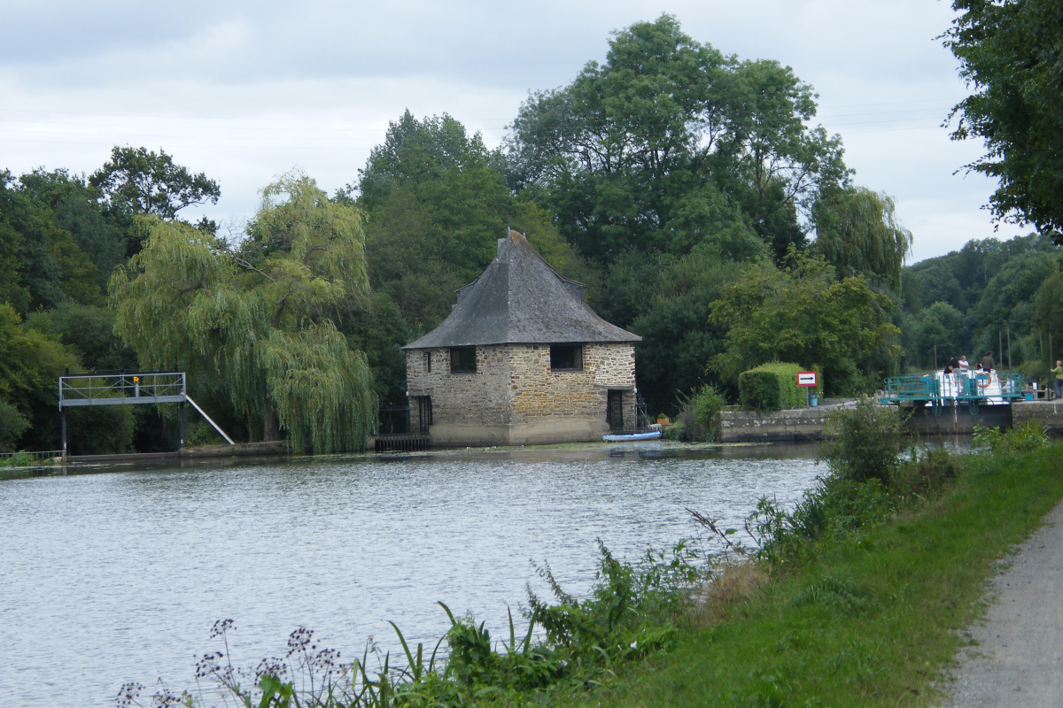
Pont-Réan, - Amis Bretons de Colomban TouristPont de Pont Réan
This elegant schist bridge has nine arches, the fifth marking the boundary between Bruz and Guichen.
The bridge dates from Roman Gaul, but was rebuilt between 1753 and 1767.
Situated on the Vilaine river, the Pont-Réan bridge is a pleasant place where walkers, whether on foot, by bike or by canoe, like to make a stop. It is also the ideal starting point to discover Bruz and the waterway, thanks to the various facilities on the site (parking, shops...).
Finally, for the curious, who wonder about the origin of the name of this bridge, some say that the word "réant" would come from "reance" (ransom) in relation to the toll that was collected there, but if we believe the Celtic toponymy, "réan" would be the derivative of "ran": the frog.
Description
At the bridge over the Vilaine de Pont Réan, take the towpath that runs along the right bank of the canal and follow it.
- After passing under the railway bridge of Cambré, the towpath goes back to the road. Follow this road and, at the place called "La Marre aux Mortiers", take the path on the right towards the chapel of Montserrat and reach the village of St Malo de Phily.
- After the church, go down the rue d'Aleth and, at the Calvary, take the " chemin de la Vigne " which goes down to the left. At the hamlet of La Bruère turn left and immediately take the path which goes down to the right and join the Vilaine.
- Turn right on the towpath up to Guipry.
- When you arrive in Guipry, at the right of the bridge over the Vilaine, turn right into the rue de la Chapelle. The chapel of Le Bon Port is at the beginning on the left.
- Departure : Immaculate Conception Church, rue de Redon, Pont-Réan, 35580, Guichen
- Arrival : Chapelle Notre Dame de Bon Port, 1, rue de la Chapelle, 35480, Guipry Messac
- Towns crossed : Bretagne
Altimetric profile
Recommandations
The route follows the route of the Ways of Compostela (Capitals Way).
Transport
Possibility of access to Pont-Réan and Guipry-Messac by train - Rennes Redon Nantes line
The modes of transport in Brittany are grouped on Breizhgo and Mobibreizh.
Report a problem or an error
If you have found an error on this page or if you have noticed any problems during your hike, please report them to us here: