Luxeuil-les-Bains to Annegray
Bourgogne-Franche-Comté
13. Luxeuil-les-Bains to Annegray
Medium
6h30
27,6km
+792m
-717m
Step
Embed this item to access it offline
Visit the Columbian sites, the Hermitage of Saint Valbert, the cave of Saint Colomban and the site of the first Columban monastery in Annegray. Emblematic places that tradition preserves through the legends of the Breuchin valley such as the Stone of the Sheep or the Stone of Sacrifice.
10 points of interest
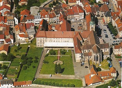
Vue aérienne de l’abbaye, de la basilique et du palais abbatial de Luxeuil-les-Bains - Amis de saint Colomban St ColumbanLuxeuil Abbey
Around 593, Colomban and his companions obtained permission from King Childebert to found a new monastery in the castrum of Luxovium.
It is likely that the first monastic buildings were located on the site of today's abbey. The various reconstruction works carried out on the abbey have erased all traces of the original monastery buildings.
The current monastic complex was built in the 17th and 18th centuries as part of a restructuring of the monastic movement initiated by the reform of Saint-Vanne and Saint-Hydulphe.
After having housed a minor seminary and then a private college until 2024, Luxeuil Abbey is now privately owned and will soon be hosting European congresses, conferences and other events, as well as pilgrims on the Via Columbani.
The architecture of the Abbey and its past, steeped in prayer and manual and intellectual work, provide an ideal setting for reflection, silence and rejuvenation. Tours are organised by the Vosges du Sud Tourist Office.
More information : Wikipedia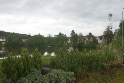
Étang de la Poche à Luxeuil-les-Bains - Amis de saint Colomban TouristThe Morbief and the Etang de la Poche at Luxeuil-les-Bains
The Morbief was dug by the monks of the Abbey of Luxeuil in the 12th century to supply water to the monastery's tanneries. A stream used to run through the lower part of the town, it was fed by the springs of the Banney forest that you will cross at the beginning of your stage. The Morbief's water intake is upstream in the Breuchin valley at La Lie aux Moines and crosses the town to join the Breuchin towards the west. From the 18th century onwards, the canal was used as a source of hydraulic power for the first ironworks. Today it has become a place for walking.
In order to have a regular flow of the canal the monks built the Etang de la Poche, still active for the regulation of the canal, and the Etang Saint-Valbert, which has now disappeared.
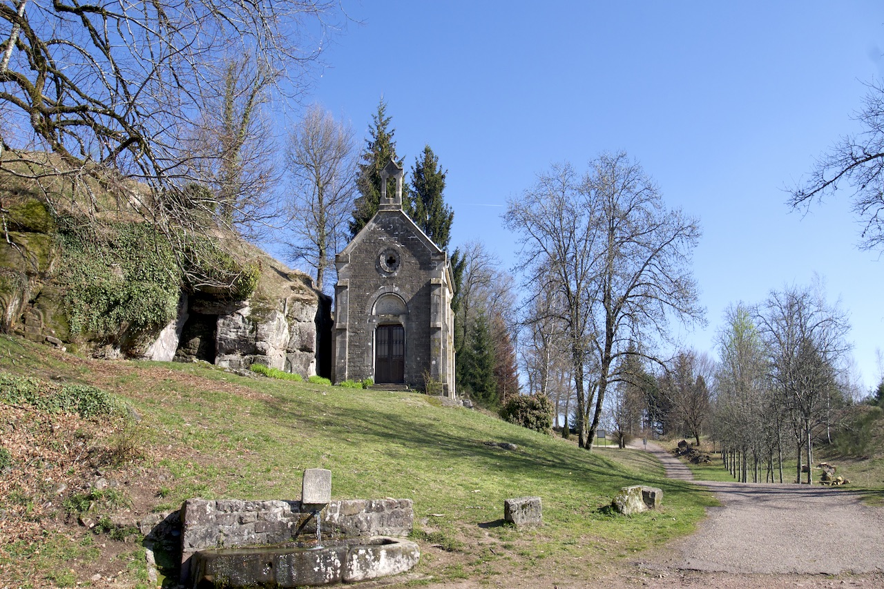
Église saint-Valbert - Amis de saint Colomban TouristVillage of Saint-Valbert
The date of the creation of the village of Saint-Valbert is not known, but it is very likely that its history is confused with that of the monks of Luxeuil. As early as the High Middle Ages, sarcophagi were extracted from the quarries near the hermitage of Saint-Valbert. The first quarrymen, monks and laymen lived in the village, which was supplied by numerous springs.
Today one can admire the 19th century church, superbly restored in 2017, and the nearby wash-house. A very dynamic commune of 200 inhabitants.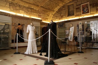
Conservatoire dentelle de Luxeuil - Amis de saint Colomban TouristLace Conservatory of Luxeuil
The particular fame of the lace of Luxeuil is essentially due to the enormous diffusion which it knew under the second empire. Until the Second World War, embroidery occupied dozens, even hundreds of female workers in the town and the surrounding communes.
At the conservatory: discovery of lacemakers at work and exhibition of needlework and original creations. Practice of lace and introductory and advanced courses.
Free visit from 2pm to 5.30pm on Tuesdays and Fridays.
Free entrance.
More informations : la Dentelle de Luxeuil website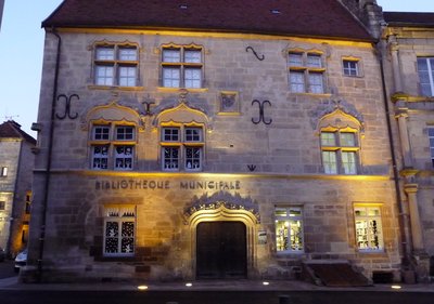
Maison Thiadot dite maison du Bailli à Luxeuil-les-Bains (15e siècle) - Amis de saint Colomban HistoricalRenaissance style houses in Luxeuil-les-Bains
From the 14th to the 15th centuries the town of Luxeuil was independent from the County of Burgundy. Merchants benefited from a favourable tax regime compared to that of the County of Burgundy. This must have been the main reason for the establishment of a Lombard family, the Jouffroy, trading in cloth between Flanders and Lombardy. They left us the two most beautiful buildings of the city, the house known as the house of Cardinal Jouffroy and the Aldermen's Tower which houses a museum. Its stone balcony is one of the oldest in France, observe the facade with its richly decorated gargoyles.
The Maison du Bailly (Thiadot Hotel, 15th and 16th centuries) and the house known as "François 1er" (which has no connection with the King of France) are worth a visit.
QR codes are affixed to the buildings for your information.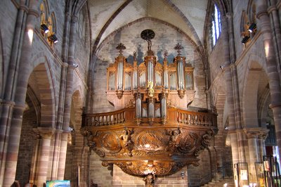
Orgue de l’église abbatiale de Luxeuil-les-Bains - Amis de saint Colomban St ColumbanBasilica of Saint Peter and Saint Paul at Luxeuil-les-Bains
When, in 590, Saint Columban, a monk from Ireland, decided to found a monastery among the ruins of the ancient Luxovium, his first concern was to build a church, probably a modest one, around which the cells of his first disciples were grouped. Since that time, several churches have been rebuilt following destruction and fires, but always on the same site. Since no archaeological excavations have been carried out in the basilica, it is difficult to reconstruct the history of this church. During the laying of the hot-air galleries at the end of the 19th century remains of walls not symmetrical to those of the church were discovered and many sarcophagi.
The construction of the present building began in 1215 and was completed in 1330. While cathedrals were being built in France, the monks preferred the rigour and austerity found in Cistercian churches of that time. The Gothic style rubbed shoulders with the Romanesque style reflecting the architectural evolution of the buildings in the 13th and 14th centuries.
Admire the most beautiful organ case in the region dating from 1617, still in perfect condition. The pulpit comes from Notre-Dame de Paris deposited in the 19th century at the request of Viollet-le-Duc who judged the piece of furniture to be not in conformity with the Gothic style of the Parisian cathedral. The choir stalls come from the cathedral of Saint-Etienne de Besançon destroyed by Vauban to build the citadel.
The Cloister
Together with the former abbey church, the pink sandstone cloister is the last medieval element of the Benedictine monastery of Luxeuil.
On the keystones of the vault, one can discover the coats of arms of three successive abbots who contributed to its construction in the 15th century. Although one of its wings was amputated during the Revolution and all but one of its arcature decorations were removed, it offers visitors an ideal setting to stroll around admiring the south façade of the abbey palace, begun in 1550 and completed a century later.
Les cuves après extraction des meules - Amis de saint Colomban TouristLa Pierre aux sacrifices à Raddon-Chapendu
The composition of the sandstone found in these forests is specific for sharpening edged weapons. For many centuries man has been extracting grinding stones from the rocks outcropping in these woods. After the extraction there remains a bowl in the rock and local legends have assimilated the sites to the tales of witches or sorcerers who sacrifice animals during occult rituals. In previous centuries, these stories told by hearth corners on local farms replaced today's television.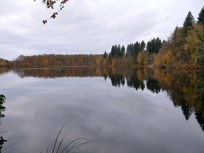
Paysage des 1000 étangs - Amis saint Colomban PanoramicThe Plateau of 1000 Ponds
A vast territory that requires several days to discover many secrets.
The topology of this place is the consequence of the retreat of the last ice age (minus 10,000 years). The ponds are the result of cavities left by the glaciers, man will create pockets of water rich in fish to feed in winter. The Irish monks who accompanied Colomban developed fish farming. The presence of natural ponds for such a long time has developed peat. Farmers have been able to exploit all the qualities of peat for heating, insulation and construction.
Calvaries and crosses are still numerous. They bear witness to a significant presence of peasants until the beginning of the 20th century who wanted to pay tribute to an event that took place there. The arrival of agricultural mechanization made some crosses disappear in crossroads where agricultural machinery could not manoeuvre.
The stone crosses exhibited on the site of Annegray Priory were donated by farmers who wanted to move crossroads crosses.
More information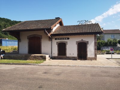 Historical
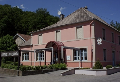
Old Tacot railway station
The Haute-Saône local railways are a former network of secondary departmental railways with metre gauge tracks, operated by the Compagnie Générale des Chemins de Fer Vicinaux (CFV), which in 1888 took over from the Compagnie du Chemin de Fer de Gray à Gy, concessionaire of the line of the same name since 1871, but then in bankruptcy. The train running on this network is locally and colloquially nicknamed ‘le tacot’ (the old banger).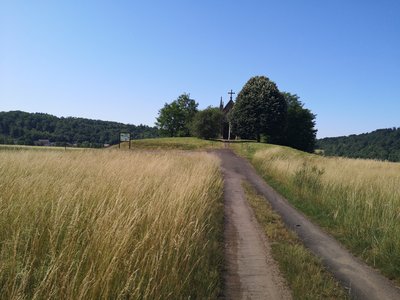 Historical
Saint Roch Chapel
The Saint Roch Chapel was built in 1636 on the very spot where the victims of the plague were buried. A burial mound marks the site of their graves. It was a simple wooden chapel that was gradually abandoned. When cholera began to rage in 1853, the inhabitants and those of the neighbouring villages vowed to rebuild it. The plague spared the valley, and the current chapel was built.
Description
Follow the north side of the Basilica of Luxeuil, rue du Sgt Bonnot, right rue Henri-Guy, left rue Saint-Colomban, at the first crossroads turn right, rue Gambetta, left cross the place de l'Étang de la Poche and head towards the path along the Morbief canal on your right.
- Take the bridge on the right to cross the canal and go straight up, turn left, go under the road. At the exit, go straight ahead towards the path which enters the wood.
- Cross the dual carriageway by the underpass on your right. At the exit of the underpass, turn left, cross the access road to the animal park, take on your right the tarred road going up in the forest. Straight ahead until Saint-Valbert. Use the game bridge to cross the 4 lanes. Cross Saint-Valbert and take the Chemin de l'Ermitage to the right of the church.
- After the visit of the Hermitage, cross the French garden and go out to the right, pass in front of the old quarry and follow the beacons of the Chemin des Moines.
- Follow the signposts towards La Plancenaye and cross the RD 18. Take the forest road in front of you in the direction of the Etang Trésurier and the pierre du mouton. Follow the signs for 200 m. to go down towards Raddon and Chapendu on the forest road following the Raddon valley.
- In Raddon, pass in front of the gymnasium in the direction of the town centre by the rue du Moulin. Cross the rue du Lieutenant-Colonel Boigey, take the rue du Rang de Fahys until 9 bis, turn left towards the Pierre aux Sacrifices.
- Turn right to continue the ascent of the hill passing in front of the sacrificial stone. Continue to the top of the hill, follow the beaconing to go down towards Amage. You arrive on the RD6 on the left a picnic shelter and a drinking water fountain follow the roadside towards the village. Take the rue du Tacot then cross the RD6 to take the rue de la sablière.
- Cross the RD139 to take the road to Saint Roch, parallel to the RD6. Take the direction of Ste-Marie-en-Chanois, take on the left the street "rue de la Proiselière".
- Cross the RD6 towards Rue Saint Colomban and follow it until the start of the climb. Turn right into the street (Les Collonges) and continue past number 26, then turn left onto the path leading up into the forest. Follow the signs to the Saint-Colomban cave and chapel. Descend via the path passing in front of the small pond towards Breuche-les-Faucogney.
- Crossroads with the RD 6, turn left towards Breuches for 200 m, cross the RD6 to take the direction of La Voivre by the departmental road. Take the stone bridge that crosses the Breuchin and turn left onto departmental road 139.
- Get to the stop sign on the RD 72, turn right then left, you are at the chapel Saint-Colomban d'Annegray.
- Departure : Basilica of St. Peter and St. Paul, place Saint-Pierre 70 300 Luxeuil-Les-Bains
- Arrival : Saint-Colomban Chapel, Annegray, 70 310 La Voivre
- Towns crossed : Bourgogne-Franche-Comté
Altimetric profile
Report a problem or an error
If you have found an error on this page or if you have noticed any problems during your hike, please report them to us here: