8. Dole to Saint-Jean-de-Losne
7 points of interest
L’hôpital de la Charité devant le canal des tanneurs à Dole, aujourd’hui Lycée C. Nodier - Amis saint Colomban HistoricalOld Hospital of Charity and Convent of the Ladies of Ounans at Dole
This hospital was built in the first quarter of the 18th century to accommodate children and the destitute. Today it is the boarding school of the Lycée Charles Nodier located nearby in the former convent of Ounans, Sisters Bernardines, built at the end of the 16th century.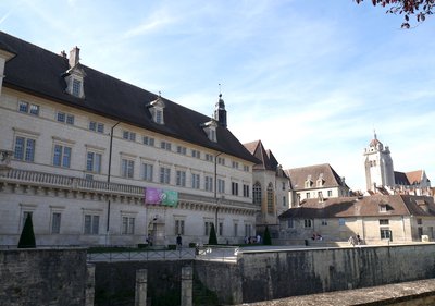
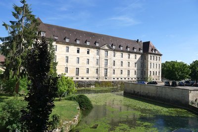
Façade de l’Hôtel-Dieu à Dole (XVIIe siècle) - Amis saint Colomban HistoricalL’Hôtel-Dieu in Dole
The Hôtel-Dieu de Dole is a former hospital, built from 1613, at the time Dole was the capital of the County of Burgundy.
In 1624, a governess and servants welcomed the first patients in the main building. Quickly overwhelmed, they called upon the hospice sisters of the congregation of Sainte-Marthe des hospices de Beaune, who took over on November 21, 1663.
From 1747 to 1753, the chapel was erected at the corner of the main body and the wing of the Rue Bauzonnet.
The building was enlarged between 1752 and 1767, as well as in 1840. Classified as a historical monument by decree of 8 June 1928, the building kept its hospital activity until its disaffection in 1992.
Rehabilitated between 1998 and 2000, it now houses the municipal archives, library and media library of the city.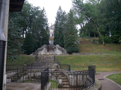
Parc de Scey à Dole - Amis saint Colomban TouristParc de Scey in Dole
At the start of your stopover and along the banks of the Doubs, you will discover a beautiful park. This 18th century English garden has many facets. Set out on the hillside, it is preceded, coté́ Doubs, by an ordered construction of basins around a pavilion. Cast iron dolphins are as many jets of water, while a beautiful pensive statue looks out over the basins. Owned by the city of Dole, it is open to the public.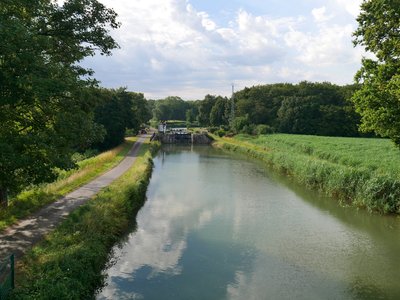
L’écluse à Saint-Symphorien-sur-Saône - Amis saint Colomban PanoramicRhone-Rhine Canal at Saint-Symphorien-sur-Saône
The Rhone-Rhine Canal is a canal that connects the Saône, a navigable tributary of the Rhone, to the Rhine through the Doubs valley and its extension in Haute Alsace to Niffer on the Rhine. Another extension joins Strasbourg through the canalisation of the river Ill. At the time of its construction, it was designed to link the seaports of northern Europe with those of the Mediterranean by creating a river link Rotterdam-Marseille through Germany.
The work on the junction between the Saône and the Doubs rivers from Saint-Symphorien-sur-Saône in Côte-d'Or to Dole in the Jura was carried out with downtimes linked to the Revolution between 1784 and 1802 by engineer Philippe Bertrand. They are continued with interruptions from 1804 to 1832 in the direction of the Rhine under the direction of Joseph Liard. Later, the canal was brought to the Freycinet gauge (a 300-tonne barge) between 1882 and 1921, but its traffic remained limited. The development of maritime traffic between Europe and Asia prompted Germany to build a canal between the Neckar, a tributary of the Rhine, and the Danube, a Black Sea river. The link was inaugurated in 1992 and commercial traffic on the Rhone-Rhine canal is only regional and therefore very limited. Pleasure boating has taken over with limited economic opportunities.
More information: Wikipedia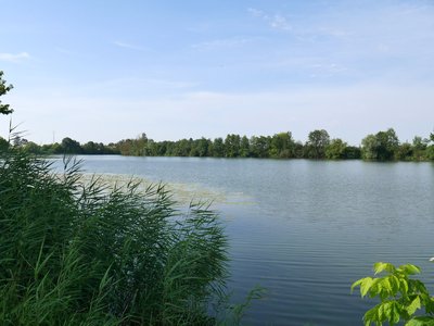
La Saône languissante - Amis saint Colomban PanoramicLa Saône in St-Jean de Losne
The Saône River originates in Vioménil in the Vosges department at an altitude of 396 metres and its confluence with the Rhône is in the city of Lyon. It is a 480 km long river, the Doubs is its main tributary. Before the confluence with the Doubs and its important flow located in Verdun-sur-le-Doubs, the Saône is called the Petite-Saône.
The river's flow undergoes significant seasonal fluctuations. The Saône is navigable from Corre, an ancient Gallo-Roman city, north of Haute-Saône, to the centre of Lyon, i.e. 365 km navigable, 167 km of which are of European size, from Saint-Jean-de-Losne to Lyon. Forty-one tributaries flow into the Saône.
Out of the summer season it is best to check the weather and the floods partially obstructing the river banks.
The fauna :
The European beaver occupies the banks of the Saône. The sheatfish, poison of the rivers of Central Europe, was introduced accidentally in the 1970s, it thrives to reach 2.50 meters in length to the satisfaction of sport fishing enthusiasts.
The river is also a migration route for birds between Africa and Northern Europe: storks, whooping cranes, black-tailed barges?
River tourism has become a prosperous economic activity for the happiness of the small municipalities crossed, which deploy significant means to welcome tourists between Northern Europe and the Mediterranean.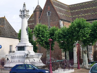
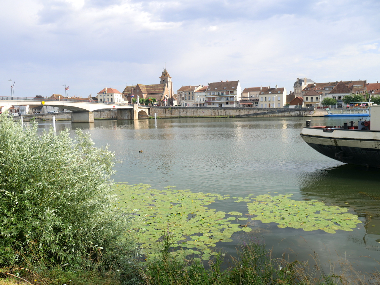
Monument commémoratif du siège de 1636. - Amis saint Colomban HistoricalThe Saint-Jean-de-Losne bridge: a strategic passage in times of war.
At this place, the Roman road between Salins and Dijon crossed the Saône to transport the salt from Comtois. The town was located opposite on the other bank, at Losne. Notre-Dame-de-Losne, a priory dependent on Cluny had been built. Initially dependent on the Dukes of Burgundy, the town was attached to the royal domain under Louis XI, on the death of Charles the Bold.
On October 28th 1636, the Austrian troops, after entering the kingdom of France from the towns of Gray and Dole in Franche Comté, decided to settle in Saint-Jean-de-Losne for the winter. The town withstood the onslaught in spite of the flooding Saône. The royal troops came to support the besieged and repel the enemy.
In 1814, an Austrian post was set up in front of the town and in a patriotic spirit the inhabitants joined the French soldiers. The war lasted one hundred days and Napoleon awarded the town the Legion of Honour in tribute to this resistance which held back the Austrian advance.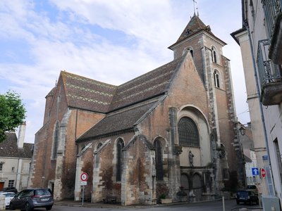
Vue générale de l’église de Saint-Jean-de-Losne - Amis saint Colomban TouristThe Saint-Jean-Baptiste church of Saint-Jean-de-Losne
The Church of St. John the Baptist (16th century) replaced an older building. The town register was already established when the church was built. As a result the building is not oriented.
In 1840, in order to access the new bridge over the Saône, the roadway had to be raised by almost two metres: today one goes down four steps to the gate, whereas before it was necessary to climb nine steps. The whole complex is built in brick with the exception of the limestone portal. The roof is made of glazed tiles, typical of Burgundy. Inside, you will discover the Sampans marble pulpit of a more beautiful effect (quarries in the region of Dole now abandoned). The high altar and the canopy, dating from the 18th century, are the work of an Italian artist, Antoine Marquetty. The organ with a rococo case dates from the same period.
Excerpt from the visitor's guide booklets available in the church.
Description
- Go under the bridge, first road on the right, go up, go around the roundabout, second road on the right, rue Charles Laurent Thouverey, D220, route de Dole
- At the roundabout turn right, Route de Dole, third street on the right, rue Jolie, straight ahead, rue des Jardins, at the crossroads turn right, rue des Chênes, right and left, rue de la Paix, chemin des Vaches on the left pass under the railroad tracks.
- Carrefour route de Champvans to the left and to the right after crossing the highway, to the left at the crossroads of the dirt road with the asphalt forest road.
- Crossroads with D 220, on the right take the cycle track, stay on your right to leave the cycle track, dirt and grass path
- Turn right at the crossroads with bicycle path, along the canal
- Turn left at the lock of Saint-Symphorien on cycle path, follow the Saône river, at the bridge on the right you arrive at the church of Saint-Jean-de-Losne.
- Departure : Notre Dame Collegiate Church, Place Nationale, 39 100 Dole
- Arrival : Saint Jean-Baptiste Church, place de la Libération, 21 170 Saint-Jean-de-Losne
- Towns crossed : Bourgogne-Franche-Comté
Altimetric profile
Report a problem or an error
If you have found an error on this page or if you have noticed any problems during your hike, please report them to us here: