Bonnal to Baume-les-Dames
Bourgogne-Franche-Comté
3. Bonnal to Baume-les-Dames
Medium
5h
21,5km
+610m
-548m
Step
Embed this item to access it offline
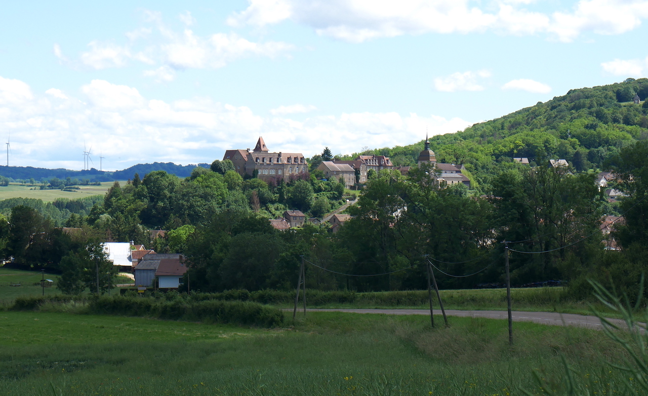
You leave the valley of the Ognon to enter the Grand Bois. The hilly landscape offers you a beautiful view of the town of Rougemont perched on its hill. Discover the heritage of this ancient medieval town. Woods and fields follow one another as you pass through villages where agricultural activity is very present. You arrive at the bottom of the Doubs valley, admire the panorama before a small detour in the arboretum. The descent to Baume-les-Dames is fast, the rich heritage of this city deserves a break.
6 points of interest
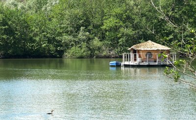
Cabanes lacustres au parc de Loisirs de la Forge de Bonnal - Amis saint Colomban TouristBonnal Water Park
The French Revolution chose the river as the departmental boundary that cut the territory of Bonnal in two: the village of Bonnal in the new department of Doubs and its forge in the department of Haute-Saône. Since then, all the land on the right bank has been under the jurisdiction of the commune of Chassey-lès-Montbozon in Haute-Saône.
The forges are mentioned several times during the 16th century. In 1545, François de Gevigney sold his possessions in Rougemont and his rights to the mills and forges of Bonnal to Jean de Civria. These mills then included a furnace for melting the ore and several forge fires. After a long silence in the seventeenth century, it is the resumption shortly before 1700. The blast furnace was shut down around 1840 and the forge was shut down around 1860. Today the de Moustier family is the owner of this tourist activity.
The Val de Bonnal campsite is in the department of Doubs and the Forge de Bonnal leisure park (commune of Chassey-les-Montbozon) in the department of Haute-Saône, a contiguous tourist complement that combines a traditional campsite with unusual accommodation and a beach in the 150-hectare leisure park.
Over the past centuries, quarries in the alluvial plain of the Ognon have modified the landscape to make way for a leisure base.
An early Christian church was discovered on the site during the extraction of sand. Nearly 150 tombs have been found dating from the 6th and 7th centuries. It is a major site of the early Middle Ages in Franche-Comté with that of the church of Saint-Martin de Luxeuil-les-Bains. In spite of development and enhancement work over the past few years, the site cannot be visited because it is not maintained and is not secure.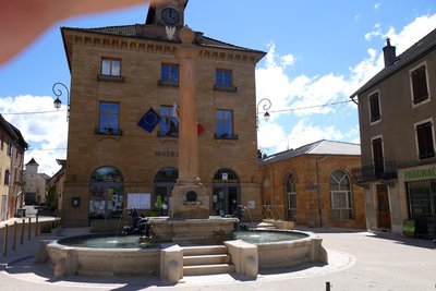
La mairie et la fontaine de Rougemont - Amis de saint Colomban TouristTown hall and former grain market in Rougemont
The Town Hall planned to serve as a town hall and boys' school was completed in 1834. It is the work of the architect Convers and was built under the mandate of Mayor Mercier. Subsequently, the grain hall (now converted into a foyer-club), the adjacent washhouse and the fountain were also built in the same style. These imposing constructions in local ochre stone, due to the presence of iron ore, give a perfect harmony to the centre of the town.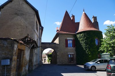
Porte médiévale du Vieux Moulin - Amis saint Colomban HistoricalThe Gate of the Old Mill in Rougemont
Until the 18th century, the village was surrounded by imposing ramparts pierced by four gates, including the Porte du vieux Moulin (Old Mill Gate) which you can admire today.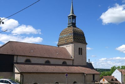
L’église de Rougemont avec son clocher comtois en tuiles vernissées typique des clochers francs-Comtois. - Amis saint Colomban TouristThe Church of the Nativité de Notre-Dame in Rougemont
The church of Le Crotot, today known as the Nativity of Our Lady, was the chapel of the castle and probably finds its origin at the end of the 11th century or the 10th century since it was the chapel of the Lords of Rougemont. Around 1640 it only became a parish church.
The church is composed of two bodies of buildings of different shape and period: one of ogival style dating from the 15th century, includes a close and two chapels. This is what remains of the former chapel of the feudal castle; the other has three naves at the end of which are two 18th century chapels. In the furniture of the church you can admire a terracotta Christ of the Spanish school, a polychrome wooden statue of St. Anthony (16th century) and two stone statues of the "Virgin and Child" from the 15th century, one of which is from the Burgundian school.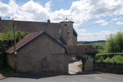
Une des tours du château de Rougemont - Amis saint Colomban HistoricalRougemont Castle
From the Via Columbani, 2 kilometres from the arrival in Rougemont, you will discover the Castral village. The Fortress, now disappeared, was to impose all its power to the travellers.
The history of the de Rougemont family is known since the 11th century. According to Castan, in 1039, at the coronation of Hugues 1st, archbishop of Besançon, the lords of Rougemont were among the first in the church of Besançon, behind the Count of Burgundy and the Montfaucon. They played an important role in the history of Franche-Comté. It should be remembered that this province, which belonged in turn, according to alliances or marriages, to Burgundy, to Flanders to the Holy German Empire and finally to the Spanish branch of the Habsburgs, was only definitively French from 1678 onwards (Treaty of Nijmegen).
Rougemont was for several centuries one of the main fortified sites of Franche-Comté. A fortified castle, visible from far away, stood at the top of the Citadel, between the present presbytery and the path of the Knights of St Georges. It defended the passage - a sort of cluse - between the Doubs and the Ognon rivers.
The castle is made up of 5 large square towers made in parts of cut stone quarters and the surplus of good barnstones.
Walking along Via Columbani, after walking along the church, you can see some remains of the rampart next to the Maison de Vigneronne and at the church's bedside a tower of the castle.
Visit the Maison Vigneronne, witness of the wine-growing past of the town until the end of the 19th century.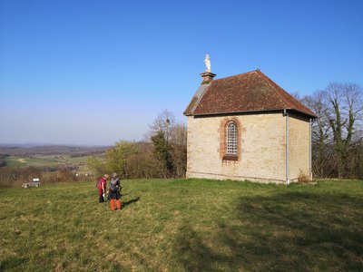
Chapelle Notre-Dame de Montaucivey - Les Amis de saint Colomban TouristThe Notre-Dame de Montaucivey chapel in Rougemont
In 1854, cholera broke out in Gray and spread to the Saône and Ognon valleys as well as to Besançon. The number of victims increased and fear took hold. Abbot Mourand, the parish priest of Rougemont, made a vow with the population to build a chapel dedicated to the Virgin if the plague spared the parish. Rougemont was spared while the plague claimed more than 10,000 victims in the region. The chapel, built in 1855, with its Virgin opening her arms in a protective gesture, remains one of the high points in the history of Rougemont.
An orientation table shows the panorama visible from this hill.
Description
Leave the church of Bonnal by the road to Rougemont, leaving the village, leave the D18 by the path on your right, then immediately turn left, go through the forest.
- At the crossroads with the D18, on the right, go over the TGV bridge, first path on the right then on the left, at the exit of the forest go down towards Rougement at the crossroads D18 on the right.
- Route de Bonnal at the crossroads on the left, first on the right, rue du Pont, at the crossroads straight ahead, rue la Glacière, on the right, rue de la petite cote, behind the church on the left.
- First road on the right, chemin de Montaucivey, first road on the left, chemin de Vers de Pluie, stay on the main road, at the fork to the left go straight on.
- At the crossroads cross the road to Morchamps, take the road on the right in the bend, straight ahead on a dirt track then a field path, turn left on a dirt track, right on D 113.
- Left towards the village centre, right after the church of Huanne. First on the left, first on the right along the woods
- Left on asphalt road towards Trouvans, first road on the right route de Verne. Verne, right then left, rue Principale. At the end of the village, take a dirt road on the right, left at the fork in the road.
- Luxiol, rue des Près, turn right on route de Baume, left and then right on rue des Champs, crossroads, exit the village, second road on the right, stay on your left, pass on the motorway, go straight on in the wood, at the crossroads stay on your right.
- After a curve to the left, to the right on a wooden path, cross the Chemin de la République, go down towards Baume-les-Dames, after the cemetery pass under the railway, straight ahead you arrive in front of the Saint-Martin church in Baume-les-Dames.
- Departure : St. Valère Church, Chemin de l’Église, 25 680 Bonnal
- Arrival : Saint Martin's Church, Place Saint-Martin, 25 110 Baume-les-Dames
- Towns crossed : Bourgogne-Franche-Comté
Altimetric profile
Transport
Report a problem or an error
If you have found an error on this page or if you have noticed any problems during your hike, please report them to us here:


