Worms to Rheingonheim
Rheinland-Pfalz
15. Worms to Rheingonheim
Difficult
7h30
29km
+151m
-158m
Step
Embed this item to access it offline
You leave Worms by following a natural zone, a first industrial zone to go around and then a new natural zone, it is this alternation which will follow one another during your day. Use the cycle paths, with caution, which are at your disposal to avoid walking along the roadsides.
3 points of interest
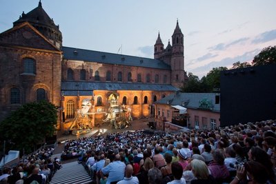
Festival Nibelungen à Worms - 1-Ambiente-hell-Bernward-Bertram CulturalThe Nibelungen Museum in Worms
The name Nibelungen Museum is only appropriate to the site. You won't see any works of art on display but all the heritage of the Nibelungen is presented and interpreted in futuristic architecture.
The song of the Nibelungen, written around 1200 is the most important epic legend of the Middle Ages, comparable to the ancient legend of Troy.
Siegfried's entry into Worms and the quarrel of the queens in front of the cathedral are two of many scenes that take place in and around Worms. Not forgetting the immersion of the famous Nibelungen treasure by Hagen in the Rhine. Many of the people and events described in the Nibelungen song are a historical testimony.
Nibelungen Museum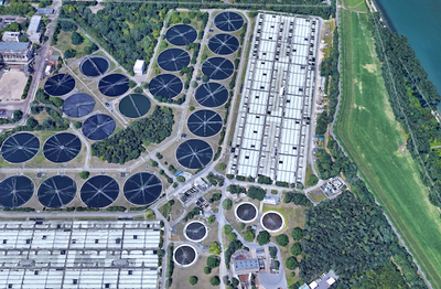
La station d'épuration de Ludwigshafen PanoramicLudwigshafen and industrial area wastewater recycling plant
Almost 100 million cubic metres of wastewater produced by the chemical industry are treated there every year. The company also cleans 20 million cubic meters of wastewater from the cities of Ludwigshafen and Frankenthal and the community of Bobenheim-Roxheim.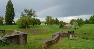
L’ancien canal de frankenthaler avec l’écluse - Wikimedia Commons Immanuel Giel PanoramicFrankenthal Canal Dam Lock
During this stage you will walk along a small park with a stream in the middle. This is the former lock of the Frankenthal Canal, a town 4,000 metres to the west. The canal connected the very commercial city with the Rhine over a length of 4,500 metres. A harbour made of ashlar was at the location of the docks behind you.
When the French revolutionary troops conquered the Left Palatinate region of the Electoral Palatinate from 1793 onwards, the bridges, dams and walls of the canal were so badly damaged by the fighting that it was no longer usable just six years after its commissioning.
With the construction of the railways, the importance of the canal continued to diminish. However, the imperial bell of Cologne Cathedral, cast in Frankenthal by Andreas Hamm and weighing 26 tonnes, was still being transported to the Rhine on one of the canal ships in 1875.
In the second half of the 16th century, refugees from the Netherlands, persecuted for their religious beliefs, settled in Frankenthal. Their work brought economic prosperity to the town. Some of them were carpet weavers, jewellers and artists, thanks to whom the Frankenthaler Malerschule (the Frankenthal School of Painting) was founded.
Further information: Wikipedia
Description
From the cathedral entrance on the right Dompltaz left to Neumarkt, cross Neuhmarky and then the car park straight ahead on Kranbühlerstrasse, left Wollstrasse
- Cross Ludwigstrasse and the car park slightly on your right to Philosophenstarsse, Friedrichsweg, pass over the B 9 motorway, walk on this green path for 3,000 metres,
- Left at the parking lot am Rheinufer after crossing the small river, right on the road following the Rhine
- Turn right at the second crossroads with a Mittlerer Busch road, left before the bridge over the B9 Nonnenbusch along motorway B9 Rheinhauptdeich, stay on your left leave the motorway to join the Rhine Rheinhauptdeich, follow the Rhine riverside
- Pass under the A6 motorway on the right, drive along the motorway for 300 metres, left Muldenweg, right on Am Hansenbusch, turn left onto cycle path, pass under Am Hansenbusch, pass under the L 523 motorway, left along the Sticklerweiher (Stickler pond) on your right
- Turn right at the end of the pond, then left across the Grosser Kartzenpfad railway, left before K1, on cycle path, right at the crossroads with Rheinstrasse cross K1, right on Bad-Aussee-Strasse parallel to K1, turn right with Horst-Schork-Strasse
- At the end of Horst-Schork-Strasse slightly to the left follow the main road into the fields Mittelpartstrasse, after the Begutenweiher Pond turn left onto Mittelpartstrasse, follow the cycle path to the left to take the railway bridge
- Turn left at the crossroads after the Prälat-Caire-Strasse bridge, take cycle path to the right, under the access road to the road bridge turn left with cycle path parallel to K3, straight ahead at the large crossroads, under A 650 and then under K3 Mittelgraben
- Turn right after K3, cycle path parallel to K6 Saumgraben, at the first houses on your right turn left and right Brühlgraben, Professor-Humke-Weg
- Turn right at the crossroads in front of an office building, cross K 13 Meckenheimer Strasse K 7, bicycle path on the left in front of the Limgurgerhofweg railway, after the station go under the railway, cross Wölhnerstrasse, take Eisenbahnstrasse, go under the motorway B 44 second street on the left you will arrive in front of St. Joseph's church.
- Departure : Petersdom, Domplatz, 67547 Worms
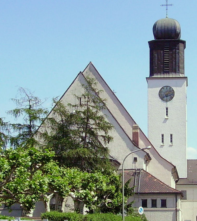
- Arrival : Saint-Joseph Church, Carolistrass 23, 67067 Rheingönheim
- Towns crossed : Rheinland-Pfalz
Altimetric profile
Report a problem or an error
If you have found an error on this page or if you have noticed any problems during your hike, please report them to us here:

