From Le Vivier-sur-Mer to Le Mont-St-Michel
Bretagne
3. From Le Vivier-sur-Mer to Le Mont-St-Michel
Medium
5h54
23,6km
+109m
-97m
Step
Embed this item to access it offline
The entire route of this stage is located on the Duchesse Anne dyke, which separates the Dol marshes from the herbus.
The herbus, also known as "salt meadows", is the area beyond the dyke that is covered by the sea at high tide. The halophilic vegetation is specific to this environment. The salt-meadow sheep that live here are unique to this area. Numerous birds also occupy this territory. Hunting huts buried near the water can be seen.
The herbus, also known as "salt meadows", is the area beyond the dyke that is covered by the sea at high tide. The halophilic vegetation is specific to this environment. The salt-meadow sheep that live here are unique to this area. Numerous birds also occupy this territory. Hunting huts buried near the water can be seen.
5 points of interest
Port mytilicole - Amis Bretons de Colomban TouristMussel Port of Le Vivier and Bay House
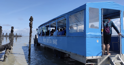
The port of Le Vivier is a major mussel-farming centre. The bouchots (rows of wooden stakes planted in the bay on which the mussels are hung) are harvested using amphibious equipment.
The Maison de la Baie, located on the harbour, offers exhibitions on the bay and mussel cultivation. It also offers discovery walks in the bay.
To find out more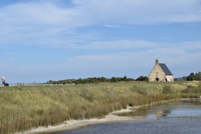
Chapelle Ste Anne - Amis Bretons de Colomban CulturalSte Anne's Chapel
Ste Anne's chapel is thought to date from the construction of the dyke. It was destroyed by a flood in 1630 and rebuilt in 1684.
A pardon is held here in July.
It marks the end of the Duchesse Anne dike and the beginning of the western polders.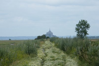
Digue principale du Polder de l’Ouest - Amis Bretons de Colomban HistoricalWest Polder
On 21 July 1856, Napoleon III signed a 99-year concession with the Compagnie des Polder de l'Ouest for the creation and operation of new polders.
The 3,000 hectares of polders were created by gradual dyking, mainly in the area where the Couesnon River had dived.
The last flood dates back to February 1869.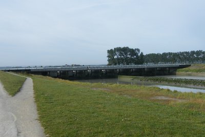
Le barrage sur le Couesnon - Amis Bretons de Colomban TouristDam on the Couesnon
This dam on the Couesnon is the central element in the series of works carried out to restore the Mont's maritime character.
At mid-rising tide, it lets the water in through the gates to prevent sediment from entering the river. At half-tide ebb, it allows the Couesnon to empty into the bay through the bottom of the sluice gates, creating a "flushing" effect that moves sediment away from the Mont. To increase the volume of water involved, the Couesnon and the Moidrey cove were dredged.
A number of symbols can be seen on the promenade bridge at this dam:
- in reference to the scriptorium, the bronze desk on the railing is engraved with letters from the four alphabets (Latin, Greek, Hebrew and Arabic),
- The bronze access doors to the piers are marked using the four numbering systems above.
- An extract from a 12th-century manuscript dedicated to astronomy is engraved in the centre of the lectern.
- The Couesnon forms the border between Brittany and Normandy. This is why the coats of arms of the two regions are engraved at each end. You can also see mouldings of shells from the bay (scallops, coquilles St Jacques or white cockles), symbols of the pilgrimages that converged on the Mont.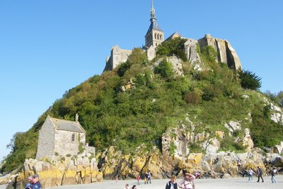
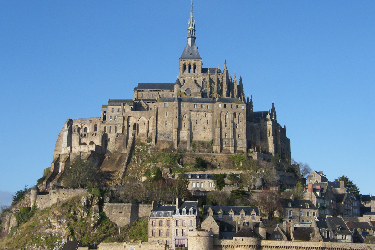
Le Mont St Michel - Amis Bretons de Colomban HistoricalThe Mont St Michel
The Mont St Michel is one of the most visited sites in France. Major works have recently been carried out to restore the Mont's maritime character. The destruction of the access dyke and its replacement by a footbridge are important phases in this process. But only a third of visitors come to the abbey.
Before it became a tourist destination, the Mont was a place of pilgrimage, attested to as far back as the 9th century.
Today, the religious presence in the abbey is assured by brothers and sisters of the Monastic Fraternities of Jerusalem.
To find out more
Description
From the church, take the D797 towards the mussel port and the Maison de la Baie:
- Turn left into the harbour and immediately right onto the road reserved for amphibious craft.
- When the road forks towards the bouchots (mussel beds), continue straight ahead on the dyke (white and red markings). Continue along the dyke as far as Ste Anne's chapel.
- After the chapel, continue along the dyke with the Mont in your sights. Make no mistake: the impression of proximity is... only an impression.
- Following the red and white signs, cross the dam and continue towards the Mont. Follow the Grande Rue up to the parish church of St Pierre.
- Departure : Place de l’église, 35960 Le Vivier sur Mer
- Arrival : Eglise St Pierre, Grande Rue, 50170 Le Mont-St-Michel
- Towns crossed : Bretagne and Normandie
Altimetric profile
Report a problem or an error
If you have found an error on this page or if you have noticed any problems during your hike, please report them to us here: