From St-Pois to Vire
Normandie
7. From St-Pois to Vire
Medium
5h54
23km
+428m
-424m
Step
Embed this item to access it offline
Until the 1970s, the area around St Michel de Montjoie, with its "Bleu de Vire" granite, was France's third-largest granite-producing region after Brittany and the Tarn. On this stage, you can see that granite is everywhere: in outcrops, in the construction of embankments in blocks or standing stones, in fence posts and in the walls of houses. The signposts for the local villages are even carved from this material.
St Michel de Montjoie owes its name to the belvedere at the foot of the church from which Mont St Michel could be seen. Groups of pilgrims would choose their king: the one who first saw the Mont.
St Michel de Montjoie owes its name to the belvedere at the foot of the church from which Mont St Michel could be seen. Groups of pilgrims would choose their king: the one who first saw the Mont.
6 points of interest
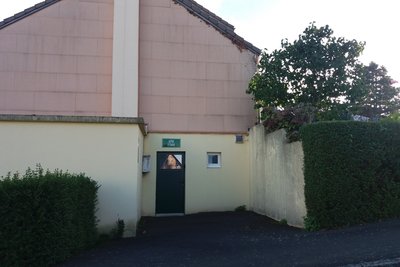
Eglise de St Pois - Amis Bretons de Colomban CulturalChurch of St-Pois
Returning from Hastings in 1066, Richard Le Servin had the old church built and dedicated to St Patern, Bishop of Avranches. The present church dates from 1880 and is dedicated to St Louis. The two bells were in a temporary belfry. After one of the bells fell in 1909, it was decided to install them in the tower, to which a spire was added. When the local granite quarry refused to supply the stone at the price quoted, the tower was built using granite from Louvigné-du-Désert.
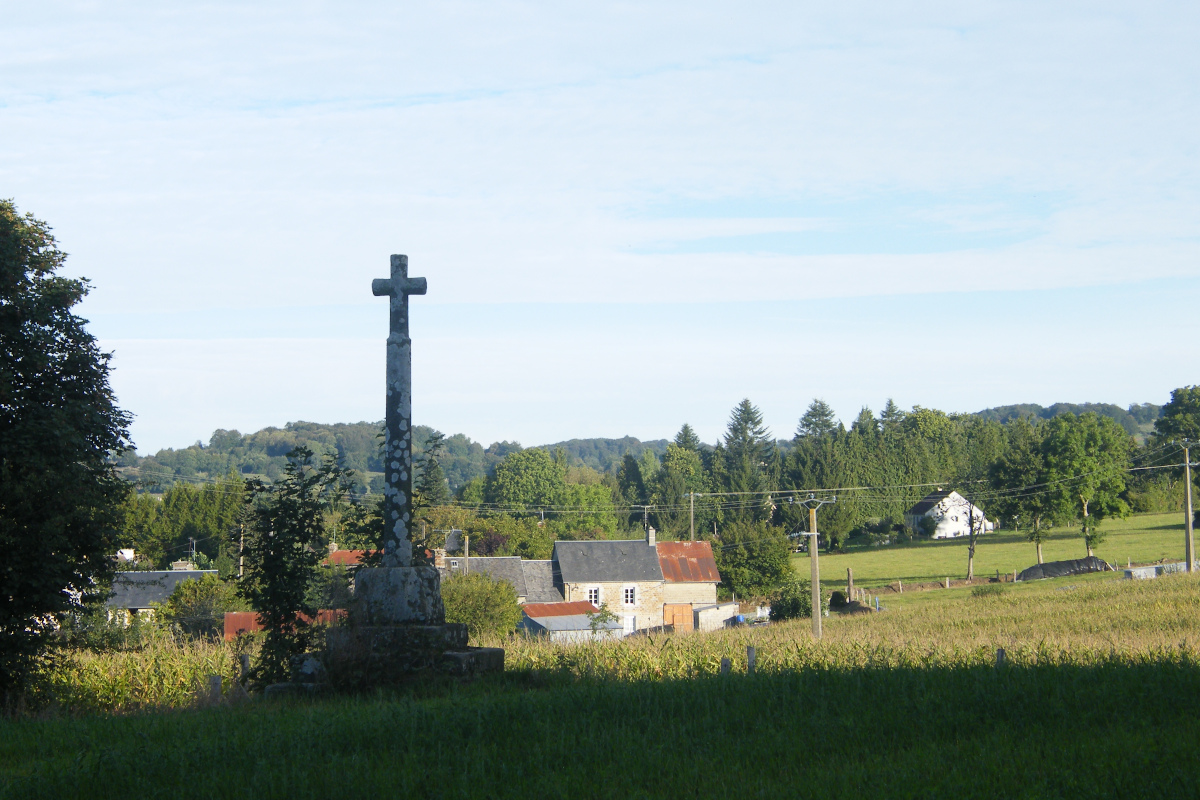
On leaving the village, at the top of the hill on the road to St Michel, in the corner of a field on your right, the Montjoie cross marks the spot from which pilgrims could see Mont-St-Michel.
Enseigne du musée - Amis Bretons de Colomban CulturalGranite Museum: St-Michel-de-Montjoie
This museum, set outside in a park, traces the history of the "Bleu de Vire" granite extraction sites. You can see a reconstructed quarry, the extraction methods used and the tools used. You can also see various sculpted pieces and how they were used.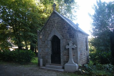
La chapelle des Nouettes - Amis Bretons de Colomban CulturalOratoire des Nouettes
This chapel was erected in memory of Pierre Lesage, known as "Les Nouettes" after the village where he was born in 1772. Returning to his village after a stay in Paris between 1789 and 1791, he went to church and, without knowing it, served mass to a priest under oath. Wanting to make amends, he devoted the rest of his life to serving refractory priests and organised a network of confessors. A pardon is held every Ascension Thursday.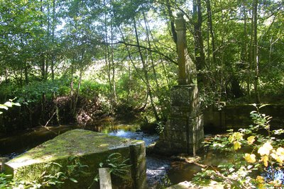
Poteau de Quintaine - Amis Bretons de Colomban CulturalThe post of Quintaine
In the Middle Ages, the Quintaine referred to the post topped by a dummy on which knights practised handling their lance. It later became a feudal fee.
Dismantled during the Revolution and moved, this piece of granite, with its old-fashioned shield, symbolises the lord's right.
At the end of the 18th century, it was used to mark water rights, divert floods or create a reservoir during periods of low water.
The entire structure (posts, weirs, spillways, cofferdams and sluice gates) formed a system for distributing the waters of the Dathée.
When the dam is emptied, fish can be retained and transferred to other water bodies.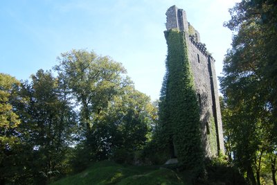
Ruines du donjon - Amis Bretons de Colomban HistoricalDungeon of Vire
In 1123, the Duke of Normandy, Henry I Beauclerc, had a square keep built on a spur, in a meander of the River Vire, with a first enclosure. In the 13th century, Saint Louis completed this defence with outer ramparts. For fear of Huguenot rebellions, Richelieu had the castle and its walls dismantled. All that remains today are the remains of the keep, the bases of some of the towers in the castle square and a few towers in the town, such as the clock tower.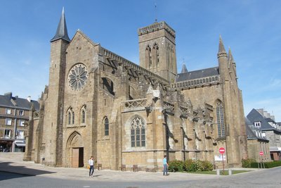
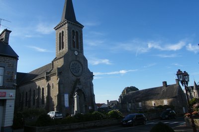
Eglise Notre Dame - Amis Bretons de Colomban CulturalNotre-Dame Church
The Gothic-style church of Notre Dame was built between the 13th and 16th centuries on the site of a Romanesque sanctuary by Henry I Beauclerc, Duke of Normandy (who also built the château).
It was listed as a Historic Monument in 1862.
It was badly damaged in 1944.
Description
From the church, go up the main road and, at the roundabout, turn right onto the road to St Michel-de-Monjoie. After passing the cross in the field, turn right onto the path that leads down through the trees and follow the white/red signs:
- At the junction with the road, continue straight ahead on the road, past the Bourg-Lopin farm, then after the right-angle bend, turn right onto the track and climb up to the village of St-Michel-de-Montjoie.
- At the junction with the D39, turn right and head up towards the church, taking the track on the left after the calvary. Walk past the church and take the road up to the left of it. Follow the road up to Les Bourdonnières. Continue along the track that runs alongside the hangar on the right. Take the second road on the left towards Les Nouettes. Pass in front of the chapel and continue along the woodland path.
- At the village of "Le Hérisson", follow the road to the right, then take the track on the left towards the village of l'Anglaicherie. After passing the houses, turn right (Chemin des Balcons du Sud Manche) and rejoin the road. At the crossroads, take the track opposite to reach the village of Champ-du-Boult.
- In the village of Champ-du-Boult, turn right at the church and walk alongside it. At the fork at the bottom of the village, turn left onto the D302 towards "La Cour" then, at the fork, take the track on the left towards "la Bietrie". After the last houses in the village, take the track on the left. At the exit, turn left onto the road, then right onto the signposted track. Follow the path towards Lac de la Dathée. At the junction with the road in the village of La Vicomtière, turn left and follow the road as far as Le Landais towards the lake. At the end of the road, take the path to the left of the hangar and follow it as far as the golf course orientation table.
- At the crossroads, turn left towards the golf course and, as you go downhill, turn right onto the track to reach the banks of Lac de la Dathée. Follow the shore of the lake as far as the dam.
- Go down the road to the right of the dam, cross the river and turn right. At the crossroads with the D218, turn right. Cross the river again at Moulin de Dathée and head for Grand Chéné. Continue until you reach the junction with the D76. Follow this to the left, and at the next crossroads, turn left onto the D305. Turn right into the cul-de-sac towards La Franquerie, then straight on along the track. Follow this in the direction of Vire.
- Take rue de Tivoli down to the Vire dam. Cross the dam and take the path leading up towards the château. Cross the Place du Château to reach Notre-Dame church.
- Departure : Church Square, 50670, St-Pois
- Arrival : Notre-Dame Church, 14500 Vire
- Towns crossed : Normandie
Altimetric profile
Report a problem or an error
If you have found an error on this page or if you have noticed any problems during your hike, please report them to us here: