From The Mont St Michel to Avranches
Normandie
4. From The Mont St Michel to Avranches
Medium
7h18
29,8km
+250m
-172m
Step
Embed this item to access it offline
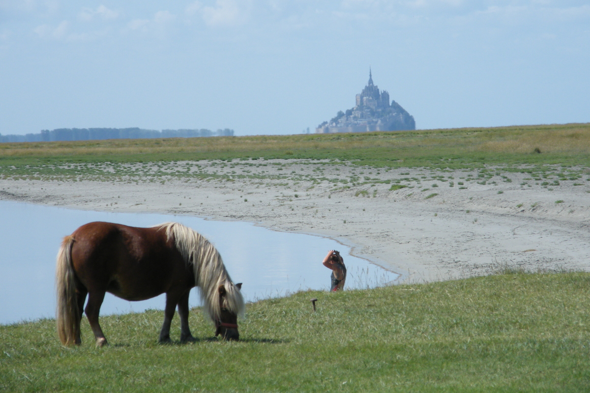
Departing from the Couesnon, we'll follow the dyke or the grasslands to the Sélune and round its mouth. We then head up the Sée as far as Avranches. During high tides, tidal bores travel up these two rivers.
3 points of interest
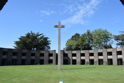
Vue intérieure - Amis Bretons de Colomban HistoricalGerman Ossuary of the Mont d'Huisne
Located opposite Mont St Michel, near Avranches, where, on 30 June 1944, the Allies made a decisive breakthrough in the German defence following the Normandy landings, this mausoleum was built between 1961 and 1963 on a hill some thirty metres high. It contains the bodies of 1,956 German soldiers from the Grand Ouest and the Channel Islands. It is a ring-shaped, buried building with an internal diameter of 47 metres. It has 68 crypts on two levels, each containing 180 bodies. A large cross stands at its centre.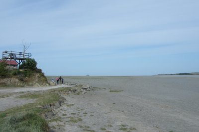
Pointe de la Roche Torin - Amis Bretons de Colomban HistoricalThe Roche Torin dam
In 1857, plans were made to build a dike from the Pointe de la Roche Torin to the Mont St Michel in order to create new polders. It was never completed.
Blocking the sediments, the part that had been built led to the extension of the grasslands. Several studies have shown the disastrous consequences for the maritime character of the Mont.
Its destruction began in 1983, marking the start of work on the bay.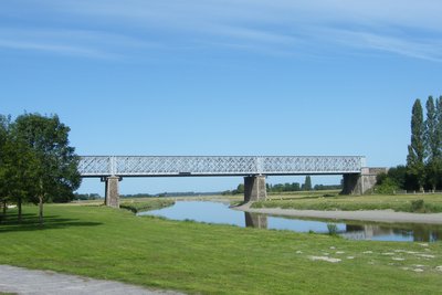
Pont de l’ancienne voie ferrée - Amis Bretons de Colomban HistoricalPontaubault
Before arriving in Pontaubault, you can see a small oratory in the cliff.
Pontaubault is located at the mouth of the Sélune and was one of the first crossing points between Normandy and Brittany.
The various metal bridges were used for railway lines, one of which is now abandoned and converted into a greenway.
The first stone bridge was built in the 15th century, close to a Roman road. In 1793, it saw fighting between Chouans and Bleus. On 1 and 2 August 1944, it saw the passage of Patton's army.
Description
Leaving the Mont, cross the access bridge again and, at its end, turn left onto the red/white signposted path that follows the dyke at the top of the grassland. Follow the dyke as far as "Le Rivage" where it meets the D275:
- Follow the road to the left and, after the car park, take the left-hand fork in the signposted path along the dyke. Continue as far as the pointe de la Roche Torin.
- Go around the point and follow the D313e. Continue as far as the crossroads with the D113. Turn left and follow the upper part of the grassland as far as Pontaubault. Pass under the metal bridge and cross the Sélune by the stone bridge.
- When you come out of the bridge, turn left onto the signposted path that follows the upper part of the grassland. Continue as far as the Avranches water treatment plant.
- Continue along Rue des Grèves until you reach Rue du Pont Gilbert. Turn right onto this street, cross the railway tracks and follow the station to the right.
- Once past the station, follow the signs for the pedestrianised town centre. Cross the footbridge over the Autoroute des Estuaires and walk up the Chemin du Tertre de la Gare. At the roundabout with the D7, go straight ahead and then turn left onto the Promenade Pierre Aguiton. Walk past the Town Hall and turn left into rue d'Islande and place d'Estouteville, as far as the Scriptorial museum.
- Departure : Eglise St Pierre, Grande Rue,50170, Le Mont St Michel
- Arrival : Scriptorium,Place d’Estetouville, 50300, Avranches
- Towns crossed : Normandie
Altimetric profile
Recommandations
During this stage, we will regularly cross the grasslands, home to the salt meadow sheep. If you are accompanied by a dog, always keep it on a lead and remember to close all the gates you cross.
Report a problem or an error
If you have found an error on this page or if you have noticed any problems during your hike, please report them to us here: