From Le Petit Celland to St Pois
Normandie
6. From Le Petit Celland to St Pois
Medium
6h
23,7km
+569m
-569m
Step
Embed this item to access it offline
At the start, the route of this stage continues to follow the "ridge line" above the Sée valley, with all its attendant views. It then crosses this valley to climb the northern slope. The Normandy bocage takes shape.
3 points of interest
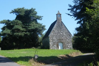
Chapelle de Signy - Amis Bretons de Colomban CulturalSigny Chapel
The Signy chapel, located a short distance from the Manoir, was built in 1620 by Françoise de Signy, the local lady. It is a place of pilgrimage to Notre-Dame-de-Pitié, Mater Dolorosa. In the past, it had several chaplains, but they were not obliged to remain in residence.
The main façade, a comb bell tower, has two levels of elevation: the first has a low-arched doorway and the second is blind. The chapel has no other openings.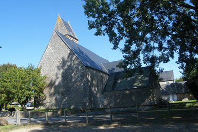
Eglise de Cuves - Amis Bretons de Colomban CulturalCuves
Cuves was the scene of tank battles during the Avranches breakthrough from 3 to 10 August 1944.
St Pierre's church, with its bell-tower roof, dates from the first half of the 18th century. There are several crosses on the surrounding wall, including a bubonic cross in front of which the faithful used to pray against the plague.
To find out more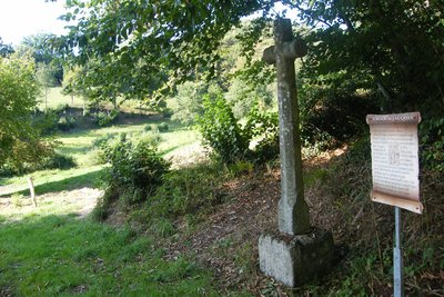
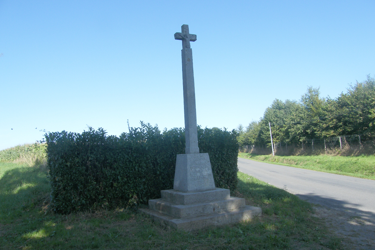
Croix St Jacques - Amis Bretons de Colomban CulturalJames Cross
Formerly located next to the now-defunct chapel of St Jacques, it was moved near this bridge in 1823.
Description
Leave the village of Petit Celland in the direction of La Fouquière. Then take the track on the right, just before the wood. Follow it to the road and turn left. Then take the track on the right (mountain bike route). At the village of La Raberie, take the track on the left and at the village of Bois Regnier turn left again onto the track and go down to the D106:
- Cross the road and take the track opposite up towards the village of La Sourdière. In the village, turn right following the white/red signs. At the next crossroads, turn right onto the D462, and leave it at the village of l'Aiglerie by taking the road on your left and the track that runs alongside it.
- At the junction with the road, turn left and as you go downhill, take the track on the right towards La Guette de Bas. Go around the village of l'Anglaicherie and join the D999.
- Cross the road and take the track opposite. Follow this track and the road that runs alongside it (white/red markings). At the crossroads, head towards the village of La Fonce and join the D48.
- Cross the dual carriageway and take the track opposite, parallel to the road, towards the Moulin de Signy. Continue along the track to the road and turn right to reach the chapel. Above the chapel, turn right at the fork, then left towards Loteray. As you climb the hill, take the track on the right and follow it to the crossroads with the D495.
- Turn left and, at the next fork, continue left towards Cuves. At the next crossroads, take the signposted path to the right. Follow the signs to the crossroads with the D79. Turn left onto the main road to reach Cuves.
- In the village of Cuves, turn right onto the D911. As you leave the village, turn left onto the D48, towards the cemetery. At the calvary fork, take the track on the left. Follow this and turn left onto the D568. On the D568, turn right and follow it to the access road to the Soudairie farm. Turn right at this point.
- At the bottom of the hill, after the bridge over the Glanon, take the footpath on the left near the calvary. Follow this signposted path into the village of St Pois.
- Departure : Place de l’église, 50370 Petit Celland
- Arrival : Place de l’église, 50670 St Pois
- Towns crossed : Normandie
Altimetric profile
Report a problem or an error
If you have found an error on this page or if you have noticed any problems during your hike, please report them to us here: