Vézelay to Cravant
Bourgogne-Franche-Comté
4. Vézelay to Cravant
Difficult
8h
31,7km
+760m
-938m
Step
Embed this item to access it offline
The landscapes of the Morvan are behind you, but the Cure valley discovers all its charm with this river that winds its way through wooded valleys. You will find vineyards that embellish the landscape in some places. A long stage that you can do over two days. During this stage, you walk against the current of the Way of St. James Compostela which comes from the north of France and heads towards Vézelay.
8 points of interest
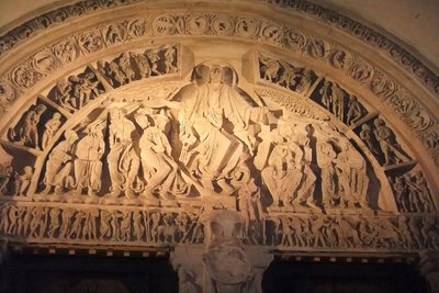
Tympan central du narthex de la basilique de Vézelay - Amis saint Colomban HistoricalThe eardrums of the narthex of the Basilica of Vézelay
The central tympanum of the basilica is a major work of Romanesque art, everything is symbolic of the folds of the tunic of Christ in the gestures of the disciples and apostles.
A guided tour is essential to understand the messages addressed to the pilgrims before entering the church.
Admire the southern tympanum: the childhood of Jesus, the beginning of Jesus' earthly life and the northern tympanum: the ascension of Christ, the end of Jesus' earthly life.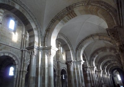
Au solstice d’hiver, 21 décembre, les chapiteaux du bas-côté sud sont éclairés par le soleil - Amis saint Colomban HistoricalThe capitals of the Basilica of Sainte-Marie-Madeleine in Vézelay
The Basilica of Sainte-Marie-Madeleine is a masterpiece of Romanesque art that almost disappeared. Prosper Mérimée, Inspector General of Historic Monuments, will obtain the necessary funds for the restoration of the basilica, which will be entrusted to Viollet-le-Duc.
The finely sculpted capitals number about a hundred on two levels and represent mythical scenes, as well as iconographic evidence of life in the Middle Ages.
They are said to be of exceptional beauty, one of the most famous is "mystical mill". One can also admire "Saint Martin and the tree of the pagans" or "Daniel saved from the lions, or "Jacob's blessing".
To discover the messages of the sculptures of the Middle Ages you must stop at the Visitor's House and take part in a guided tour.
La maison des visiteurs à Vézelay
More information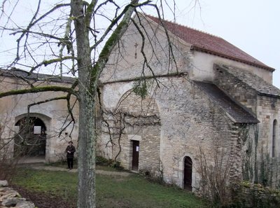
Prieuré Franciscain à La Cordelle - Amis saint Colomban TouristLa Cordelle, Franciscan priory in Vézelay
Situated on the northern flank of the Vézelay Hill, the Holy Cross Chapel, now known as "La Cordelle", was built in the year following the preaching of the Second Crusade in 1146 by Saint Bernard. Since that time, it has always remained a place of Franciscan presence near this high place of pilgrimage.
A priory under the name of St. Fiacre was built next to it for the Benedictines. The Franciscans from Italy replaced them in the 13th century and remained there until the Revolution.
Today three friars live in this hermitage, they pray and welcome in Franciscan simplicity and joy all their pilgrims, especially those who are on their way to Assisi. La Cordelle is not a place for vacationing, it is a place that one seeks because one is attracted by a spiritual thirst, a need to contemplate the Beautiful, while keeping the Silence of the heart.
Source of information Wikipedia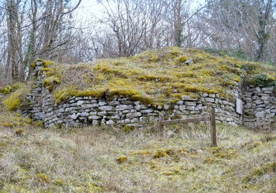
Ruine d’une tour du camp romain de Cora - Augusta 89-Wikipédia HistoricalAncient site of Cora in Saint-Moré
Before arriving in Saint-Moré-sur-Cure, you will go around the archaeological site of Cora which you can visit.
The ancient camp of Cora, of its full name Cora-Villaucerre camp, is a prehistoric site of the Neolithic, Bronze Age, Hallstatt and then a Roman camp. "Cora" is the Latin name of the river La Cure which flows through the valley.
The camp is built in the shape of an oval, 600 metres long and 400 metres wide, giving an area of between 20 and 25 hectares.
In Roman times the Neolithic site became a fortified camp on the Via Agrippa.
In summer the vegetation takes possession of the wall and its surroundings, so that not much can be seen. Also the visit is to be made in winter. The path is lined with explanations.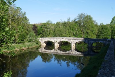
Pont de Saint-Moré sur La Cure - Amis saint Colomban St ColumbanThe site of Cora in the Life of Saint Colomban written around 640.
In the Vita Columbani, Jonas de Bobbio, quotes the name of the city of Cora (Saint-Moré). The monks under guard arrive in Cora and meet five men suffering from frenzy, who were healed immediately.
Translated into French by, Life of Saint Columban and his disciples.
Today St. Moré and a peaceful village on the banks of the river La Cure.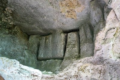
Carrière de sarcophages à la Roche Taillée avant Arcy-sur-Cure - image-institut-iliade.com HistoricalLa Roche Taillée in Arcy-sur-Cure.
On the Via Columbani, the sarcophagus quarry of the "Roche taillée" is located at the top of the coral cliff overlooking the river, about a kilometre, as the crow flies, from the famous cave of Arcy sur Cure.
The cut face extends over 85 m and rises up to 25 m. Here you can see the cuttings made to drive in wedges of dry wood that were wetted so that the swelling would cause the rock to break. The negative imprints left by the removal of the sarcophagi are also visible. The quarrymen, before proceeding with the extractions, levelled the wall : the blows of the picks left traces arranged in "fish bones", clearly visible in certain places. Holes were dug in the rock for scaffolding.
Underground mining was also carried out, as evidenced by several chamber entrances hidden by scree.
Once extracted, the sarcophagi were dug on site and then lowered to the river, where they were transported on barges or driven by oxcarts to via Agrippa, 300 m further on, to be taken to their destination. The face has receded by several dozen metres over the centuries.
This text is a synthesis of Pierre Poulain's work: "La carrière de sarcophages d'Arcy sur Cure".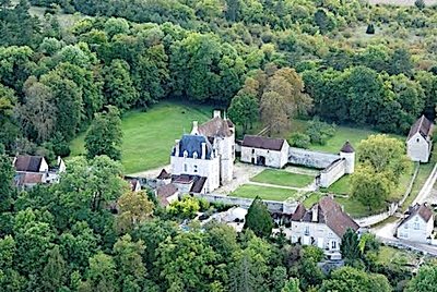
Manoir du Chastenay, Arcy-sur-Cure - http://www.arcy-sur-cure.fr/fr/information/37305/patrimoine-histoire HistoricalChastenay Manor of Arcy-sur-Cure
Private property located on Via Columbani.
This residence is sitting on a network of flooded underground caves, at the intersection of two roads that are Via Agrippa de l'Océan. This mansion was a place of alchemical research during the Middle Ages, as shown by the many symbols carved or painted in this mansion.
The manor house's large facade, decorated with a turret, as well as its tower, are Renaissance. Most of it dates from the 14th century and replaces an older residence called the Château du Lys, built in the 11th century. One reaches the Saint-Jean tower through the "Porte des Sages" (Gate of the Wise Men) to enter the interior of the castle whose porch is sculpted with numerous allegorical figures.
The left wing dates from the 18th century and was redesigned around 1850 by a pupil of Viollet-le-Duc. A neo-Renaissance style pavilion was built next to the manor house in 1875.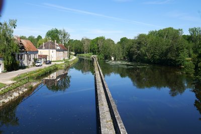
Canal d'Accolay et l'Yonne - Amis saint Colomban HistoricalThe Accolay Canal and the Yonne River
From Cravant, thousands of steres were led by the Cure to its confluence with the Yonne. During the 19th century, voices were raised to make this river navigable. With the decline in the consumption of driftwood, the port of Vermenton needed a commercial outlet in the Yonne. In a report of 1873, one can read: "This canal will be very useful for the transport of wood and will even be indispensable as soon as continuous navigability has been restored to the Yonne upstream from Auxerre to Clamecy". Recognised as being of public utility by decree of 17 January 1876, work began in 1878 and was completed in 1883 (Yonne Departmental Archives,3 S 176; Dictionary of Rivers and Canals of France.
Description
In front of the basilica turn left, rue de la Porte Sainte-Croix at the corner of the north aisle, cross Cours de la cordelle.
- La Cordelle, go along the chapel on the right, dirt road, straight ahead, La Bouillère on the left, rue de la Fontaine Bouillère, second street on the right, Chemin de la Croix Blanche, cross the Chemin de la Canotte straight ahead, Chemin de la Croix rouge
- Crossroads with D 123 on the right then on the left, crossroads D 21 on the left, on the right asphalt road, cross the rue des Maraichers, path on the edge of the wood, take the path in the direction of Les Hérodats, rue de la Croix
- In the forest first road on the left, at the crossroads road on the left, straight on, cross the asphalt road, first road on the right after the cross.
- Follow the edge of the wood and turn right, go through the village Lac Sauvin, leave the village, turn right into the forest, at the crossroads stay on your left, follow the turning road on your right, left at the crossroads with D 950
- First path on the right in the forest, on the right at the crossroads, you bypass the ancient Camp of Cora, follow the railway track on the left at the level crossing rue du Crot, on the right leave the tarmac road, first path on the left, stay on your right following the Cure valley.
- Val-Sainte-Marie on the left Grande-Rue, take the road following the Cure, go around the town hall, rue de l'Eglise, after the cemetery first road on the left in the forest, stay on the main dirt road in the forest
- Bessy sur Cure at the first houses, turn left then right Chemin du Haut, in front of the church take the Grande Rue, straight out of town follow the cure, chemin de la Vernault, Croix de Montacourt straight on a dirt road between the fields, Accolay, rue du canal, on the left take the bridge over the canal, take D 39A on the right, crossroads D 606 on the left then on the right,
- At the crossroads, go straight along the wood,
- Cravant right rue de Monteloup, left around the rampart on the left, promenade Saint-Jean you arrive at the church.
- Departure : Basilica of Saint Mary Magdalene, place de la Basilique, 89 450 Vézelay
- Arrival : Saint-Pierre et Saint-Paul Church, Promenade Saint-Jean, 89 460 Cravant
- Towns crossed : Bourgogne-Franche-Comté
Altimetric profile
Transport
Report a problem or an error
If you have found an error on this page or if you have noticed any problems during your hike, please report them to us here:
Close by8
- Information
Information
La Maison du Visiteur in Vézelay
The rich heritage of Vézelay requires information and guidance in the basilica. You present the architecture, the tympanum and reading the capitals is the objective of this association which makes you discover the messages of the builders addressed to the pilgrims in the Middle Ages.


