Variant : Wädenswil in Tuggen
Schwyz
9. Variant : Wädenswil in Tuggen
Medium
7h
18,4km
+0m
0m
Step
Embed this item to access it offline
Crossing successive cities along the lake but less and less dense as you move away from Zurich. Beyond the bridge that connects Rapperswil, Lake Zurich continues with Lake Obersee and the countryside is really back after Lachen last town at the beginning of the Obersee.
2 points of interest
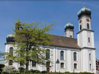
Église Ste Croix CulturalHoly Cross Church
Baroque church worth a visit. It was built in 1707-1711 according to plans and a collaboration attributed to the architect of the monastery of Einsiedeln, Brother Caspar Moosbrugger.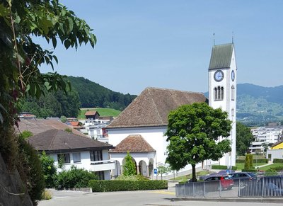
Tuggen St ColumbanTuggen
In the centre of the village there is a church and a St. Gallus fountain. Around 610, Columban and Gallus passed by this place where they burned the pagan temples and threw the idols into the lake that came to Tuggen at that time. Then they had to flee from the wrath of the pagans. Tuggen's coat of arms represents the passage of the two saints.
Description
From Wädenswil, two variants are available to join Wattwil:
- Shortest route through Rapperswil on the opposite shore of Lake Zurich (itinerary described in the steps : N°7 Wädenswil-Rapperswil and N°8 Rapperswill in Wattwil),
- By Tuggen, a historical site of Saint Colomban, staying on the south shore of the lake (itinerary described below and in N°10 Variant: Tuggen to Wattwil).
Two routes are possible at the church, to reach the shore to find the 84 Zürichsee Rundweg or continue south-east with Etzelstrasse to Tannstrasse on the right just before a crossroads:
- This street leads to a wooded area. At the entrance, turn left, walk over the dike of a pond and down Einsiedlerstrasse. Turn right on this street and left shortly after a company in Alte Landstrasse that goes down and under a railway track. In the fields, after a group of houses on the right, turn right onto the hillside road (Schönauweg) until you reach Erlenstrasse.
- Turn right and follow this entrance into Richterswil to a church. At this point, turn right into the Bürgliweg and follow the local yellow "Wanderweg" markings to cross the city centre and reach the shore.
- Continue along the waterfront next to the railway line until you reach the Seestrasse at a tunnel.
- Pass under the tunnel to walk on the other side of the railway track (Bächerstrasse). At the bend to the right of this street, continue opposite (Wanderweg: Fabrikstrasse) then immediately turn right (Wanderweg: Bächergassli) to reach Haupstrasse. Then turn left and continue until the next bend. Turn left into Wilenstrasse, which further on crosses the railway line.
- At this level, continue on this side of the railway line through a pedestrian crossing and then along Breitenstrasse, which gently descends into the vineyards and joins Leuchtschenstrasse. Cross the cantonal road and turn slightly right into the Wanderweg, which goes down to the railway track and follows it on its right side until you reach the Unterdorfstrasse level crossing. Cross the tracks, continue on the other side between the railway track on the right and the natural area on the left. When the railway turns towards Rapperswil, take the underpass under the railway at the casino (N°84 Zürichsee Rundweg).
- Now follow another railway line eastwards to the shore of Lake Obersee. The track follows the contours of the shoreline and the railway line to the entrance to Lachen. Then it sticks to the shore in the town and in the countryside to the village of Nuolen.
- After the Nuolen church, turn left into Linthgasse. At the top of the hill, turn right into Buebentalstrasse along an air pipeline. At the point where it crosses the road, turn left (Rüteliweg) onto the track that crosses the golf course, joins vineyards and follows the edge of a forest. At the crossroads with Bachtellenstrasse, turn left, leave N°84 on the left, which rises on the ridge, but continue on this road in the mountain pastures until Tuggen via Weingarten and Buchbergstrasse (on the left) which leads to the church.
- Departure : Roman Catholic Church of St. Mary, Eintrachtstrasse, 8820 Wädenswil
- Arrival : St. Gallen Church, Zürcherstrasse 5, 8856 Tuggen
- Towns crossed : Schwyz and Zürich
Report a problem or an error
If you have found an error on this page or if you have noticed any problems during your hike, please report them to us here:
Close by5
- Accommodation

