Ronchamp to Héricourt
Bourgogne-Franche-Comté
2. Ronchamp to Héricourt
Medium
6h30
23,3km
+495m
-494m
Step
Embed this item to access it offline
When you leave the town of Ronchamp you can still guess the coal slag heaps that were witness to the coal mining. Water and wood are present throughout your stage. Let yourself be told the story of the village of Étobon. Take advantage of strolling along the Lizaine river as the next villages and their many recent or renovated houses mark the arrival in a population basin that will accompany you on your next stage. The chapel of the priory of Saint-Valbert awaits you to tell you its history.
6 points of interest
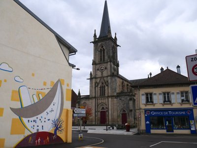
L’église Notre-Dame du Bas à Ronchamp - Amis saint Colomban TouristNotre-Dame-du-Bas Church in Ronchamp
The history of this church, in the centre of the town of Ronchamp, must be told in conjunction with that of the Notre-Dame-du-Haut chapel on the Bourlémont hill.
An 11th century document attests the presence of a Notre-Dame chapel on the hill, attached to an abbey in Besançon. The Lords of Ronchamp found the place of worship too remote and were authorised by the archbishopric to build a Saint-Hubert chapel in their castle during the 15th century.
A new parish church was built in 1737 to replace the Saint-Hubert chapel.
During the 19th century, major alterations were made to the lower church, which is the building we see today. While the chapel of the upper church is subject to storms and low attendance outside the pilgrimages to Notre-Dame.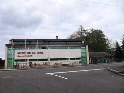
Musée de la mine Maurice Maulini à Ronchamp - Association Colomban en Brie HistoricalRonchamp Coal Mines
Coal mining covered a vast territory backed by the foothills of the southern Vosges mountains well beyond the town of Ronchamp. Mining began in the 18th century under the authority of the Lords of Ronchamp and the Prince Abbots of Lure Abbey, and closed in 1958. At the end of the Second World War France exploited the coal from the Saarland, a German province, which was of better quality than that of Ronchamp and easier to extract.
In the 20th century the coal seams are getting thinner and it is necessary to go deeper and deeper. At the end of the 19th century Ronchamp had the deepest mineshafts in France, more than 1000 metres. The site was hit by disasters caused by firedamp.
More information: Wikipedia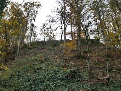
Les contours des fondations de la muraille du château d’Ètobon sont encore visibles. - Amis saint Colomban HistoricalEtobon Castle
The first mention of the castle on Etobon hill dates back to the middle of the 13th century when the fief was under the control of the Count of Burgundy. It occupied an important strategic place which allowed the circulation of goods and people in the south of the Vosges. This is why, during the Middle Ages, it suffered numerous destructions and fires by the lordships located near the lands of Étobon. In 1519 the castle is attacked again by the Lord of Porrentruy who burns it. He did not recover from this last battle and the Princes of Montbéliard authorized the population to take the stones for their personal use. During the Reformation, Protestant worship was practised in Ètobon. A pastor was installed in 1552, and the Catholic Church was assigned to Lutheran worship.
In the 18th century, the seigneury of Étobon was attached to the county of Montbéliard and was reunited with France in 1793.
To visit the site with a superb panorama in good weather, you must leave the Via Columbani when you arrive in Ètobon, stay on the D 127 and take the Rue du Château on the right with a steep slope for 800 metres.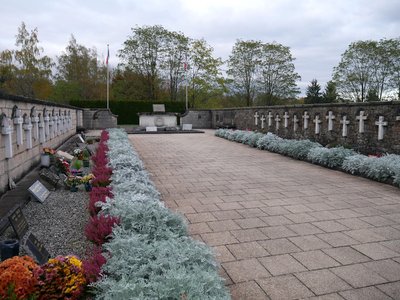
L’allée des Martyrs du 27 septembre 1944 - Amis saint Colomban HistoricalThe Ètobon massacre in 1944
When the German troops withdrew in 1944, the maquis of Ètobon took many prisoners and some escaped to warn their brothers-in-arms of the presence of the maquis. On 27 September 1944 a platoon of Russian mercenaries, incorporated into the German army, invaded the village. They arrested 67 men at random and shot 39 of them in front of the wall of the Protestant Temple of Chenebier and deported the other men. This act of barbarism without judgment is commemorated every year.
Next to the communal cemetery a martyrs' alley recalls the memory of the murdered civilians.
A plaque recalls the devotion of the population of Étobon to welcoming Indian and British soldiers who escaped from a camp in Épinal during a bombing raid. The maquis had organized the escape of the soldiers to Switzerland.
The villages of Ètobon and Chenebier were awarded the Croix de Guerre 1939-1945.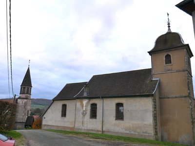
Le temple au premier plan et le clocher de l’église Saint-Martin en arrière-plan à Chagey - Amis saint Colomban TouristCatholic and Protestant worship in Chagey
The patronage of the church of Chagey was given to the Abbey of Luxeuil by Pope Eugene III in 1147 and subsequently confirmed by his successors. The Abbey of Luxeuil attached the parish to the priory of Saint-Valbert d'Héricourt. At the Reformation the majority of the population embraced the Lutheran reform. The commune was part of the County of Burgundy under the authority of the Catholic Prince of Parma. The Prince of Montbéliard sent a delegation to the Prince of Parma who refused. His subjects had to practice the religion of the sovereign.
In 1561 the seigneury of Hericourt was reintegrated into the County of Montbéliard. This was the beginning of a succession of conflicts between the representatives of the two religions with hostage-taking.
In 1748 a silutaneum was envisaged between the King and the Prince of Württemberg and the seat of the Protestant parish was transferred from Couthenans to the county of Montbéliard. The discord continued until 1793 when a compromise was reached to celebrate Protestant worship in the Catholic church. In the choir of the temple of Chagey, the rails that allowed the altar to be moved to celebrate the Protestant cult are still visible. The construction of a Catholic church at the end of the 19th century put an end to the conflict.
On an industrial level, the particularity of Chagey is its forge and blast furnaces, installed in 1586 by Protestant refugees from Lorraine, and which still existed in the 20th century.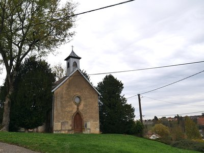
La chapelle Saint-Valbert dans l’ancien village de Saint-Valbert-lès-Héricourt - Amis saint Colomban St ColumbanSaint-Valbert Priory at Héricourt
The priory of Saint-Valbert, near Héricourt, of the order of Saint-Benoît and the dependency of the seigniorial abbey of Luxeuil, was founded around the year 1120 by Count Thierry II of Montbéliard, who was considered to be a man of great devotion. He received his name from Saint Valbert, who died as abbot of Luxeuil in 665, to whom his church was dedicated. He is first mentioned in a charter of the year 1123; but, as this charter clearly announces, he goes back to an earlier time. Another document of the year 1186 shows that even before this date he had subjects of servile condition and lands consisting of fields, meadows, ponds, forests in the hamlet of Saint-Valbert, which had not long before being formed around his buildings; that he had subjects, buildings and tithes on part of the territories of Chagey and the Chapel near Granges ; tithes and pieces of land on different parts of the territory of Héricourt, as well as the patronage of the churches of Chagey and Héricourt, i.e. the right of presentation of the parish priests of these places to the confirmation of the Archbishop of Besançon, with the income attached to them...
He kept all his possessions until his suppression in the sixteenth century following the Reformation. He had lower justice and all the seigneurial rights and incomes on his subjects of Saint-Valbert and other places. Count Thierry II of Montbéliard was not content with founding the priory of Saint-Valbert; he erected the church of Saint Maimbœuf (an Irish monk of the 5th century, who died a martyr in the Montbéliard region), which was within the walls of the castle of this town, as a collegiate church around 1142, and he established a chapter of twelve Augustinian canons there.
Description
Leaving Ronchamp church on the right in rue Le Corbusier, place de la Mairie, go around the town hall on the left, behind the town hall on the right, allée du Canal, cross the canal and follow it.
- First street on the right, rue Strauss, cross the Rahin at the crossroads take in front of you esplanade du Stade, rue du Stade, third street on the left rue des Fougères, on the left rue du Morbief second street on the right rue d'Éboulet, on the left rue de Verdun
- Third street on the right rue de la Belle Fontaine, enter the woods on chemin des l'Étang Grand Chardon, stay on the main road, turn right at the junction with the asphalt road, at the end of the asphalt road after passing the pond turn right.
- Straight ahead on main road on the right at the junction with D 127 Chemin d'Étobon, in the first houses of Étobon on the left chemin des Champs Vautier, straight ahead chemin de la Roignotte
- Left at the junction with D 127E first dirt road on the right before the first house on the right, chemin des Psottes, left at the crossroads with rue d'Étobon first street on the right rue de la Revenue, right dirt road
- Turn right at the junction with rue de la Revenue, stay on this street and then the path that continues in the woods, straight ahead, stay on your right, take the asphalt road at the entrance to Chagey, stay on your left in rue du Fourneau.
- Left rue de Couthenans, cross the Lizaine, right Grande Rue D 16, stay on the D 16 until Luze; in Luze turn right down rue du Breuil right rue de la Luzine, left after the transformer follow the Lizaine and cross it on your right at the next bridge, rue de Grande goutte.
- At the crossroads turn left on chemin de Mouteille, go over the N19, at the crossroads turn left along the N19, cross the Lizaine, straight ahead at the crossroads and cross the D 438 straight ahead.
- First dirt road on the right, cross the Lizaine river on the left rue des cités Chevret, on the left avenue de Saint-Valbert D 438H, second street on the left up rue Georges Tournu you arrive at the chapel Saint-Valbert.
- Departure : Notre-Dame-du-Bas Church, 1 rue de l’Église, 70 250 Ronchamp
- Arrival : Saint-Valbert Chapel, 1 impasse de la Chapelle Saint-Valbert, 70 400 Héricourt
- Towns crossed : Bourgogne-Franche-Comté
Altimetric profile
Report a problem or an error
If you have found an error on this page or if you have noticed any problems during your hike, please report them to us here:


