01. 590 Ireland
Carlow
01. 590 Ireland
Medium
638,4km
+7291m
-8047m
Multi-day trek
Embed this item to access it offline
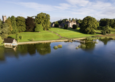
The itinerary is the route followed by Saint Columban at the age of twenty, around 560, from his birthplace to the great abbey of Bangor, which he left around 590 at the age of 50 to evangelise the European continent, of which he was one of the founding fathers according to Robert Schuman.
This route is currently being finalised.
This route is currently being finalised.
33 steps

Description
The Irish route has a different name depending on the language spoken: Colomban Way in English or Turas Columbanus in Gaelic.
There are two possible starting points to reach Myshall via Mount Leinster, the presumed birthplace of Saint Columban:
There are two possible starting points to reach Myshall via Mount Leinster, the presumed birthplace of Saint Columban:
- from Saint Mullins after a two-day walk of 20km and a stopover in Borris,
- a one-day walk from Bunclody.
- Departure : Mount Leinster (County Carlow in the Republic of Ireland)
- Arrival : Bangor (Northern Ireland)
- Towns crossed : Carlow, Kilkenny, Laoighis, Kildare, Meath, Cavan, Fermanagh, Monaghan, Armagh, Banbridge, Newry and Mourne, Louth, Down, Ards, and North Down
Altimetric profile
Access and parking
Mount Leinster is only accessible by road.
Bangor is accessible by all means of transport, including by air from Belfast International Airport.
Report a problem or an error
If you have found an error on this page or if you have noticed any problems during your hike, please report them to us here: