Killyleagh to Comber
Down
32. Killyleagh to Comber
Easy
7h
22,8km
+300m
-310m
Multi-day trek
Embed this item to access it offline
Through lush green hills, the route skirts Lake Strangford at varying distances. From time to time, the path runs along the water's edge, then turns away from it and climbs into the hills to offer lovely views of the fjord.
4 points of interest
 Historical
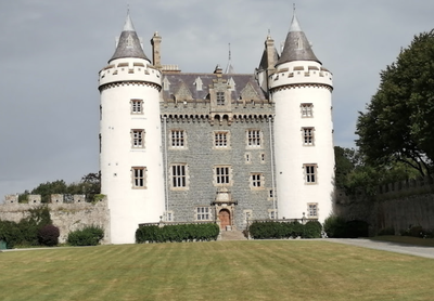
Castle Towers
Killyleagh Castle is believed to be one of the oldest inhabited castles in the country, with parts dating back to 1180. It follows the architectural style of a Loire Valley castle, redesigned in the mid-nineteenth century. It has been in the Hamilton family since the early 17th century.
Find out more here.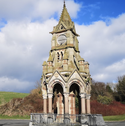 Historical
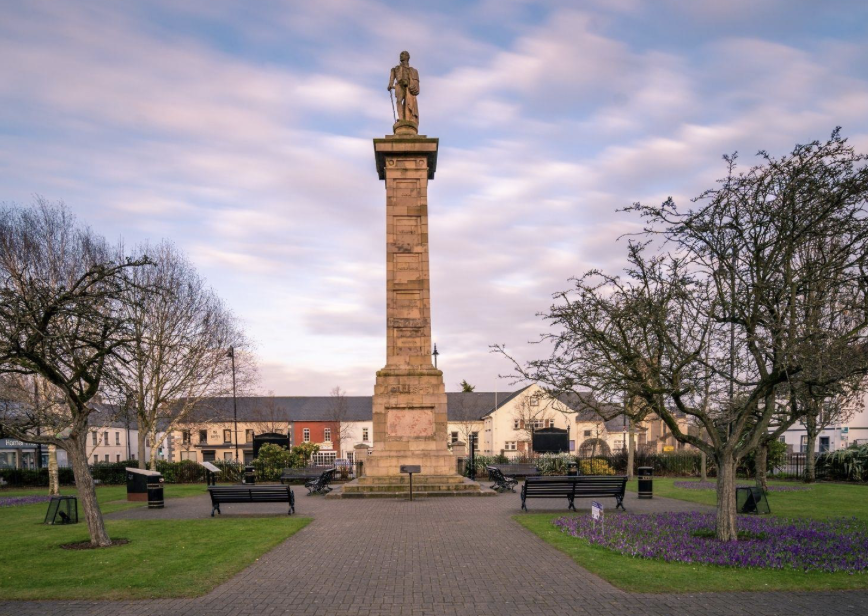
Shrigley Monument
Built in 1871, this monument adjoined a large mill and then a large tannery, which has now disappeared.
Find out more here. Historical
The Livingston Centre
Located behind the parish church, a café and museum tell the story of the Livingstone family, who were responsible for the first voyage across the Atlantic from Ulster to America aboard the ship Eagle Wings in 1630.
Find out more here.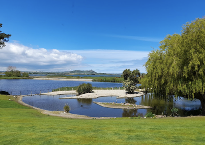 Panoramic
Castle Espie
A protected wetland adjoining a former castle and quarry, now home to ducks, swans and brant.
Find out more here.
Description
Di fronte all'ingresso del castello, si prende il marciapiede sul lato destro della strada che costeggia la tenuta e poi scende fino alla frazione di Shrigley, a 1 km di distanza:
- Svoltare a destra su Clay Road in corrispondenza di una torre con orologi, resti di una grande conceria sostituita dall'odierna industria della plastica. Continuare su questa strada in direzione nord per 1,5 km fino all'incrocio con la strada principale Comber Road. Seguire questa strada per 200 m.
- Svoltate a destra su una piccola strada, Ringdufferin Road (segnalata per il ciclismo) e seguitela verso est per raggiungere il confine di Strangford dopo 1 km. La strada, anch'essa segnalata per il ciclismo, si dirige verso nord per 2 km.
- Lasciare la strada principale e seguire la pista ciclabile svoltando a destra su Quarterland Road, in direzione est. Raggiungere nuovamente la riva dello Strangford (400 m) e camminare verso nord per 1 km sulle colline prima di seguire nuovamente lo Strangford. Al centro della baia di Ballymoran, in corrispondenza di un piccolo parcheggio sull'acqua, lasciate la strada principale e girate a sinistra in direzione ovest sulla collina con vista sul fiordo. Proseguite verso nord-ovest per 1,5 km e raggiungete Killenchy.
- Nel villaggio, salite verso la chiesa e scendete verso nord per 600 metri. La strada asfaltata diventa una pista sterrata che si dirige verso ovest per 200 m prima di incrociare una piccola strada asfaltata.
- Cross the road and turn off onto Ballymartin Road, which continues for 1.5km before crossing Ardmillan Road. Continue opposite on the grass track for 1km in the same northerly direction. Continue for 800m on the minor Lisbane Road heading north-west.
- At major junction turn left and immediately after onto Castle Espie Road which is reached in a straight line after 1.5km.
- Turn left onto Ballydrain Road. Follow the busy Ballydrain Road for 4.4km before finding a safer pavement and crossing the Killenchy Road.
- Turn right onto the main road which leads to the centre of Comber after 700m.
- Departure : Killyleagh Castle
- Arrival : Square
- Towns crossed : Down and Ards
Altimetric profile
Report a problem or an error
If you have found an error on this page or if you have noticed any problems during your hike, please report them to us here:

