11. Wattwil to Magdenau (Flawil)
11 points of interest
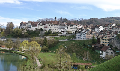
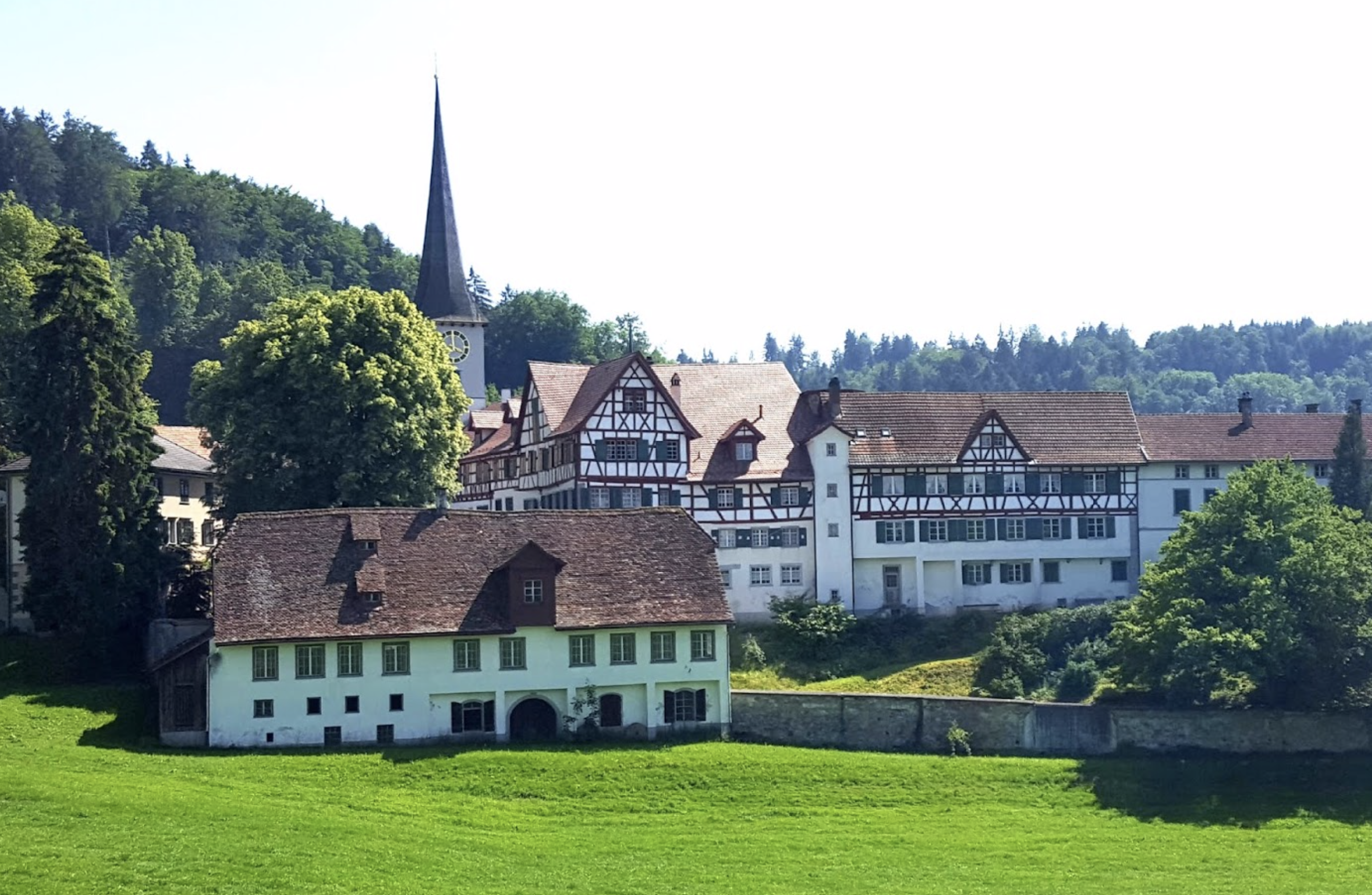
Lichtensteig - Amis St Colomban PanoramicLichtensteig
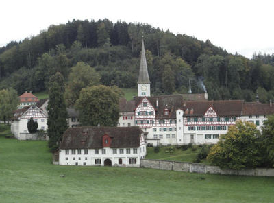
Lichtensteig is a medieval town and since 2016 has been a member of the association of the most beautiful villages in Switzerland. The oldest houses, which are part of the town walls, date from the first half of the 15th century.
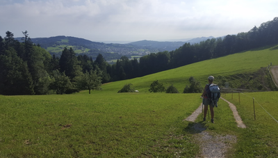
Alpage - Amis St Colomban PanoramicMoos
High point that gives a beautiful view of the mountain pastures, the working farms and the Alpstein mountains in the background.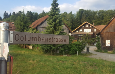
Kolumbanweg - Amis St Colomban St ColumbanColumbanway
In the hamlet of Burgau, there is a street named Colomban on the approach to Saint Gall.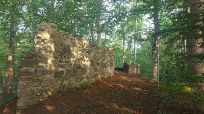
Ruine Helfenberg - Amis St Colomban HistoricalHelfenberg Castle Ruins
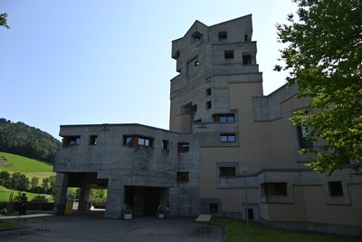
Ruin of a castle built in 1244 on the grounds of Magdenau Abbey. In 1388 it came under the authority of St. Gallen Abbey.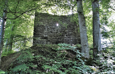
Ruine Rosenberg HistoricalRosenberg Castle Ruins
Ruin of a castle built in the 12th century by the Abbey of St. Gallen and administered by the Lords of Rorschach. The castle was stormed and burnt down during the Appenzell Wars (1401-1429).
Find out more.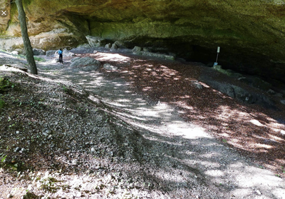
Grotte saint Colomban St ColumbanSaint Colomban Cave
The saltpetre cave also called Kolumbanshöhle is located near the river. The descent is quite steep and not recommended in rainy weather. Also, it is forbidden to enter the bottom of the cave because of the risk of landslides. The nearby picnic area is a nice place to rest.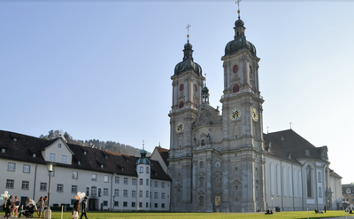
Abbaye St. Gallen St ColumbanAbbey of St. Gallen
It was founded by Otmar in 719 on the site of the hermitage of St. Gallen, who died in 646. Few remains of the medieval abbey. Most of the buildings, including the abbey church, were built between 1755 and 1768 in the Baroque style.

Bibliothèque St. Gallen St ColumbanLibrary of the Abbey of St. Gallen
The abbey library was part of the former Benedictine abbey founded in 719. It quickly became one of the most important historical libraries in the world. It is the only one of the great monastic libraries of the early Middle Ages whose outstanding quality collection has remained relatively intact from the 8th century to the present day. It holds 2100 manuscripts, 1650 incunabula (printed up to 1500) and old prints (printed between 1501 and 1520) as well as about 160,000 books. It is included in the UNESCO World Heritage List.
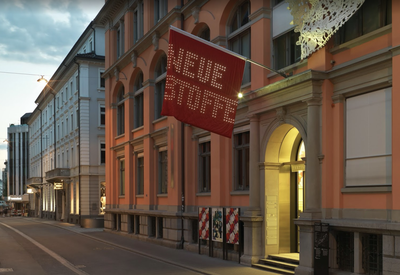
Musée du textile HistoricalTextile Museum
The rise of the city of St. Gallen is due in particular to the textile industry. From the 15th century onwards, the city was the centre of a flourishing linen industry. In the 18th century, the first embroidery crisis shook the city. With the introduction of mechanisation in the textile industry, St. Gallen regained a leading role, which led to a second boom in the textile industry in the 19th century. Even today, St. Gallen is still known for its high-quality embroidery. These are exhibited in the Textile Museum, which is dedicated to the history of the textile industry in Eastern Switzerland.
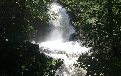
Mülenenschlucht St ColumbanMuelenen Gorge
Gorge where St. Gallen founded his hermitage around 610 which is at the origin of the city of St. Gallen.
Read more about it.
 St Columban
Saint Gall Church Lichtensteig
Modern church named after Saint Gall, companion of Saint Columban.
Description
- Turn left onto this street. After 300 metres, take the path on the right (Sonderegger Weg) that runs alongside the River Thur. Cross the river on the right using the second footbridge (1 km). Continue left on the other bank (Vogt Anderegg Weg) for 500 metres to cross the Thur on the left using the next footbridge. At the next intersection, turn right to follow the railway line and cross the Thur one last time. Take Steigstrasse to the main street of Lichtensteig, which turns right in front of the town hall (Rathaus). Continue straight ahead at the fountain, where No. 24 Thurweg is abandoned, and follow the sign for ‘Wasserfluh Pass’.
- Climb eastwards on road No. 8 (Bürgistrasse), turn right at the last house to cut across the hairpin bends of the road via a path (Schulhausweg). Cross the road and take the path opposite that climbs up the Lederbach stream valley on one bank and then the other to join the road at the hamlet of Wasserfluh. Cross the hamlet along road No. 8 to the last house and take the path diagonally to the left that climbs up through the meadows towards a forest and a pass, then descends towards the village of Brunnadern.
- When you reach a railway line, turn left and follow it to the Necker river, which you follow to the hamlet of Necker, where you join the main road on the right. Take the first road on the right after the village, which climbs towards Mogelsberg, reached via Neckertalerstrasse, then turn right onto Dorfstrasse to reach the church.
- At the post box on Dorfstrasse, turn left (Böschenbachstrasse) downhill towards the bottom of the valley, cross a railway line and climb back up opposite Böschenbach for a short while on the road, then on a path that cuts across a hairpin bend and continues up the slope before rejoining the road higher up at the crossroads with the road to the right of Gonzenwil and Moos. Take this small road to the second hamlet of Tubbach, continue straight ahead at the bend in the road and pass the last farm (Drüeggg).
- Continue along the path that joins and climbs into a wood to reach a small road and Moos, the highest point of the stage (866m). Then take the first road on the left, then the first on the right and continue north through the forest before descending towards Magdenau Abbey.
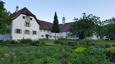
- Departure : Convent of St. Mary, Klosterhof, 9630 Wattwil
- Arrival : Cistercian Convent, Hauptstrasse, 9116 Degersheim
- Towns crossed : Sankt Gallen
Altimetric profile
Report a problem or an error
If you have found an error on this page or if you have noticed any problems during your hike, please report them to us here:
Close by6
- Accommodation