9. from Saint-Brieuc to Hillion
The exit of the town is along the deep valley of the Gouëdic river, making you forget the town, which is so close by. After the port of Le Légué and the Pointe de Cesson, the route then follows the customs path around the Yffignac cove with, as a red thread, the old metric railway line between Lamballe and St Brieuc.
5 points of interest
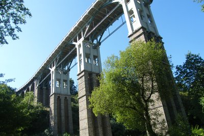
Viaduc du Toupin - Amis Bretons de Colomban HistoricalToupin Viaduct
This viaduct, 35m high and 179m long, spans the Gouedic valley. It was built between 1902 and 1904 by Louis Auguste de la Noë for the metric railway line between Moncontour and St Brieuc.
After the passage of the last train in 1948, it became a road bridge in 1956. Its demolition is planned for 2013 after a diagnosis of its defects and cracks. The briochins, who do not want to relive the demolition of the Souzain viaduct, are defending it. It is listed as a Historic Monument in 2014 and restored in 2016.
To find out more…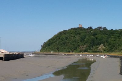
Tour de Cesson - Amis Bretons de Colomban HistoricalTower of Cesson
The tower, which can be seen at the top of the promontory of the Pointe de Cesson, is a vestige of an old 14th century castle of the Dukes of Brittany. The site had previously housed a Roman castrum, then a medieval castle. Later it was fortified again by the German army.
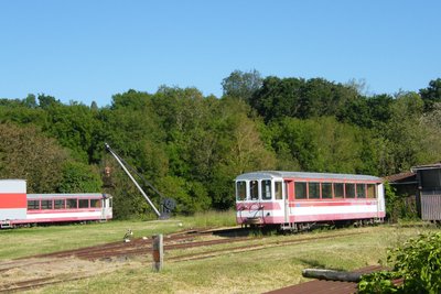
Le musée de la Briquerie - Amis Bretons de Colomban CulturalLittle train track.
The train ran for the first time on the metric track between Moncontour and St Brieuc on 1 May 1905. The line was created by Louis Harek de la Noë. This stage follows in his footsteps and his works of art on several occasions. This line first carried passengers and then goods. The line was closed on 31 December 1948.
Since 1986 the Côtes du Nord Railways Association has been working to publicise the history of this little train through its Brickworks Museum. Cultural
The pre-salted
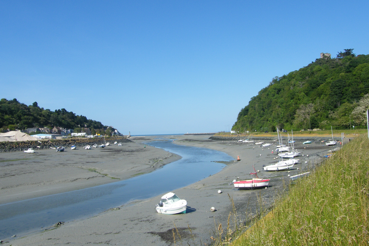
From the 11th century, saltworks were established at the bottom of the bay of Yffiniac. There were 53 of them in the 18th century. This activity of sauniers was a complementary activity of the farmers. From April onwards, they worked the land of the strikes, to encourage the deposit of salt by the sea. The top layer of soil was then collected, poured into a pit and washed. The recovered water was then boiled to recover the salt.
The bay of Yffiniac is the 5th bay in the world for the importance of its tides. The tidal range (difference between low and high tide) can reach 13m. It has been classified as a nature reserve since 1998.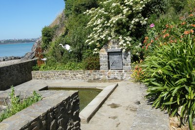
Fontaine de St Guimont - Amis Bretons de Colomban CulturalFountain and wash house of St Guimont
The fountain and wash-house of Saint Guimont were built in 1926 but a fountain already existed in 1788. Legend has it that St Guimont landed on this shore to evangelise the peninsula.
Description
Starting from the square in front of the cathedral, go along the cathedral on the right and join the rue Saint Goueno. Then turn right on rue Charbonnerie and continue on rue Saint Guillaume until you reach place Du Guesclin. Then continue straight on rue du Couedic. After passing under the bridge, turn left onto Chemin de Belle-Isle, in the direction of the Gouëdic valley (red sign).
- Follow the banks of the river through the different alleys of the valley park and join the port of Le Légué. Turn right and follow Quai Surcouf. Leave the Chemin de l'Écluse road on the right and take, to the right of the tourist sign on the Cesson tower, the white/red marked path on the right after crossing the railway. Follow this path that goes around the Pointe de Cesson.
- Pass in front of the Petit Monaco huts and, on the car park, turn left (white/red markings in the direction of Hillion). At Grève du Vallais, turn right on the coastal path to go around the point and join the rue du Commandant d'Estienne D'Orvès. Turn left on this one. Before it passes over the railway, continue straight on the road and then turn left towards the Pointe de Gourien. After this one, turn right before the Grève des Courses and join the Chemin des Nouettes. Turn left on this one.
- When the road rises, turn to the left on the former railway (Promenade Louis Harel de la Noë closed by a wooden barrier) and join Bout de Ville. Then continue straight ahead to the crossroads at the entrance to Yffiniac. Then turn left on rue du Houlet in the direction of Maison de la Baie. After the crossroads with the Rue du Canard, turn left onto the signposted path. When it comes back on the road, cross the bridge and immediately take the marked path on the left. Follow this path until you reach a small parking lot. Then turn right and join, via rue de Fontreven, the church of Hillion.
- Departure : St Etienne Cathedral - Rue de La Préfecture - 22000 - St Brieuc
- Arrival : Church Square - 22120 - Hillion
- Towns crossed : Bretagne
Altimetric profile
Transport
Public transport in Brittany is grouped on Breizhgo and Mobibreizh.
Report a problem or an error
If you have found an error on this page or if you have noticed any problems during your hike, please report them to us here: