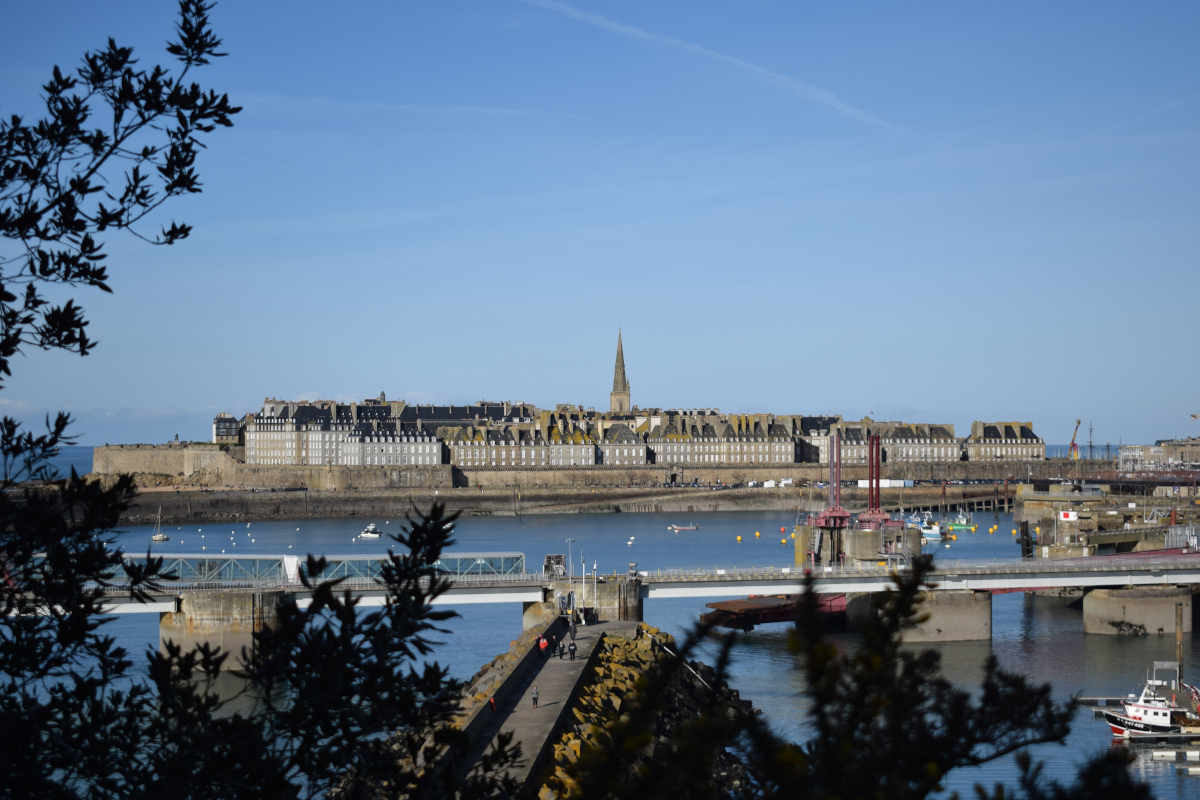
14. from St Suliac to St Malo
Two visions of Rance during this stage. Firstly, the river suffering from the consequences of the tidal power plant dam. It silts up at high speed. Past the dam, it's another landscape open to the open sea. In both cases, the influence of the tide is very visible.
10 points of interest
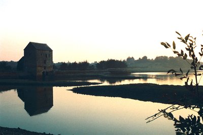
Moulin de Beauchet - Amis Bretons de Colomban PanoramicTide mills of Beauchet and Quinard
The high tidal range (difference between high and low water levels) of the Rance estuary has long since allowed the construction of many tide mills. A dyke built in the bottom of a cove held back the water at high tide. At low tide, this water reserve allowed the operation of the mill. The last work of this type to be built was in 1966: the Rance tidal mill.
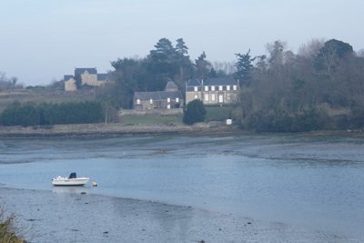
Environs de la malouinière - Amis Bretons de Colomban TouristMalouinière du Bosc (Château du Bos)
Les malouinières, are country residences built by these "Gentlemen of St Malo" to escape the city life. To be qualified as "Malouinière" a residence must meet a certain number of criteria which are: to be built in the Clos Poulet (=Plou Alet, former country of St Malo), at the end of the 17th century or beginning of the 17th century (often by Garangeau, Vauban's assistant, hence the strict and somewhat military style) less than two hours by horseback from the port and for a ship owner (often privateer). The malouinière du Bosc is one of the most important.
To find out more...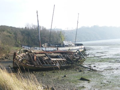
Cimetière de bateaux - Amis Bretons de Colomban PanoramicPassenger Boat Cemetery
Many shipyards once existed in the Rance estuary. Apart from the one in Quelmer, there was the one in La Landriais located on the other bank of the Rance where the "Pourquoi Pas", the boat of Commandant Charcot, was built. In the cove of Quelmer a cemetery of boats recalls this past. The place known as La Passagère, with its Maison du Passeur (ferryman's house), reminds us of the old ferry that used to cross the river.
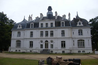
La Briantais - Amis Bretons de Colomban PanoramicBriantais Park
Magnificently situated on the mouth of the River Rance in the middle of a large park, Château de la Briantais was built in 1864. It offers a breathtaking view of St Servan, the Solidor tower and La Richardais. On his death, Guy La Chambre, a former minister and mayor of St Malo at the time of the reconstruction of the corsair town, donated it to the Diocesan Association of Rennes. The estate was bought by the town of St Malo in 1999. The park is now open to the public.
To find out more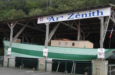 Historical
Ar Zenith
The Breton Dundee was built in 1939 to transport passengers and goods between Audierne and the Ile de Sein.
After General de Gaulle's appeal on 18 June 1940, it enabled the first Senans to reach England.
It was found in 1995 by a group of Malouins who brought it back and restored it.
To find out more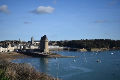
Anse St Pèer et Tour Solidor - Amis Bretons de Colomban HistoricalSolidor Tower
Built at the end of the 14th century by Jean IV of Brittany, this keep was designed to protect the entrance to the Rance estuary. It was listed as a Historic Monument in 1886. Until its transfer to the future St Malo museum, it housed the Cap-Horniers museum.
To find out more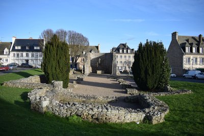
Ruines de la cathédrale St Pierre - Amis Bretons de Colomban CulturalSt Peter's Cathedral and City of Alet
It was on the Alet peninsula that the first traces of human occupation of the area were found. This occupation, first Gallic and then Roman, can be traced back to the 1st century BC. At the end of the 2nd century, the town was surrounded by a wall, which was dismantled in 1255 (a small remnant remains above the port of Bas-Sablons). A fort was then built to protect the mouth of the River Rance. During the Second World War, major fortifications were built to prevent any Allied landings at St Malo. This led to the almost complete destruction of the area. Many remains of these fortifications remain. A museum has been set up in part of the underground passageways.
There is some uncertainty as to when the episcopal see was founded, but it was in 1290 that it was transferred to the "rock" of St Malo.
From 1890 onwards, Mgr Louis Duchesne undertook excavations. They revealed the unusual layout of the former cathedral.
In fact, the remains of the ancient Gallo-Roman town of Alet are the oldest Christian buildings discovered in the region, along with the crypt of Notre-Dame de Sous-Terre in the abbey of Mont Saint-Michel. Excavations on the same site uncovered an ancient complex comprising a courtyard surrounded by buildings, then a Merovingian cathedral and finally the foundations of the last pre-Romanesque cathedral. The latter dates back to the 9th or 10th century. It is unusual in that it has two apses facing east and west. This is reminiscent of a project conceived in the first third of the 9th century for the abbey church of Saint-Gall in Switzerland.
To find out more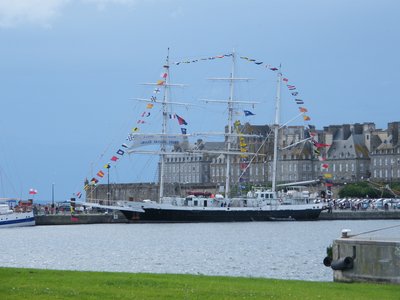
Bassin Vauban devant les remparts - Amis Bretons de Colomban HistoricalPort of St Malo
Initially, the town of St Malo was only linked to the mainland by a strip of dunes (a tombolo) between "the rock" and what is now the Paramé district. On the site of the present-day port was the Mer Bonne cove, which served as a beaching port for boats. At low tide, the sea withdrew completely and the boats were left out to dry. The quarrels between St Malo and St Servan, formerly independent and competing towns, greatly complicated the work.
In 1850, the first dyke with a pass was built between the ramparts of St Malo and the Pointe du Naye, creating a large inner basin... with a lock for each town.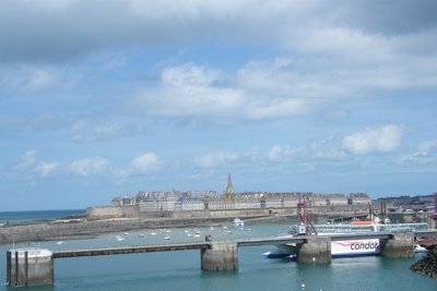
La gare maritime puis l’alignements des hôtels de ces Messieurs de St Malo derrière les remparts - Amis Bretons de Colomban HistoricalThe walls of St Malo
The town of St Malo Intra-muros is surrounded by ramparts approximately 1800m long. The original walls were built between the 12th and 17th centuries. The construction of the "grand donjon" and the castle made it possible to protect the only access to the town from the furrow. However, the castle also included a curtain wall armed with cannons controlled by the town. Faced with opposition from the inhabitants of Saint Malo, Anne de Bretagne replied, "Quic en griogne, ainsi sera, c'est mon plaisir". However, the inhabitants of Saint Malo succeeded in demolishing the curtain wall.
In 1686, Vauban intervened to protect the town from English attack. The Dutch bombardment of 1689 accelerated the work. In addition to the sea forts, these consisted of various extensions built between 1708 and 1744.
At night, the town was protected from looters by the watchdogs that were let loose after curfew.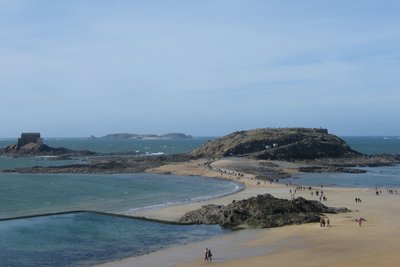
Le Grand Bé, le Petit Bé et Cézembre au loin depuis les remparts - Amis Bretons de Colomban HistoricalLe Grand Bé
The Grand Bé is an islet at the foot of the ramparts of St Malo, accessible at low tide. It was used for quarantine and fortified by Vauban. The presence of a German firing post during the Second World War led to its bombardment by the Allies. In 1823, François René de Chateaubriant asked to be buried on a promontory on this islet. This was done on 18 July 1848. He remains at the top of the cliff, eternally turned towards the sea and the storm.
To find out more...
Description
Leave the church square and, facing the apse, take the rue de la Petite Cohue and, at the end of it, turn left onto the rue de Dom Allain and join the Place du Carrouge.
- Go up then, to the right, the Grande Rue, and go straight ahead to leave the village by the road D117. Leave it by taking to the right, the road in the extension of the dike of the tide mill of Beauchet. Then take the road on the left and join the departmental road. Turn left on the road, then after a few meters, turn right on the road along the mudflat. Follow this road until it joins the D117. Then turn left.
- After the small bridge, take, on the left, the track which goes along the mudflat in the direction of the tide mill of Quinard (red/white markings). Follow this path until its junction with the D5 near Quelmer.
- Turn right on the D5 and, at the exit of the village, turn left to join the coastal path (red/white markings). Follow the coast up to the Basse Flourie castle. By road, go back up to the road (D168) leading to the Rance dam. Turn right on the exit ramp and go under the four-lane road.
- Turn left on rue du Coetquen, then in the bend, turn left on chemin du Tertre Richard. At the end of this road, continue straight ahead on rue de l'Alcyon. At the first crossroads, turn left on rue de l'Achille. In the bend, turn right onto the path and go down towards the Rance following the red/white marked path.
- Pass at the end of the dam and the tidal plant and continue on the coastal path. At the junction with the access road to the beach of Vau Garni, take the street opposite which goes up towards Le Rosais. After the cemetery, turn left onto Boulevard du Rosais. Turn left on the first lane (Pas de la Rance). At the crossroads with Rue de l'Enfer, continue across the street on Rue des Fours à Chaux until the crossroads with Rue du Génie.
- Turn left on this street. At the end of the street, turn right on rue de l'Equerre, then turn left on rue Jeanne Jugan. In front of the Ste Croix church, turn left onto rue de La Fontaine. At the end of the street, turn right onto Quai Solidor, then onto Esplanade du Commandant Menguy and Quai Sébastopol, following the edge of the quay. At the right hand side of the access ramp to the Solidor Tower, turn right on rue d'Alet, then follow the Place St Pierre.
- At the top of the square, turn right on rue de la Cité. Go down it and turn left on the access street to the marina. Continue straight ahead on the quay overlooking the Plage des Bas Sablons. At its end, after the swimming pool and before the ferry terminal, turn right to reach the Rond-point du Naye roundabout.
- Turn left, Chaussée Eric Tabarly. Follow it to the ramparts of St Malo. Then turn left on the Promenade de La Bourse and join the Porte de Dinan in the ramparts. Pass this gate and go up the rue de Dinan to reach the cathedral.
- Departure : Church St Suliac - Ruette Dom Jean - 35430 - St Suliac
- Arrival : St Vincent Cathedral - Place Jean de Chatillon - 35400 - St Malo
- Towns crossed : Bretagne
Altimetric profile
Recommandations
The tidal range (difference in level between high and low water) is the highest in Europe in the Bay of St Malo. At high tide, some passages may be impossible on the coastal path (mainly in front of the Malouinière du Bos near Quelmer). Don't forget that the tide hours are shifted behind the dam because of it.
Transport
In Brittany, public transport is grouped in Breizhgo and Mobibreizh.
Report a problem or an error
If you have found an error on this page or if you have noticed any problems during your hike, please report them to us here:
