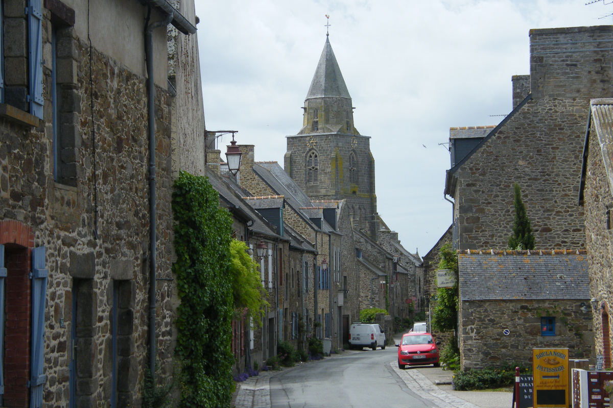
13. From Taden to St Suliac
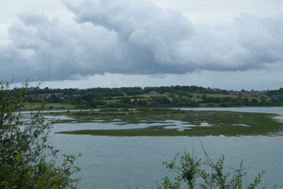
Maritime Rance begins at the Châtelier lock. Like the Bay of St Malo, it is subject to the highest tides in Europe. Although disturbed by the hydroelectric dam, these tides are felt very deeply in the Rance estuary. The landscape is constantly changing. At high tide, the Rance appears as a wide and peaceful river. A few hours later, at low tide, it reveals immense mudflats (harmful consequences of the dam). This important tidal range has always been used by man. Thus many coves or estuaries of tributaries are closed by a dam. The water reservoir thus created at high tide activated a mill when it was released at low tide. These tide mills are the ancestors of the hydroelectric dam.
Fauna is important in the estuary. You may even have the pleasure of meeting a seal sunbathing on a slipway.
4 points of interest
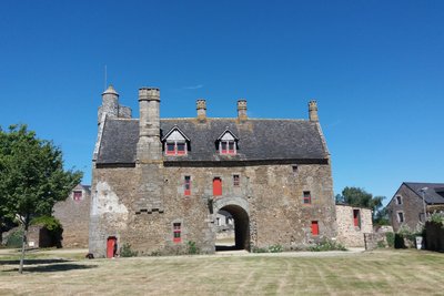
Manoir de la Grand’Cour - Amis Bretons de Colomban CulturalTaden
St Peter's church dates from the 14th century and was rebuilt in the 19th century. In 2003, rehabilitation work revealed the presence of 14th century mural paintings.
The manor of the Grand'Cour is a seigniorial residence of porch dwelling type from the late Middle Ages. It was classified as a MH in 1993.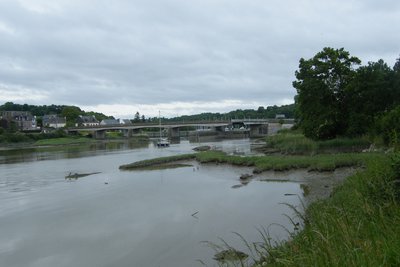
Ecluse du Châtelier - Amis Bretons de Colomban TouristChâtelier lock and Lyvet bridge
The Châtelier lock marks the limit between, downstream, the maritime Rance subject to the influence of the tides shifted by the dam (brackish water) and upstream the navigable river Rance (fresh water). The lock was put into service in 1832 and modified in 1837 with a "floating" gate which closes at rising tide and opens at falling tide. The first swing bridge dates from 1892. The present bridge dates from 1950. It was modified around 1960 with the addition of a swinging bridge system to allow the masts of sailing boats to pass through.
 Historical
Pont St Hubert
The first bridge between Port St Jean and Port St Hubert, with a span of 173m for a total length of 286m was built between 1913 and 1928 by Ferdinand Arnodin, also author of his twin, the Pont du Bonhomme in Lanester (see stage 36). It made it possible to avoid the big diversion via the Le Châtelier bridge or the ferry at St Servan. Bombed by the allies in 1944, it was rebuilt in reinforced concrete in 1959. Since 1991 it has been doubled by the Châteaubriant bridge.
Camp viking - Amis Bretons de Colomban HistoricalViking Camp
In the cove of Vigneux, at low tide, the square shape of an old fortified camp called "Viking camp" appears, of which only the stone foundations remain. The Normans would have established a stronghold there between 900 and 950, on the bases of an ancient Roman camp. The fortifications were to be made of wood. Piles could accommodate drakkars sheltered on the land side. The site accessible from the sea was protected by a muddy expanse at low tide or by the sea at high tide. The excavations undertaken since 2008 have not provided any material evidence for these hypotheses put forward by the academic Loïc Langouet in 1991.
Description
Starting from the church square, go down the rue des Grèves and reach the port and slipway of Taden.
- Arrived on the Rance river, turn to the left on the towpath and join the lock and the movable bridge of Châtelier.
- By the access road to the lock buildings, go up to the level of the bridge and turn left on the road D57. Opposite the car park entrance, turn right on the white/red marked path towards the port of Plouer and follow it up to the railway bridge of Lessard which crosses the Rance river.
- A few metres before the private property sign at the foot of the bridge, turn left on the path which goes up (green "servitude de passage" sign) and join the first arch of the bridge just under the bridge deck. After passing under the bridge, turn to the right (green right-of-way sign). Continue to the mouth of the Coutances stream. Cross the brook by the footbridge and turn right onto the access path to the Rochefort tide mill, then turn left onto the path that goes up into the woods (green sign for right of way). At the end of this path, when it reaches the edge of the forest, turn right onto the path and go down towards the Rance. A few metres before the river, turn left onto the path that runs alongside it. Before the hamlet of La Moinerie, take the large staircase on your left to join the road and go down towards the houses on the right.
- Before the road passes between the houses towards the slipway, turn left onto the path. Follow it until you reach the boulders, then turn left and join the belvedere on the Rance and the Mordreuc slipway.
- Turn left on the path leading to the viewpoint, cross the various access paths to the point and join the hamlet of Kerael and then Plumazon. When the road joins the Rance, at low tide turn right onto the coastal path. At high tide, continue on the road and, after the wall at the exit of the hamlet, take the path which leaves on your right. Go round the hamlet and join the port of Plouër by following the river Rance.
- Long the nautical base, then the basin, cross the bridge and turn right. Take the road to the Moulin de Plouër and then to the nautical base. Take the path on the left after the reception point and pass behind the main building. Follow the path (white/red markings) and join the D366. Hang on the right in the direction of the St Hubert bridge.
- Cross the bridge and, at its exit, take the path on the left which goes down between the small car park and the house. Pass under the Chateaubriant bridge deck and follow the path to the hold of the Ville es Nonnais (Tro Breiz and white/red markings). Go up the access road to the slipway and, halfway up the slope, take the coastal path on the left and follow it to the crossroads with rue de Garot.
- Turn left onto the path. When the path climbs to the top, turn left onto the coastal path (signposted Tro Breiz and yellow/red). Follow this path to go around Mont Garot and reach St Sulliac. Arrival in St Suliac is by the shoreline. At high tide, go up the path and walk along the meadow to reach the port. Opposite the slipway, go up the alleyway on your right and join the church.
- Departure : St Peter's Church - Church Square - 22100 - Taden
- Arrival : Church St Suliac - Ruette Dom Jean - 35430 - St Suliac
- Towns crossed : Bretagne
Altimetric profile
Recommandations
The Rance estuary is subject to the influence of the tides. At high tide, certain passages can be complicated. The timetable and the level of the tides are influenced by the hydroelectric dam and are not the same in the estuary as in the bay.
To find out more...
Transport
Public transport in Brittany is grouped on Breizhgo and Mobibreizh.
Report a problem or an error
If you have found an error on this page or if you have noticed any problems during your hike, please report them to us here: