11. From Lamballe to Bourseul
The different faces of the Penthièvre region through the state-owned forest of La Hunaudaye, its fortifications from different eras such as the feudal mounds of the Arguenon valley or the majestic ruins of the Château de la Hunaudaye, and beautiful residences such as the Château de La Moglais (17th century) which is hidden in its park or the abandoned Château de Billy (17th century).
6 points of interest
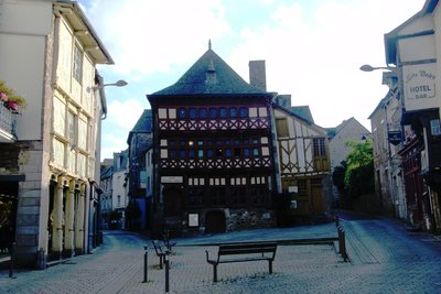
Musée Mathurin Meheut - Amis Bretons de Colomban CulturalMathurin Méheut Museum
Mathurin Méheut was born in Lamballe in 1882. After an apprenticeship as a building painter, he entered the School of Fine Arts in Rennes and continued his training at the School of Decorative Arts in Paris.
He worked on the fauna and flora of the marine environment and became a Marine Painter. During the First World War he produced his "War Sketches" on life in the trenches. Then, fascinated by his native region which he will criss-cross in all directions, he will witness the Breton life of his time.
The museum dedicated to him in Lamballe is located in a 15th century timber-framed house known as the Executioner's House. It is to be transferred to the former National Stud in 2022.
To find out more about it...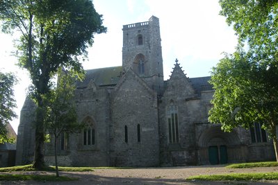
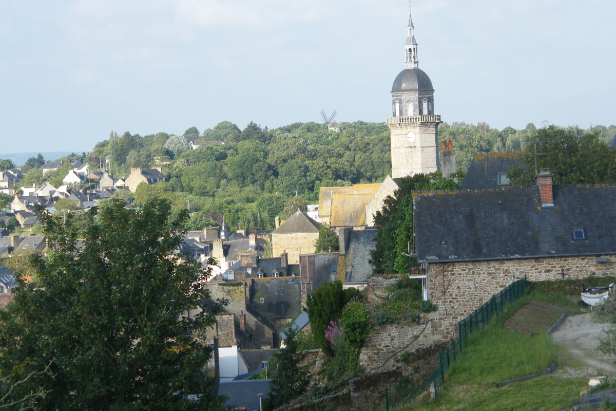
Collegiale Notre dame de Lamballe - Amis Bretons de Colomban CulturalNotre-Dame de Lamballe Collegiate Church.
This Romanesque style church was originally the chapel of the 11th century fortress built on this rocky spur surrounded by marshes. It escaped the destruction of the castle in 1420 and in 1435, Duke Jean V founded a college of canons.
Very damaged, the stained glass windows were replaced. We can therefore see stained glass windows from the 19th century, figurative stained glass windows from the 20th century or contemporary stained glass windows from the 21st century.
To know more about it...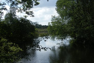
Landes de La Poterie - Amis Bretons de Colomban TouristThe moors of La Poterie
The Landes de La Poterie was exploited from the 11th to the middle of the 20th century to extract clay from potters, which led to the formation of pools and bumps. A protection order was issued in 1989 for an area of fifty-five hectares. The subsoil is in fact made up of Gabbro which, as it deteriorates, is transformed into basic clay. In a granite Brittany with acidic soil, this "stains".
In the moors of La Poterie you can observe plants in a limestone environment, which are extremely rare in Brittany.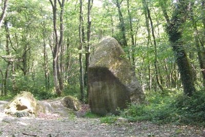
Roche de Guihalon - Amis Bretons de Colomban CulturalGuihalon Menhir
Also known locally as "Grosse Pierre", this menhir erected on the highest point of the commune measures 5.20m in height for a circumference of 10m. It is in local gabbro.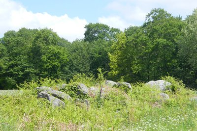
Allée couverte de St André - Amis Bretons de Colomban CulturalCovered lane and alignment of menhirs " Les Kervès " of St André
This megalithic ensemble consists of a 20m covered walkway and about ten menhirs, all of which have collapsed. They are made of gabbro (local stone). The covered alley and the four nearest menhirs were excavated in 1985 and 1986 without making any major discoveries,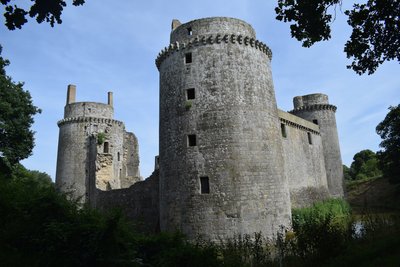
Château de la Hunaudaye - Amis Bretons de Colomban HistoricalHunaudaye Castle
The Hunaudaye castle, built in the 12th century and rebuilt in the 16th century, has been classified as a Historic Monument since 1922. It consists of five towers connected by curtain walls with moats and drawbridge. Numerous consolidation and restoration works have been carried out following collapses. Since 2008, it has been the property of the Côtes d'Armor General Council.
To find out more...
Description
From the church of St Jean, go up the parvis St Jean and join the rue Pasteur and the adjoining square. Walk along this street and go up the rue Notre-Dame to the Collegiate Church.
- Walk along the church and continue on Notre-Dame Street up to the roundabout. Cross the roundabout and follow St-Sauveur Street up to the cemetery. Turn to the right on the car park and, after having passed in front of the cemetery gates, take the track which goes to the left at the end of the car park. At the end of the road, cross Paul Langevin street and take the street opposite to reach the Ville Gaudu water body and take the path that runs along it on the left. After point n° 8 of the sports course, turn left on the path then right on the rue de la Ville Gaudu and join the rue du Bout du Val la Poterie.
- Turn to the right on this street and continue on the street "rue du Pont de Coetquen" up to the roundabout. Turn to the right on the road D28 towards La Poterie. Cross the railway and turn to the right towards La Moglais. Follow the road that goes around the castle park on the right. After the park, at the top of the hill, take the road on the left (yellow markings and horse route). At the end of this one, turn left on the road towards La Poterie.
- At the crossroads with the street "rue de la Croix d'en Hue", at the exit of the forest, take the footpath on your left. At the intersection with the forest track, turn to the right on it and join La Poterie. At the crossroads, take, slightly to the right, the path that goes along the town hall and the school on the right and join the D28. Then turn left (yellow/red markings and Tro Breiz), and at the crossroads, turn right towards the Equestrian Centre, on the Rabine des Portes, and continue on the path that follows it. At its end, turn right and then, at the next crossroads, turn left onto the road.
- Then, turn to the right on the track which runs along the Landes de la Poterie. At its end, turn to the right on the road and take the track opposite. At the crossing, turn to the left (yellow/red markers and Tro Breiz). Cross the rue de St Robin e, continue on the path opposite. At the next crossroads of the Barrière, turn right and continue to the village of Haut-Bourg.
- Take the road on your left. At the entrance in the forest, take the track on your right-hand side in the direction of the menhir of Guihalon. Pass this menhir, and, at the end of the track, turn to the right on the road towards the villages of Hussonais, then Hessardais. At the exit of the latter turn right (yellow/red markings and Tro Breiz).
- Well before the village of St André, on the descent, turn left on the path (yellow/red markings) in the direction of the covered lane. Go along the covered lane, then, at the entrance to the forest, turn right onto the track and join the D52. Turn right onto the D52. When it makes a right turn, take the path which goes on your left (path without barrier with markings towards St Esprit). At the Croisée du Queux Pays (forest crossroads of six paths) continue following the signs for Tro Breizh (towards St Esprit) until you reach the entrance to Le Chaffaud.
- At the crossroads of the Calvary with picnic area, turn to the left and join the village of Le Chêne au Loup. Cross the roundabout and take the dead end in the direction of Le Clos Chantoux. In the left bend before the farm buildings, turn right into the road and continue straight ahead to the pumping station. Then turn left onto the road and join the village of Belouze. Continue on this road until you reach the village of St Jean.
- An arriving in the village, take the street on the left, then turn to the right of the small house and take the track on the right of it. After passing over a small footbridge, turn left and follow the brook on its right. After passing over a new footbridge slanting to the left at the fork (when the brook starts to widen, it should be on your right). Then go along the banks of the Arguenon reservoir on the left until you reach the D68.
- Cross the river Arguenon by the bridge and, at its exit, take the marked track on the left in the direction of Plancoët. Follow this track which runs along the reservoir up to the dam of Ville Hatte. Pass the kiosk presenting the dam and continue straight ahead along the road towards the village of Malabry. Cross the village and continue until the D68. Cross the departmental road and continue on the road in the direction of Bois Billy. Go round the back of the castle and reach its entrance gate. Turn left onto the road and join the hamlet of l'Hotellerie and at the exit turn left onto the road and join the village of St Maleu. Turn left onto the D792 and join the church of Bourseul.
- Departure : Church St Jean - Parvis St Jean - 22400 - Lamballe
- Arrival : St Nicodème Church - Rue Chappedelaine - 22130 - Bourseul
- Towns crossed : Bretagne
Altimetric profile
Recommandations
The path along the Arguenon reservoir presents some more difficult passages
Transport
The modes of public transport in Brittany are grouped on Breizhgo and Mobibreizh.
Report a problem or an error
If you have found an error on this page or if you have noticed any problems during your hike, please report them to us here: