Dervio to Lierna high variant
Lombardia
8. Dervio to Lierna high variant
Medium
6h
20,2km
+1656m
-1692m
Embed this item to access it offline
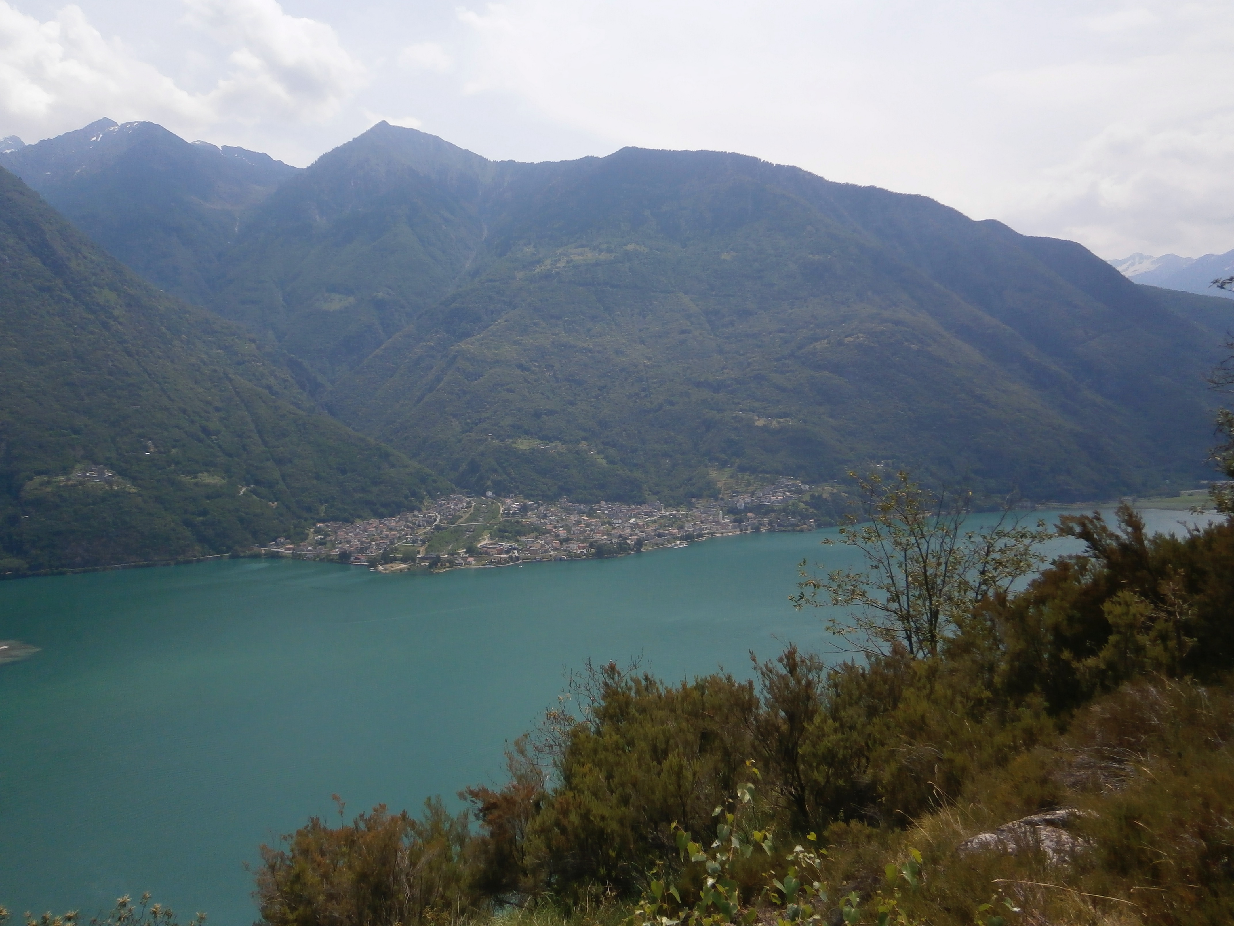
The mountain falls directly into the lake leaving only a few sites for coastal towns. The path climbs to higher elevations with views of the lake and crosses many streams that provide a welcome coolness in summer.
8 points of interest
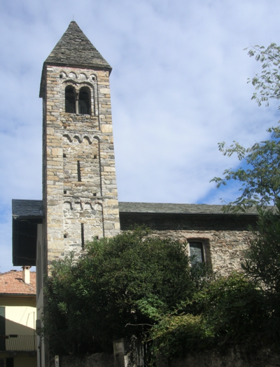
Chiesa di Santi Quirico et Giuditta TouristChurch of Saints Quirico and Giuditta
Built in Dervio at the foot of the mountain on the left bank of the Varrone, is dedicated to the two martyrs of the fourth century and is the oldest church in the region so it is mentioned in documents dating from the year 814.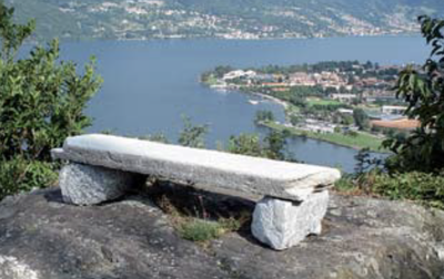
Ronci PanoramicPanoramic point
View of the lake from the village of Ronchi before crossing the Torrente Valle Grande.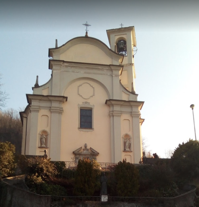
Lezzeno TouristSanctuary of Our Lady of Tears
The sanctuary is set in a panoramic area overlooking Lake Como. It has a baroque façade and a unique nave with a wealth of marble, stucco and paintings. Outside the church, there are chapels depicting the life of Jesus.
Orrido di Bellano PanoramicGorge of Bellano
Narrow and deep gorge dating back 15 million years with waterfall, accessible by suspension bridge.Bellano TouristChurch of Saints Nazaro and Celso
Built around 1300, it is very well maintained and surrounded by a beautiful view of the village and the lake.Bellano HistoricalChurch of Santi Rocco e Sebastiano
The church of Saints Rocco and Sebastiano al Ponte stands next to the stream of Pioverna, which shortly afterwards flows into the famous Orrido. Its construction in 1489 is attested to by the date inscribed above the portal. The church was consecrated in 1502 and again in 1587, and became the seat of the Confraternity of the same name, which administered it until it was abolished in 1786. Restored in 1969, it is now the Sanctuary of the Bellanese fallen in all wars and houses two paintings by Bellanese painter Giancarlo Vitali.Varenna PanoramicPanoramic point
View of Lake Como before arriving in Varenna.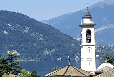 Tourist
Church of Sant'Ambrogio
Baroque church with one of the oldest Romanesque cloisters in Lombardy.
Description
From the village of Vezio, two marked paths are possible:
- a faster lower version, described in the previous stage.
- a longer, higher version that climbs in altitude (+ 1km and 1000m of positive difference in altitude), described as a variant in this stage,
- a faster lower version, described in the previous stage.
- a longer, higher version that climbs in altitude (+ 1km and 1000m of positive difference in altitude), described as a variant in this stage,
- Pass to the left of the Orezia tower and descend to the via Valvarrone (SP67) by a path that zigzags through the houses after the tower and then up the mountainside. Follow the via SP67 which turns left towards the via Armand Diaz which then becomes the via Duca d'Aosta (former Austrian military road from Stelvio to Spluga. Cross the river Varrone, pass the church of San Quirico and gradually leave Dervio, approaching the mountain and reaching the railway bridge.
- Before the railway bridge, turn left onto a staircase marked Sentiero del Viandante "SV" which climbs towards Chignolo. Enjoy this path with care for its view of the lake and for its construction, either dug into the rock or terraced with retaining walls, between gardens and terraces planted with vines, olive trees and palm trees. After a rock engraved in 1693, pass over the houses of Ronchi, then past a baroque chapel before reaching the furrow of the Valle Grande torrent, the boundary between the towns of Dervio and Bellano. After a second valley, join the road that climbs to Verginate and follow it southwards, crossing three thalweg to the hamlet of Oro.
- At the exit of Oro, after the third stream, take the path on the left that climbs towards Pendaglio. At the top, turn right to bypass the SS36, follow the path into the Mulini valley (in reference to the presence of mills in the past) and then into a second narrow valley with water niches to climb to the carriage road that leads up from Bellano to Vendrogno. Cross the road and continue upwards to enter the old part of Lezzeno, and take an alley that leads to the sanctuary dedicated to the Madonna delle Lacrime. From the park of the sanctuary, descend a moderate slope towards the hamlet of Ombriaco and then after the washhouse, a steep slope and many steps towards the church of San Rocco in Bellano to reach the bridge over the Pioverna torrent.
- After the bridge, follow the path, crossing the SP62 three times and passing the chapel of Sant'Andrea halfway up the hill and then the chapel of the Madonna Addolorata before reaching the bridge over the Bosio. Climb the SV path on a moderate slope to the valley of the Valle Masna torrent below the hamlet of Regoledo and continue along the slope to join the Sacra Famiglia road until you reach a marked bend on the left with an oratory. At the bend, take the path on the right that descends and joins the Cava Bassa road and then climb the Perledo road to a hairpin bend in the via per Esino. Take the road to the right and then the first path to the left at a fork in the road, and follow the SV path upwards, passing under the village of Regolo and arriving at the baroque chapel of the Madonna di Compallo with a magnificent view of the Vezio promontory. After a steep descent, pass through the artistic quarter of Compallo and cross the Esino torrent before climbing steep stairs to the centre of Vezio.
- Turn left onto the well-marked Sentiero del Viandante (Ortanella), which climbs up to the hamlet of Ortanella.
- At the Boccheta di Ortanella (960m), turn left onto the path towards Alpe Mezzado as far as the village of Gineco. Join the Via Gineco until the beginning of the Via Seminario.
- Turn left onto the path until you reach the roundabout. Take Via Olciano to reach your destination.
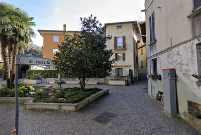
- Departure : Church di San Leonardo, via al Castello, 23824 Dervio
- Arrival : Church Sant'Ambrogio, Via Papa Giovanni XXIII, 41, 23827 Lierna
- Towns crossed : Lombardia
Altimetric profile
Report a problem or an error
If you have found an error on this page or if you have noticed any problems during your hike, please report them to us here:
Close by26
- Information
- Information